 |
City of Rocks Back Country Byway |
 The Bread Loaves in Emery Canyon, City of Rocks National Reserve |
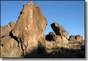
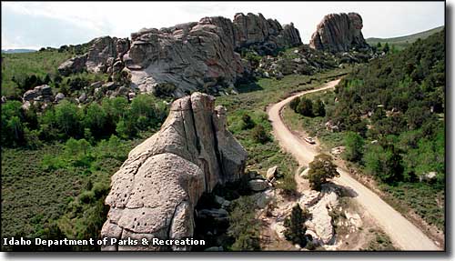
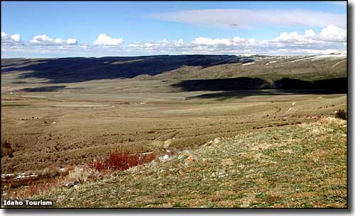
The City of Rocks Back Country Byway is a 49-mile route that almost encircles the Albion Mountains in southern Idaho. As the California Trail once passed through this area, it is rich in geological and historic value (those historic European migrants even left graffiti in the form of signatures made with axle grease that can still be seen on the rocks today, 150 or so years later). The City of Rocks National Reserve itself is the site of thousands of granite outcroppings, some several hundred feet high, that have attracted almost as many boulderers and technical rock climbers as Yosemite National Park. Starting in Albion and heading south, the City of Rocks Back Country Byway skirts the edge of Pomerelle Mountain Resort and the Lake Cleveland Recreation Area as it follows the paved Idaho Highway 77 to Connor. Connor Creek is where Cassia Creek cut a gap between the Jim Sage Mountains to the south and the Cotterrell Mountains to the north. At the south end of Connor Creek, Highway 77 turns off to the east and the Elba-Almo Road continues to the southwest along the valley cut by Cassia Creek. Continue on the pavement through Elba to Almo. Almo is a ranching community founded in 1879. In the shadow of Cache Peak (10,399'), Almo is home to Idaho's oldest continuosly operating mercantile. At Almo you need to follow the signs to the City of Rocks National Reserve. At the south end of town is where you'll find the Visitor Center for City of Rocks and for nearby Castle Rocks State Park, another spot where many beautiful granite formations and technical rock climbs are preserved. If you're in the area for the night, RVs usually go to Castle Rocks State Park to enjoy one of the 38 RV-capable campsites the state park offers. If you're into primitive camping, you might just want to continue into City of Rocks and find an empty tent campsite (there are more than 60 of them scattered on the property). 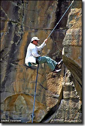
The gravel section of the City of Rocks Back Country Byway is not often plowed in winter so there's times when you can't get there from here. But when you can get there, the City of Rocks contains hundreds of established and tempting technical rock climbs on literally thousands of granite outcroppings and spires. Climbers gravitate to the area because there are more than 700 mapped climbing routes on the walls, pinnacles and spires that dot this landscape, making City of Rocks a world-class climbing area. The granite in City of Rocks National Reserve varies from almost 3 billion years old to about 25 million years old and represents two separate magma intrusions: the Green River Complex (the older) and the Almo Pluton (the younger). In places you'll find pinnacles of each almost side by side. For whatever reason, experienced rock climbers say they much prefer the younger Almo Pluton rock for playing on. Once past City of Rocks, the back country byway heads northwest, following a narrow, deep canyon with high volcanic cliffs along Birch Creek until it reaches the other terminus in the historic town of Oakley. This is the most enclosed stretch of the back country byway with Middle Mountain to the west and the Albion Mountains to the east. In the early days of Idaho settlement, the Kelton-Boise Stage Line ran through here. These days, the local ranchers still use the road for running cattle to summer pasture in the late spring and back home again in the fall. Oakley is known for featuring the largest concentration of old stone and wood-framed buildings in Idaho. The whole town is on the National Register of Historic Places. From Albion to Connor Creek, the route is on a secondary paved highway. From Connor Creek to Almo, the route is along a narrow, winding paved road. From Almo to Oakley, the road is an improved gravel route that is usually closed in the winter. Once in Oakley, Idaho Highway 27 leading north to Burley is a paved secondary highway. The best time to travel is from April to November. |
 Along the City of Rocks Back Country Byway near Albion 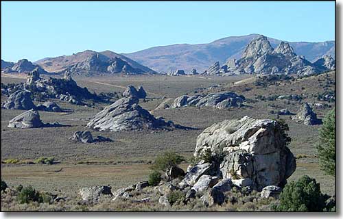 The view at Circle Creek Overlook 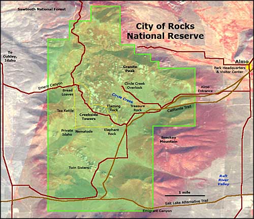 City of Rocks National Reserve map 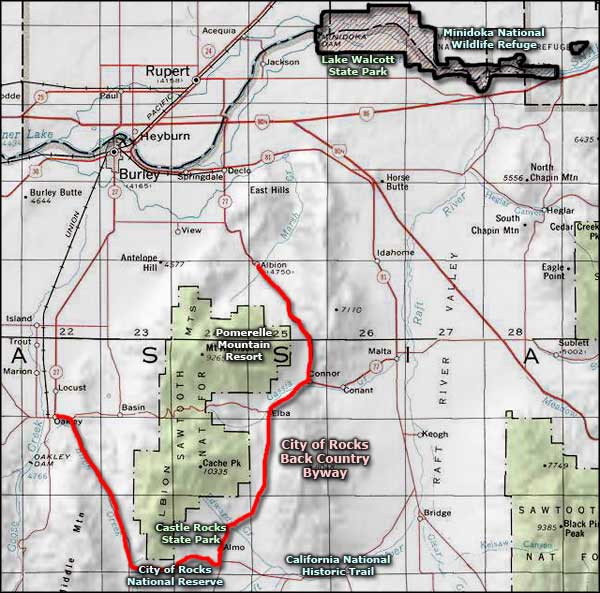 City of Rocks Back Country Byway area map |
|
|
 |
| Index - Arizona - Colorado - Idaho - Montana - Nevada - New Mexico - Utah - Wyoming National Forests - National Parks - Scenic Byways - Ski & Snowboard Areas - BLM Sites Wilderness Areas - National Wildlife Refuges - National Trails - Rural Life Advertise With Us - About This Site - Privacy Policy |
| Upper photo of City of Rocks National Reserve courtesy of Idaho Department of Parks & Recreation. Photo of the countryside near Albion courtesy of the Idaho Department of Tourism. Area map courtesy of National Geographic Topo! Other photos and map courtesy of the Bureau of Land Management. Text Copyright © by Sangres.com. All rights reserved. |