Fishhooks Wilderness

The 10,500 acres of Fishhooks Wilderness are in the Gila Mountains about 30 miles (as the crow flies) northwest of Safford, up against the San Carlos Apache Indian Reservation in an isolated and seldom visited part of Arizona. This is rugged country with reasonably easy hiking along the canyon bottoms in the riparian vegetation. There are springs, tanks and wells through the whole area so water isn't a big problem.
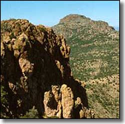
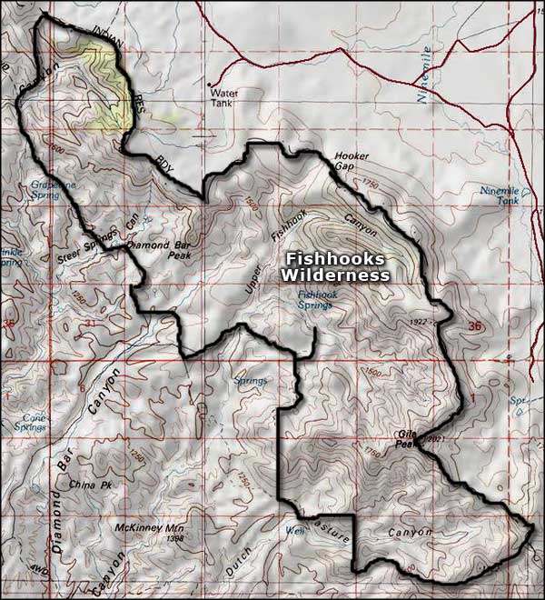
Fishhooks Wilderness got its name from the resemblance that the shape of some of the canyons have to a fish hook. On the southeastern side of Fishhooks Wilderness, Gila Peak rises to 6,629' with a pinon pine forest on its upper slopes. Below that the open country vegetation is mostly chaparral and grasslands. There are no developed trails (but there are some ancient jeep trails) in Fishhooks Wilderness so your highly honed compass and route-finding skills will come in handy... In your wanderings, if you cross the upper rim of the heights to the east, you'll probably want to have a recreation permit from the tribe first.
To get to Fishhooks Wilderness from Safford go west on Highway 70 for 15 miles, then turn and go north on Eden Road until you cross the Gila River Bridge. Then go left on the occasionally maintained, dirt Hot Springs Road for 13 miles along the north shore of the Gila River. You'll come to a wire gate across the road: go through it, leave it the way you found it. Just before the farm fields about 1 more mile in you'll turn northeast on an unmarked dirt road. Go straight through the junction and about 10 miles from the county road you'll come to the Diamond Bar Ranch headquarters area. From there you can go north 1 mile to the wilderness border or go east 1/2 mile to the wilderness border. Both roads continue on with occasional signs to remind you there is a wilderness area there.
USGS Maps: 7.5 minute: Ash Creek Ranch, San Carlos NE, Gila Peak

Fishhooks Wilderness map
