San Francisco Peaks Scenic Road

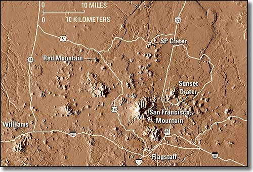
The San Francisco Volcanic Field from space
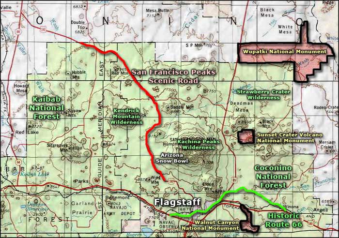
The San Francisco Peaks Scenic Road is a 31-mile route across the San Francisco Volcanic Field on US Highway 180, headed toward the Grand Canyon. The San Francisco Peaks (there are 4 summits, 3 of which top 12,000' with 12,643' Mt. Humphreys being the highest point in Arizona) are the remains of a giant stratovolcano that blew itself apart about 220,000 years ago. The remains of the cone are sacred to several tribes of Native Americans and a large part of the mountain is part of the designated Kachina Peaks Wilderness. At the same time, the Arizona Snobowl Ski Area is on the southwest side of the mountain and usually does a pretty good business in the winter months.
Kendrick Mountain Wilderness is a bit further north of the Kachina Peaks, and several miles to the west. Past Kendrick Mountain is when the road begins to descend out of the Ponderosa and fir forest on top of the Mogollon Rim and down into the sagebrush, juniper and pinon that you'll be driving through for the rest of your journey to the south rim of the Grand Canyon.

San Francisco Peaks Scenic Road area map
