Pajarita Wilderness

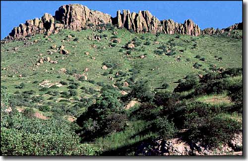
A typical view along the Ruby Road, southern edge of Pajarita Wilderness

The Pajarita Wilderness (7,553 acres) is a botanist's paradise ("Pajarita" means "little bird" - and more than 160 species of birds have been seen here). Of the 660+ species of plants identified here, 17 of them grow nowhere else on the planet. Photographers come from all over the world just for the wildflowers of Pajarita Wilderness. Because of the wide diversity of plants and animals found here, part of the Wilderness is included in the Goodding Natural Research Area. Camping is allowed everywhere in Pajarita Wilderness except in the Goodding Natural Research Area.
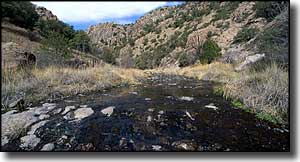
The most prominent landform here is the twisting, steep-walled and narrow Sycamore Canyon with its' lush riparian habitat. The stream flows only in certain seasons but there are pools of water in the bottom of the canyon that last all year long. This is also a major wildlife migration corridor. Elevations in the wilderness range from about 3,800' to about 4,800'.
A lot of folks like to start at the Hank and Yank Spring (off the unpaved Ruby Road) and hike the 7-mile Sycamore Canyon Trail through the length of the canyon. This trail intersects with the Border Trail about 4 miles into the wilderness. The Border Trail skirts the international boundary and connects Sycamore Canyon with the Summit Motorway, a very rough 4WD route that parallels the eastern boundary of Pajarita Wilderness. One thing to watch out for though: the closer you get to that border, the more likely you'll run into nefarious activities.
USGS Quads: Alamo Springs, Ruby

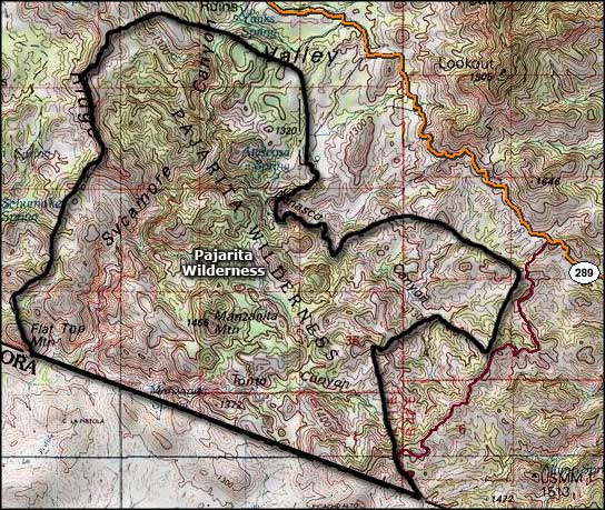
Pajarita Wilderness map

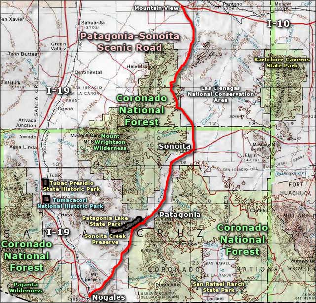
Pajarita Wilderness area map
