Deer Trail, Colorado

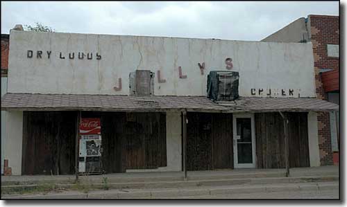
In downtown Deer Trail
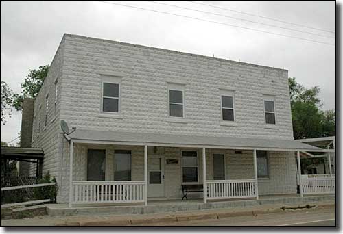
Deer Trail is in southeastern Arapahoe County, about 55 miles east of Denver. Deer Trail was originally a siding built on the Kansas Pacific Railroad in 1870. In 1875, the railroad platted out a town that grew to have 5 grocery stores, 2 banks and 3 hotels in the 1920's. Deer Trail was a shipping point for eggs, livestock and grain in those days but the Great Depression nearly killed the town. Then came a devastating flash flood in 1965 that damaged or destroyed many of the business structures on Main Street. There are still folks living in Deer Trail but the town is not nearly what it once was.

Fast Facts about Deer Trail, Colorado
Deer Trail, Arapahoe County, CO 80105
Latitude: 39.6159°N
Longitude: 104.043°W
Elevation: 5,194'
Education:
High School or Higher: 84.9%
Bachelor's Degree or Higher: 11.2%
Graduate or Professional Degree: 1.5%
2009 Cost of Living Index for Deer Trail: 93.9
Latitude: 39.6159°N
Longitude: 104.043°W
Elevation: 5,194'
Education:
High School or Higher: 84.9%
Bachelor's Degree or Higher: 11.2%
Graduate or Professional Degree: 1.5%
2009 Cost of Living Index for Deer Trail: 93.9
2009 Estimates:
Median Resident Age: 34.8 Years
Estimated Median Household Income: $44,850
Estimated Median Home Value: $138,500
Major Industries:
Construction, Educational Services, Transportation Services, Lodging & Food Services, Utilities, Government, Waste Management Services, Retail Services, Social Services
Unemployed (March 2011): 9.0%
Population Demographics: 2010
| Total Population | 546 |
| Males | 281 |
| Females | 265 |
| Population by Age | |
| Under 18 | 143 |
| 18 & over | 403 |
| 20-24 | 31 |
| 25-34 | 57 |
| 35-49 | 110 |
| 50-64 | 109 |
| 65 & over | 81 |
| Population by Ethnicity | |
| Hispanic or Latino | 10 |
| Non Hispanic or Latino | 536 |
| Population by Race | |
| White | 516 |
| African-American | 5 |
| Asian | 7 |
| Native American | 4 |
| Hawaiian or Pacific Islander | 0 |
| Other | 3 |
| Two or more | 11 |
Arapahoe County Related Pages
Aurora - Bennett - Bow Mar - Centennial - Cherry Hills Village - Columbine ValleyEnglewood - Foxfield - Glendale - Greenwood Village
Littleton - Sheridan - Arapahoe County
Chatfield State Park - Cherry Creek State Park
More Colorado Information, Photos and Maps
Towns & Places - Scenic Byways - State Parks - National Forests - National Wildlife RefugesNational Park Service Sites - BLM Sites - National Wilderness Areas - Unique Natural Features
Outdoor Sports & Recreation - Ski & Snowboard Areas - Photo Galleries - Colorado Mountains
