Grand Mesa National Forest Trails

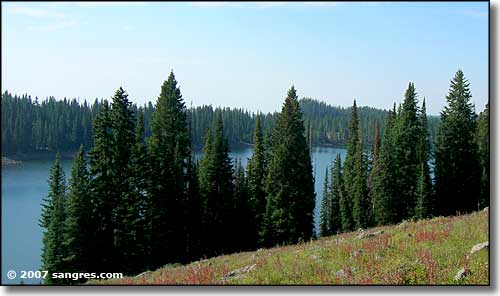
Island Lake
Crag Crest National Recreation Trail:
The Crag Crest Trail in the Grand Mesa National Forest is a designated National Recreation Trail. The trail is a 10.3 mile circular trail consisting of a hike along the crest and a loop return. In the summer rainy season you'll want to get an early start to avoid the afternoon thunderstorms. The Crag Crest Trail is accessed from two trailheads: one trailhead on the west end across from Island lake and another trailhead on the east end adjacent to Eggleston Lake. The crest part of the trail (6.5 miles) rises steeply from the East Trailhead to the top of Crag Crest. From the West Trailhead, the crest portion rises more gradually to the high point of Crag Crest. Sections of the trail are on a narrow ridge with steep drop offs on both sides. The loop portion (3.4 miles) provides an alternate to returning to your vehilce by going over the crest. Only foot access is allowed on the crest portion between the East Trailhead and the Cottonwood Lakes Trail junction. Rocky dropoffs and narrow trails make any other type of passage unsafe. Foot, horse and mountain bike are allowed on the loop portion and on the crest portion between the West Trailhead and the Cottonwood Lakes Trail junction.
Elevations: 10,150' at Eggleston Lake, 11,189' at the crest.
| Trail Name | Trail # | Length in Miles | Difficulty | Comments |
|---|---|---|---|---|
| Mesa Lake Shoreline |
503
|
1.5
|
Easy
|
Handicapped accessible, interpretive signs |
| Lost Lake |
502
|
1.5
|
Moderate
|
Basalt rock formation, lakes, forest. Trail climbs several hundred feet in elevation |
| Deep Creek |
709
|
2.0
|
Moderate
|
Through forest and meadows to the rim of the Mesa. Trail continues steeply down for 5 miles to Coal Creek Trail and Kannah Creek Basin. |
| Deep Creek Cutoff |
709.1
|
0.5
|
Moderate
|
Connects Mesa Lakes Resort to Deep Creek Trail |
| West Bench |
501
|
5.5
|
Moderate
|
Ends at the top of Powderhorn Ski Area near lift #2 |
| Land-O-Lakes |
713
|
0.5
|
Easy
|
Paved trail with interpretive signs and great views of the mesa and lakes from the ridge top. |
| Ward Lake |
744
|
1.25
|
Easy
|
Circles Ward Lake connecting the campground and picnic area. |
| Grand Mesa Discovery |
745
|
0.3
|
Easy
|
A self-guiding interpretive trail at the Grand Mesa Visitor Center. |
| Cobbett Lake |
747
|
0.6
|
Easy
|
Circles Cobbett Lake. |
| Cobbett to Ward |
746
|
0.3
|
Easy
|
Connects Cobbett Lake and Campground to Ward Lake and Campground. |
| Cobbett to Crag |
749
|
1.0
|
Moderate
|
Connects Cobbett Lake and Campground to Crag Crest Trail. |
| Island Lake |
748
|
1.68
|
Easy
|
Circles Island Lake connecting campgrounds, boat launch and Grand Mesa Visitor Center. |
| Baron Lake |
751
|
1.3
|
Easy
|
Connects Ward Way Picnic Area to Baron Lake, passing by Alexander Lake and the former site of the Radcliff Hotel and fish hatchery. |

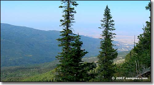
View over Kannah Creek Basin
