 |
Grandmother Mountain Wilderness Study Area |
 Grandmother Mountain Wilderness Study Area |
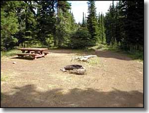
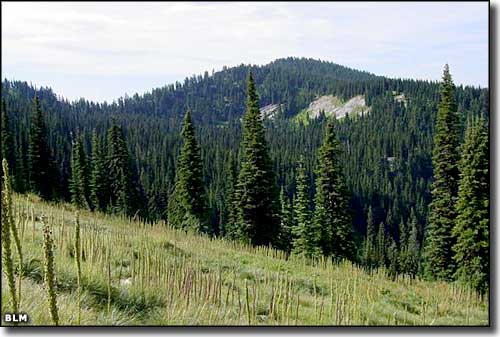
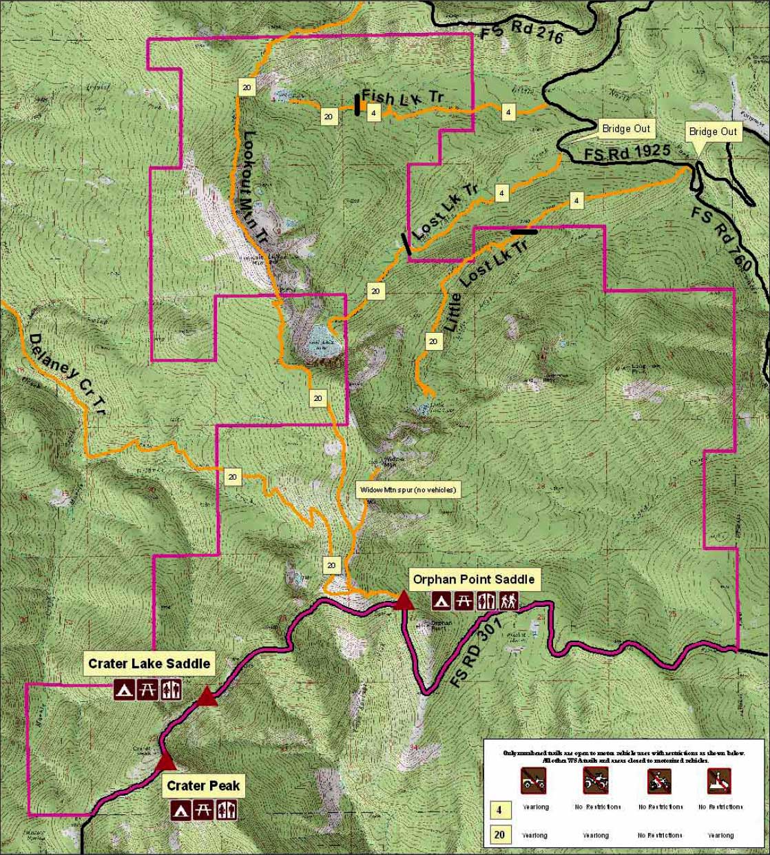
The 12,140-acre Grandmother Mountain Wilderness Study Area is located about 45 miles northeast of Moscow, Idaho. Elevations range from a low of about 4,600 feet in the drainages of Lund Creek to the high at 6,800 feet on top of Widow Mountain. This is an area where bare peaks rise above heavily forested drainages that begin at several small, high mountain lakes. Hunters love the area because moose, bear, elk, deer and upland game are plentiful. Rumor has it the fishing is pretty good, too. Fish Lake is the headwaters of the Little North Fork Clearwater River and has a good population of cutthroat trout. Lost Lake also carries cutthroat trout but Little Lost Lake is too small: the lake freezes to the bottom every year and has no fish. Be careful fishing in this area, though, because the threatened bull trout also lives in these waters. Forest Service Road 301 is the primary access route to the property and the primitive campsites at Crater Peak and Crater Lake Saddle are right off the road. Forest Service Road 301 goes east from Idaho Highway 3 at Clarkia. Crater Peak is about 23 miles east from that intersection. Crater Lake Saddle is another mile east, Orphan Point Saddle is a couple miles beyond that. The campgrounds are free but primitive (no water, no electric, no garbage collection but vault toilets are in place). Use season is July through September. 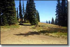
Orphan Point Saddle is the trailhead location for the Delaney Creek Trail and the Lookout Mountain Trail. Delaney Creek Trail descends to the northwest following the contours of the hillsides as it "parallels" Delaney Creek. Lookout Mountain Trail stays high on the ridgetop for miles, until just above Fish Lake it begins to descend to the northern trailhead on Forest Service Road 216. On the eastern side of the property, the subalpine forest is mixed with stands of old-growth hemlock. The rest of the wilderness study area is vegetated mostly with mixed conifers. Among the several smaller drainages you'll find riparian areas with marshes, wet meadows, sphagnum bogs and seasonal stream flows. 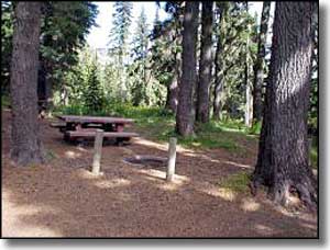
As a result of funding from the American Recovery and Reinvestment Act, a steep stretch of the Little Lost Lake Trail was worked over with drainage features installed to reduce run-off into the stream (Little North Fork Clearwater River) while a second crew installed informational kiosks at the Crater Lake and Crater Peak campsites. Grandmother Mountain Wilderness Study Area was first proposed to Congress for Wilderness designation in 1992. Sometime later that year, title to about 10,000 acres of the property was transferred to the National Forest Service, the remainder still being managed by the Bureau of Land Management. Since that time, the property has been tied up in various land exchange efforts with the State of Idaho. Technically, the whole of the 12,140-acre property is still under the "foot and horseback travel only" provisions of the Wilderness Act but who knows what will happen when Congress ultimately makes a decision. At this point, it seems the BLM is still enforcing the rules and doing the grunt work. |
 Click on the map for a larger version (330KB) |
|
|
 |
| Index - Arizona - Colorado - Idaho - Montana - Nevada - New Mexico - Utah - Wyoming National Forests - National Parks - Scenic Byways - Ski & Snowboard Areas - BLM Sites Wilderness Areas - National Wildlife Refuges - National Trails - Rural Life Advertise With Us - About This Site - Privacy Policy |
| Photos and map are courtesy of the Bureau of Land Management. Text Copyright © by Sangres.com. All rights reserved. |