 |
|---|
Culebra PeakSangre de Cristo Mountains - Southern Colorado |
|
|
 Red Mountain on the left, Culebra Peak in the center, from Torres, Colorado |
|
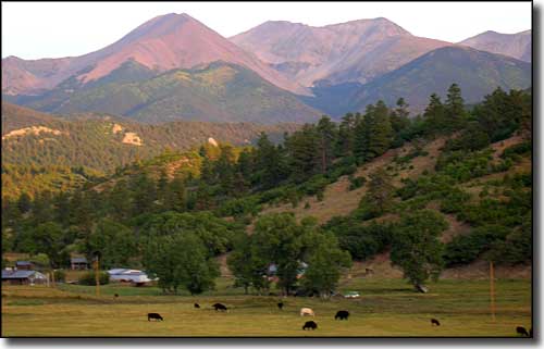
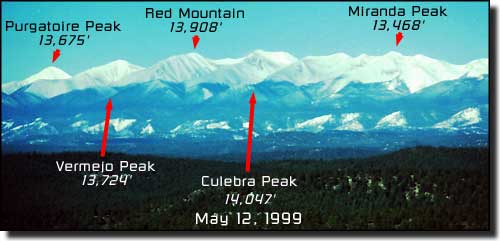
Culebra Peak is wholly located on what is now known as Cielo Vista Ranch. The new owners have put a few restrictions on climbing the mountain but it's a lot better now than it was just a couple years ago (when one of the Enron corporate thieves owned it). These days, the mountain is open for climbing most weekends in summer. They prefer to have a least five climbers or more on the mountain, all five do not have to be part of the same group. Start and finish are by the ranch gate. The owners charge $100 per person ($150 per person to climb Red Mountain and Culebra). The July 4 weekend they charge $300 per person for unlimited climbing, hiking and fishing. Compared to what has been the rule for the last five years, this isn't a bad deal. The lower photo below this text is taken from the west side of the Sangres and the ridge in front of Culebra is the easiest path up. The mountain top on the right is Red Mountain and it is possible to reach it directly from the top of Culebra by traversing the connecting ridge. Similar ridges connect Red Mountain with Vermejo Peak and Purgatoire Peak. These last three peaks are also accessible via a series of trails that lead off of the main Culebra trail above treeline but before the top of the west ridge onto Culebra.  Red Mountain (left) and Culebra Peak (right) from near Stonewall, Colorado 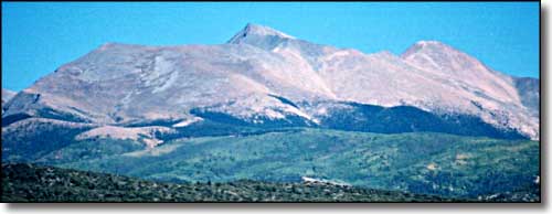 Culebra Peak in the center, Red Mountain on the right, from near San Luis, Colorado |
Culebra Peak and neighbors, from Bon Carbo, Colorado 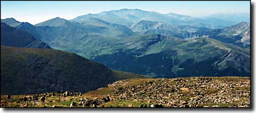 A late summer view of Culebra from the top of Trinchera Peak 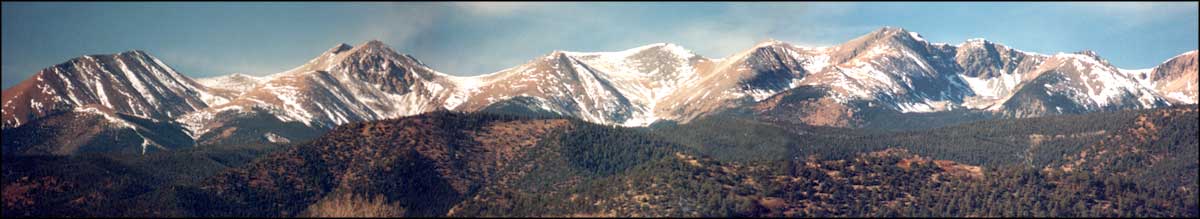 Select the photo above to see a larger panoramic view of the Culebra Range from near Stonewall 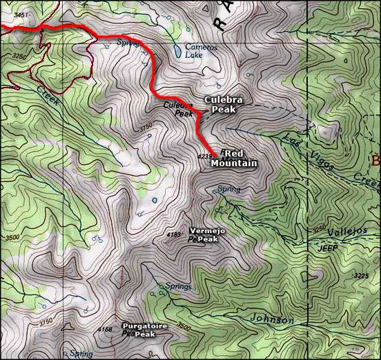 Culebra Peak area map |
|
|
Culebra Peak Related PagesColorado Pages
Towns & Places - Scenic Byways - State Parks - BLM Sites - History & Heritage Ski & Snowboard Areas - Photo Galleries - Colorado Mountains - Scenic Railroads Unique Natural Features - Wilderness Areas - Outdoor Sports & Recreation Colorado's National Forests - National Wildlife Refuges - Colorado's National Parks |

|
| Index - Arizona - Colorado - Idaho - Montana - Nevada - New Mexico - Utah - Wyoming National Forests - National Parks - Scenic Byways - Ski & Snowboard Areas - BLM Sites Wilderness Areas - National Wildlife Refuges - National Trails - Rural Life Advertise With Us - About This Site - Privacy Policy |
| Photos courtesy of Sangres.com, CCA ShareAlike 3.0 License. Map courtesy of National Geographic Topo! Text Copyright © by Sangres.com. All rights reserved. |