 |
Old Spanish National Historic Trail |
|
|
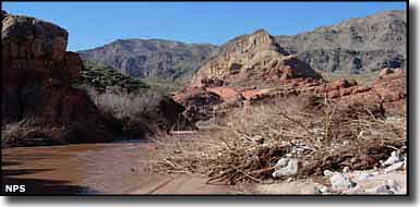
The Old Spanish National Historic Trail was a 1,200-mile trade route connecting Santa Fe, Nuevo Mexico with the Spanish settlements in southern California. Of all the trade routes established by Europeans in North America, this was the most arduous and most dangerous. The Old Spanish National Historic Trail winds across high mountains, wide deserts and through deep canyons. The first explorers on the trail were probably on the route as early as 1776 but the trail didn't come into its own until about 1829 and was only in use up until the mid-1850's. Along its route, the Trail crossed parts of New Mexico, Colorado, Utah, Arizona, Nevada and Colorado. When John C. Fremont published the report of his 1844 journey, his guide Kit Carson is mentioned to have said parts of the trail were in existence in the 1600's. Fremont said the sections he traveled had only been in use for about 15 years. Mexican trading caravans were the biggest users of the Old Spanish Trail, carrying goods back and forth between Santa Fe and Los Angeles. The second biggest users of the route were slave traders, horse thieves and Indian and outlaw raiders. For much of its distance, the route followed the path of countless Indian footpaths across the Colorado Plateau and Mojave Desert. The biggest money-maker exported from Santa Fe was woolen goods, the biggest export from California was horses and mules. The heaviest season for traffic was the fall, when river crossings were at their lowest and temperatures cool but not yet continually freezing. The Dominguez and Escalante Expedition set out from Santa Fe in 1776 seeking a route to Monterrey, California. They returned to Santa Fe the next year, unsuccessful in their quest after turning back just to the west of what is now Delta, Utah. In 1829, Antonio Armijo with 60 men and 100 mules retraced the Dominguez and Escalante return path until he came to the place on a map drawn by Jedediah Smith showing his routes between central Utah and southern California during travels in 1826 and 1827. Armijo also followed part of the route taken by Rafael Rivera in 1828. 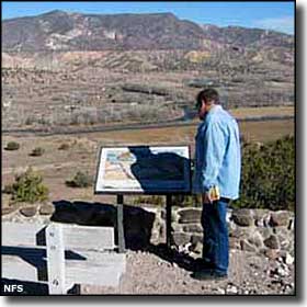
The Armijo caravan reached San Gabriel Mission in California by skirting south around Death Valley and avoiding the worst of the Mojave Desert but they also survived the last few days of the trip by eating mule meat, because there wasn't anything else to work with. They traded their blankets and other woolens for several thousand pack mules and horses which they then drove back to Santa Fe across the same route. Many of those mules and horses then went on to work in caravans plying the trade routes connecting Santa Fe with St. Louis, Missouri and Chihuahua, Mexico. Emigrants to California began traveling the route in the later 1830's. Outlaws were also using the trail to raid the ranchos in southern California. Slavers also traveled the trail, picking up new slaves at Indian settlements they passed along the way and selling them at both ends of the route. This caused a problem for many years after the trail ceased to be used by legitimate travelers. In 1830-1831, George Yount and William Wolfskill blazed a route out of California that followed the Armijo route to the area of Needles before heading up the Mojave River and over Cajon Pass to the Las Vegas area. The routes came together again for the journey uphill through the Virgin River Canyon into Utah where it then followed old Paiute trails, sometimes all the way to the Great Salt Lake. But most folks headed east along the route now followed by Interstate 70, passing by Green River and then turning south to cross the Colorado at Moab and heading southeast into Colorado. Traffic on the Old Spanish Trail really dropped off with the conclusion of the Mexican-American War in 1848. Easier, more wagon-friendly routes were opened up. Some wagon trains continued between Santa Fe and the Mormon colonies in Utah but that business was mostly over by 1853. Today, there are only a few places where you can still see vestiges of this once busy trade route. Local efforts over the years have served to mark significant portions of the route in many of the states involved but the trail didn't become a Congressionally-designated "National Historic Trail" until 2002. That means that facilities and interpretive features along the trail are still being worked out. Administration of some public features along the Old Spanish National Historic Trail is being done jointly by the National Park Service and the Bureau of Land Management. |
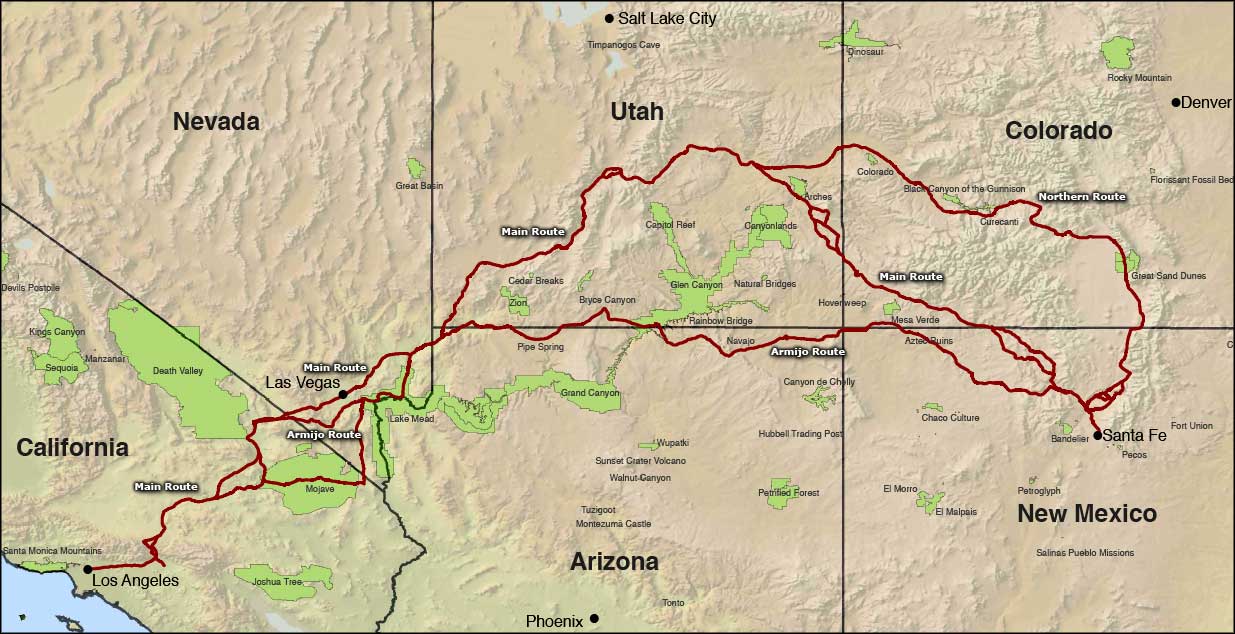 Map of the Old Spanish National Historic Trail, click on the map to see a larger version |
|
|
| National Trails |

|
| Index - Arizona - Colorado - Idaho - Montana - Nevada - New Mexico - Utah - Wyoming National Forests - National Parks - Scenic Byways - Ski & Snowboard Areas - BLM Sites Wilderness Areas - National Wildlife Refuges - National Trails - Rural Life Advertise With Us - About This Site - Privacy Policy |
| Upper left photo courtesy of the National Park Service. Mid-right photo courtesy of the National Forest Service. Map courtesy of the National Park Service Text Copyright © by Sangres.com. All rights reserved. |