 |
Arrow Canyon Wilderness |
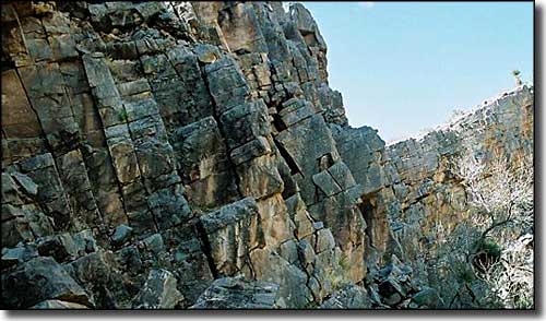
 The wall of Arrow Canyon |

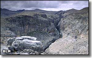
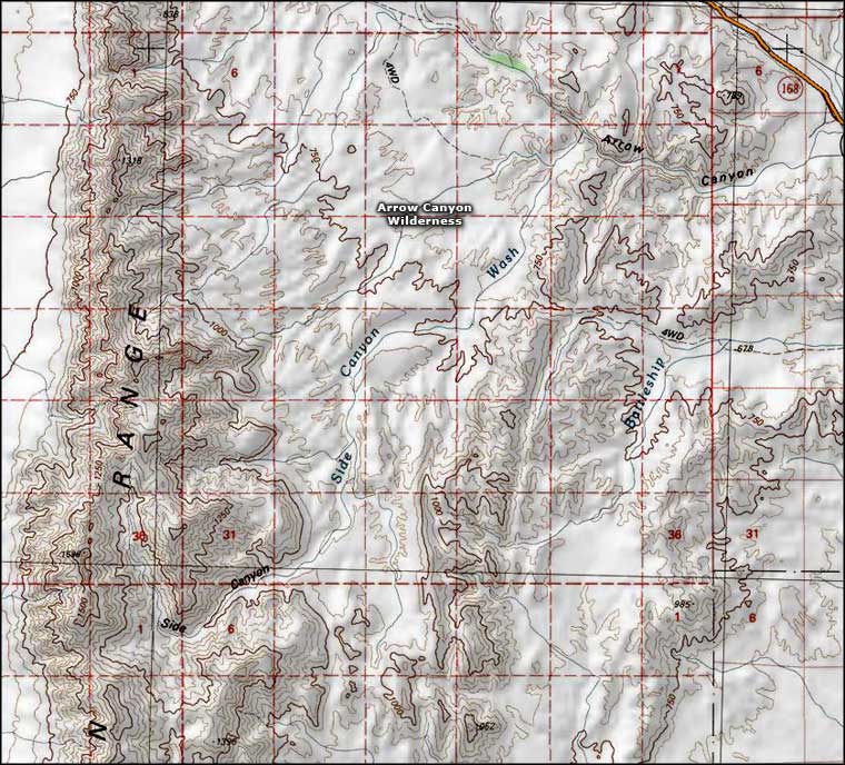
Arrow Canyon Wilderness is a 27,530-acre property about 35 miles north of Las Vegas in Clark County. The west side of Arrow Canyon Wilderness is occupied by the Arrow Canyon Range: characterized by a spectacular cliff face of tilted and layered sedimentary rock rising several thousand feet along the west side of the ridge. The escarpment displays black, gray and white bands of carbonate rock, limestone and quartzite along the whole length of the mountain range. The central portion of the wilderness on the northeast is a wide valley cut by a number of sandy washes. Arrow Canyon itself lies along the northeast edge of the wilderness: a deep cut wash several miles long with nearly vertical canyon walls that are between 200 and 300 feet deep, so deep and narrow (18' at its narrowest point) that the sun never shines in many areas at the bottom (essentially a slot canyon). The majority of the land contained within the boundaries of Arrow Canyon Wilderness is along the Arrow Range escarpment. Vegetation is typical southern desert: mesquite and catclaw in the washes, ash trees in the canyon bottom, creosote bush and desert scrub everywhere. In the higher areas you might come across desert bighorn sheep. In the canyon walls you might also find the fossilized remains of mollusks, brachiopods, corals and other ancient sea creatures. The climbing routes in Arrow Canyon vary from 5.8 to 5.11 along the canyon walls and up to 5.12 in the 2 overhung caves. However, there are 2 access issues for climbers to consider before mounting the walls. The canyon has many petroglyphs and other rock art adorning the walls. There are also several places where historic period names are incised into the limestone. There are even prehistoric rock foundations, rock shelters and hunting blinds built/left over in some areas of the canyon. The area has been identified as a potential traditional cultural property. Don't climb anywhere within 100 feet of the rock art or the cultural artifacts: Arrow Canyon has religious significance for the nearby Moapa Tribe. A second issue emanates from that wilderness designation: rock climbing can continue but no new bolting is allowed. To get there: Turn off the I-15 about 45 minutes north of Las Vegas at the Glendale exit. Go west on State Route 168 for about 9.5 miles to a junction with a paved road on the left. Turn left and go 0.3 miles down that paved road. On the right you'll find a dirt 2-track trail. Follow that 2-track about 1 mile to the wilderness boundary. The mouth of the slot canyon is another 1.3 miles in from that boundary. Vertical climbing is available virtually at the mouth of the canyon but the cave climbing is another 0.6 miles into the canyon. Because this is a slot canyon, be careful of any rainfall in the area and the potential for flash floods. |
 Arrow Canyon Wilderness map |
|
|

|
| Index - Arizona - Colorado - Idaho - Montana - Nevada - New Mexico - Utah - Wyoming National Forests - National Parks - Scenic Byways - Ski & Snowboard Areas - BLM Sites Wilderness Areas - National Wildlife Refuges - National Trails - Rural Life Advertise With Us - About This Site - Privacy Policy |
| Photos of Arrow Canyon courtesy of the Bureau of Land Management. Map courtesy of National Geographic Topo! Text Copyright © by Sangres.com. All rights reserved. |