 |
Far South Egans Wilderness |
 In the Far South Egans Wilderness |
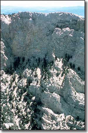
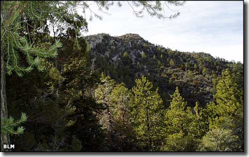
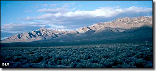
The 36,384 acres of the Far South Egans Wilderness tend to be wild and extremely rugged with sheer rock cliffs rising above deep-cut canyons. The west side of the mountain range features multicolored strata running through a series of rugged limestone cliffs. Below Shingle Pass, those cliffs rise to as much as 4,500' above the valleys below. The east side of the Egan Range is less rugged and sports a lot of dense pinon/juniper forest with the occasional Ponderosa pine thrown in. On the western side is a mix of Ponderosa and bristlecone pine. There are also a few hidden caves and shelters in these mountains. This is excellent habitat for elk, bighorn sheep, mule deer, mountain lion and various raptors such as red-tailed hawks and golden eagles. On the west side of the Far South Egans Wilderness is Whipple Cave, a limestone-solution cave with about 1,000' of explored passages. Getting into the cave requires a 70' technical descent but once you're in, you'll find some great draperies, rimstone dams and a 30-foot-tall column. A historic element in the Far South Egans Wilderness is the rehabilitated area around a former logging operation in Sawmill Canyon. This area is an excellent example of how a wilderness area can reclaim itself from the depradations of humans over time. On the other hand, this area of the Egan Range probably had many more Ponderosa pines before that logging operation began. Access to the Far South Egans Wilderness is via State Highway 318, about 50 miles south of Ely near the settlement of Sunnyside. |
 The Egan Range 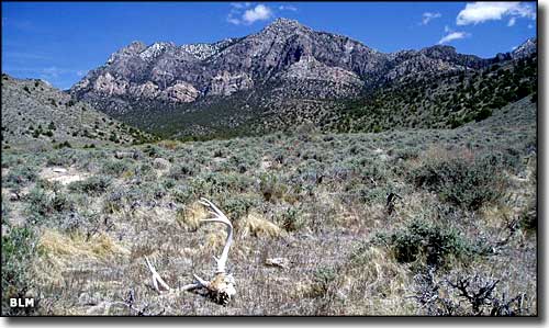 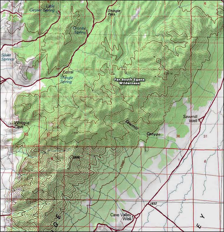 Far South Egans Wilderness map |
|
|

|
| Index - Arizona - Colorado - Idaho - Montana - Nevada - New Mexico - Utah - Wyoming National Forests - National Parks - Scenic Byways - Ski & Snowboard Areas - BLM Sites Wilderness Areas - National Wildlife Refuges - National Trails - Rural Life Advertise With Us - About This Site - Privacy Policy |
| Upper left photo of the Egan Range is courtesy of the Friends of Nevada Wilderness. All other photos of the Far South Egans Wilderness courtesy of the Bureau of Land Management Map courtesy of National Geographic Topo! Text Copyright © by Sangres.com. All rights reserved. |