 |
Mount Irish Wilderness |
 In the Mount Irish Wilderness |
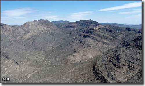
The 28,334-acre Mount Irish Wilderness is in the center of the Mount Irish Range in west-central Lincoln County. The present Mount Irish Wilderness is just part of a complex of Citizen Proposed Wilderness that extends throughout the Mount Irish Range. Mount Irish (8,743') is a steep and rugged centerpiece for the wilderness that also includes some of the mountain's western and southern foothills. Vegetation in the wilderness is mostly of the pinon pine and juniper orientation, which means this area is prime mule deer and desert bighorn sheep habitat (which also means bobcat, mountain lion, coyote, etc.) 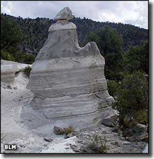
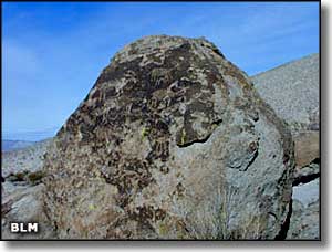
The Mount Irish Archaeological District is a large and not yet fully explored area mostly to the east of Mount Irish itself. The entire mountain range is filled with pre-historic and historic cultural resources, including many petroglyphs, ancient campsites, hunting blinds and lithic scatters. Silver mines were developed in the area starting in 1867, enough silver that a town site and post office were established and lasted for a few years. The Archaeological District is most easily reached via a rough and rocky road that heads west from Nevada Highway 318 about 1 mile south of the Key Pittman Wildlife Area Headquarters. The road will take you to an interpretive sign and the nearest rock art panels. You're going to want a high clearance vehicle to get there. Mount Irish Wilderness is northeast across Tikaboo Valley from Groom Lake and the famous Area 51. Access is via State Highway 375 (the Extraterrestrial Highway): about 7 miles southwest of Crystal Springs turn northwest on an unnamed county road that leads to the wilderness boundary. |
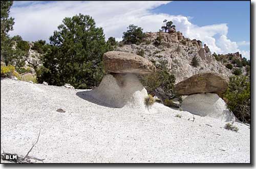 Hoodoos in the Mount Irish Wilderness 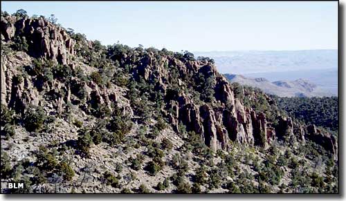 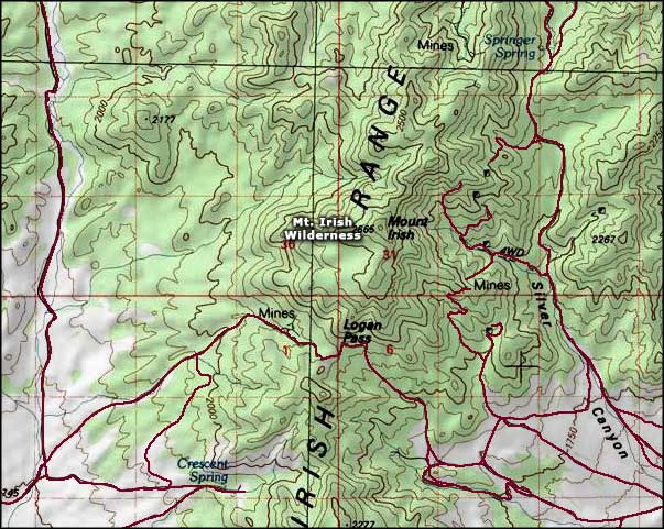 Mount Irish Wilderness map |
|
|

|
| Index - Arizona - Colorado - Idaho - Montana - Nevada - New Mexico - Utah - Wyoming National Forests - National Parks - Scenic Byways - Ski & Snowboard Areas - BLM Sites Wilderness Areas - National Wildlife Refuges - National Trails - Rural Life Advertise With Us - About This Site - Privacy Policy |
| Photos from the Mt. Irish Archaeological Area & Wilderness courtesy of the Bureau of Land Management. Map courtesy of National Geographic Topo! Text Copyright © by Sangres.com. All rights reserved. |