 |
Fort Churchill to Wellington Back Country Byway |
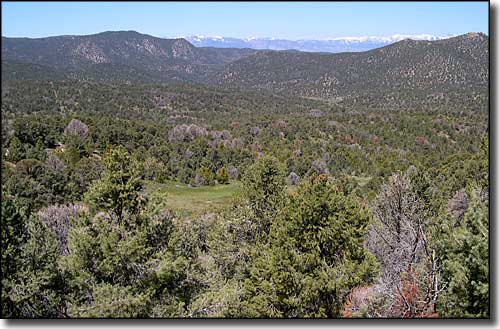 In the Pine Nut Mountains along the Fort Churchill to Wellington Back Country Byway |
|
The Fort Churchill to Wellington Back Country Byway connects a frontier fort with a historic mining town partly by following the route of the historic Pony Express Trail and the Carson Trail section of the California Trail. In 1860, Fort Churchill was established as a means of protecting early trail emigrants and Pony Express riders as they passed through this area of western Nevada. The Fort was decommissioned and sold for $750 in 1870. Today, the property is Fort Churchill State Historic Park. Leaving the Fort, follow the graded gravel of State Route 2B west along the tree-lined Carson River for about 21 miles to Dayton. At Dayton, turn and go south for about 29 miles through the rugged Pine Nut Mountains. This will be a steep climb above Eldorado Canyon before entering and passing though the Como Mining District and then dropping down the south side of the Pine Nuts to Wellington on State Route 208. This is a 4-5 hour drive over 67 miles and is probably best done in summer and fall. The section of road over the Pine Nut Mountains may have you wishing you were in a high-clearance 4WD vehicle, especially if the previous winter was bad or if it's been raining lately. |
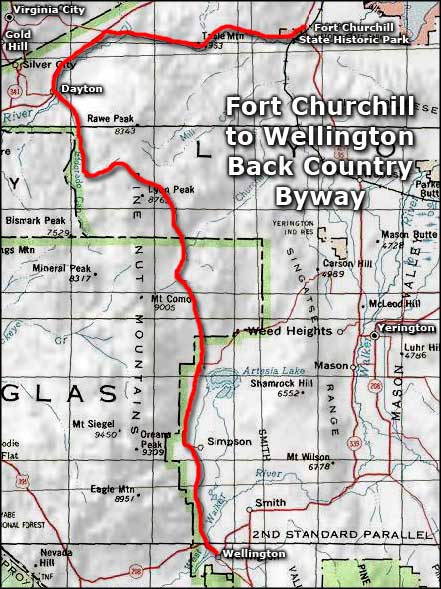 Fort Churchill to Wellington Back Country Byway area map |
|
|

|
| Index - Arizona - Colorado - Idaho - Montana - Nevada - New Mexico - Utah - Wyoming National Forests - National Parks - Scenic Byways - Ski & Snowboard Areas - BLM Sites Wilderness Areas - National Wildlife Refuges - National Trails - Rural Life Advertise With Us - About This Site - Privacy Policy |
| Photo of the Pine Nut Mountains courtesy of Wikipedia userid Phill214. Area map courtesy of National Geographic Topo! Text Copyright © by Sangres.com. All rights reserved. |