 |
The Loneliest Road in America |
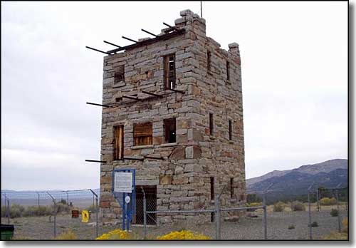 Stokes Castle, on the outskirts of Austin |
|
The Loneliest Road in America gets its name from the long distances between towns, these days. In the old days, there were towns scattered all along this route, but no more. This is US Highway 50 crossing Nevada from east to west (or vice versa). The route length is 287 miles and you could drive it in 5 to 6 hours, or a couple days, it's up to you. There's lots of old ghost towns, some good fishing spots (Illiapah Reservoir is reputed to be excellent), the remains of several Pony Express stations (US 50 roughly parallels that route), the petroglyphs at Hickison Summit, but what I remember most from driving this road: every time you reach the summit of a mountain range there are huge vistas that open up on the other side as you rush down the hill, cross the valley floor and climb yet another mountain range. This is a historic corridor that looks much as it did before the Europeans came. And just when you think you've left civilization behind forever and your gas gauge has you worried, you'll come to a place like Eureka or Austin or Ely or Fallon. |
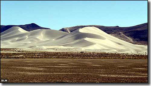 Sand Mountain, A BLM Recreation Area near Fallon, alongside the Loneliest Road in America 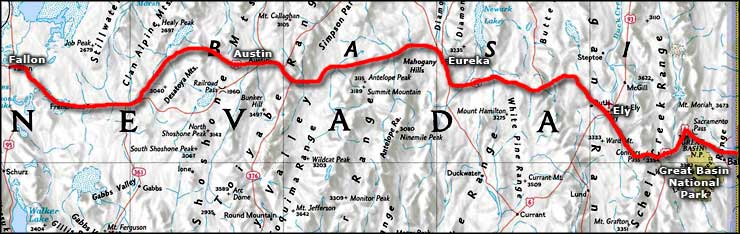 Loneliest Road in America area map |
|
|

|
| Index - Arizona - Colorado - Idaho - Montana - Nevada - New Mexico - Utah - Wyoming National Forests - National Parks - Scenic Byways - Ski & Snowboard Areas - BLM Sites Wilderness Areas - National Wildlife Refuges - National Trails - Rural Life Advertise With Us - About This Site - Privacy Policy |
| Photo of Stokes Castle courtesy of Peter Schmalzer, CCA ShareAlike 3.0 License. Area map courtesy of National Geographic Topo! Text Copyright © by Sangres.com. All rights reserved. |