 |
Las Vegas Ski and Snowboard Resort |
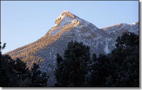 |
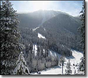
Las Vegas Ski & Snowboard Resort is about 47 miles northwest of Las Vegas at the upper end of Lee Canyon (take US 95 30 miles north of Las Vegas to Highway 156, then follow 156 to the end of the road). It's a gorgeous area in the high mountains of the Humboldt-Toiyabe National Forest. There is a good sport shop at the resort and an equipment rental shop that even offers parkas. In the Base Lodge, the Big Horn Cafe offers hot/cold drinks, salads, soups, sandwiches, burgers and other snacks. In peak season the outdoor mesquite grill is fired up to deliver more fire-grilled entrees. The Bristlecone Bar offers full-service daily from 8:30 to 4:30. There is a 500' intermediate half-pipe off of chair #2 at the bottom of the Strip run, and a variety of terrain features scattered around the mountain. |
| Quick Facts about Las Vegas Ski and Snowboard Resort |
|
Humboldt-Toiyabe National Forest
Nearest City: Las Vegas GPS Coordinates: 36.301638, -115.680759 Google Satellite Map Season: November to late March (Weather permitting) Hours of lift operation: 9:00 AM to 4:00 PM Lifts: 4 * 1 triple chair * 2 double chairs * 1 surface lift Base Elevation: 8,510 ft
Top Elevation: 9,370 ft Vertical Rise: 860 ft Snowmaking: 75% Average annual snowfall: 120" Number of trails: 11 Types of Terrain: Beginner: 20% Intermediate: 60% Advanced: 20% Longest Run: .6 miles |
 Las Vegas Ski and Snowboard Resort trails map 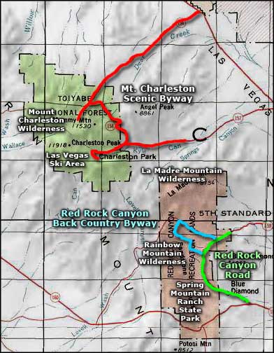 Las Vegas Ski and Snowboard Resort area map |
|
|

|
| Index - Arizona - Colorado - Idaho - Montana - Nevada - New Mexico - Utah - Wyoming National Forests - National Parks - Scenic Byways - Ski & Snowboard Areas - BLM Sites Wilderness Areas - National Wildlife Refuges - National Trails - Rural Life Advertise With Us - About This Site - Privacy Policy |
| Photos and ski trails maps are courtesy of Las Vegas Ski & Snowboard Resort. Text Copyright © by Sangres.com. All rights reserved. |