 |
Currant Mountain Wilderness |
|
|
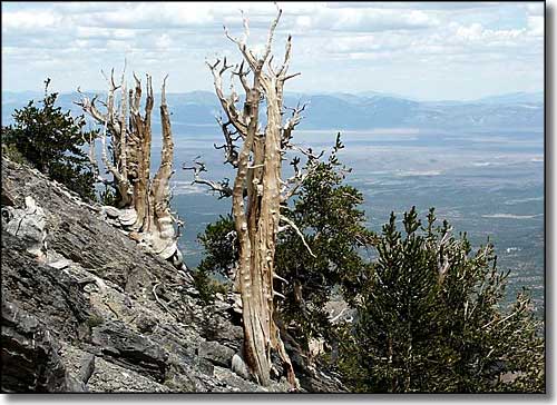 Bristlecone Pines in the Currant Mountain Wilderness |
|
The 47,357-acre Currant Mountain Wilderness is in the White Pine Range of eastern Nevada, bordered on the east by the Red Mountain Wilderness and on the north by the White Pine Range Wilderness. Currant Mountain (11,500') is the highest point in the White Pine Range, a very scenic area with steep, white limestone cliffs banded with beautiful layered strata. This is a fault-block range of uplifted volcanic sediments. The spine of the mountains is a long, sheer, narrow white limestone ridge. There are almost no trails, no lakes, no streams (although this area is the watershed at the headwaters of the White River), almost no horizontal ground and virtually no humans. A hiker in this area may have the whole area to himself, although the elk, mule deer, mountain lion, bobcat and the small band off bighorn sheep that live here may not agree with that statement. Easiest hiking access is probably via the Broom Creek Trail on the western side as it follows an old jeep trail for about 2.5 miles before disappearing. Most of that high mountain spine is a strenuous 10-mile loop that can be traversed in a long day, if you are determined enough and properly prepared for the rugged terrain. The lower western area of the Currant Mountain Wilderness is an area where the Duckwater Shoshone Indians harvest pine nuts in the dense forest of pinons. Above 9,000', the eastern and northern exposures support forests of white fir, Ponderosa pine and limber pine. Above that is the zone of the sub-alpine bristlecone forest of young and vigorous trees. High on the exposed crests is where you'll find the gnarled, older bristlecones, twisted and sculpted by centuries of exposure to the weather. Also along the crest is where you'll find currant bushes... Campgrounds are available at Ellison Creek, along Currant Creek and at White River. Access is available via several dirt roads that run along the southern and western sides of the wilderness. There is a dirt road running along Currant Creek that allows access from the east. The Corduroy Basin Road gives access to the northern part of the wilderness. The Monte Cristo Wild Horse and Burro Territory encroaches on the western part of the Currant Mountain Wilderness but you probably won't see any wild horses around here. |
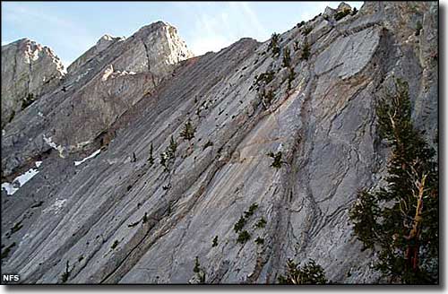 The crest of Currant Mountain 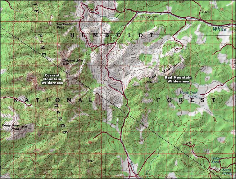 Currant Mountain Wilderness map |
|
|

|
| Index - Arizona - Colorado - Idaho - Montana - Nevada - New Mexico - Utah - Wyoming National Forests - National Parks - Scenic Byways - Ski & Snowboard Areas - BLM Sites Wilderness Areas - National Wildlife Refuges - National Trails - Rural Life Advertise With Us - About This Site - Privacy Policy |
| Photo of bristlecone pines in the Currant Mountain Wilderness courtesy of G. Thomas. Map courtesy of National Geographic Topo! Text Copyright © by Sangres.com. All rights reserved. |