 |
Eldorado Wilderness |
|
|
 In the Eldorado Wilderness |
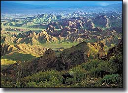
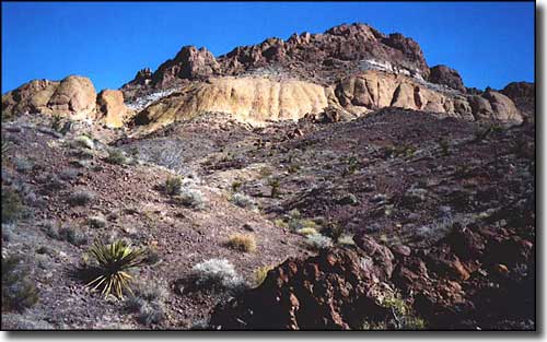
The Eldorado Wilderness is some 31,950 acres that drop from the tops of the rugged and scenic Eldorado Mountains through a maze of peaks and side canyons to a series of vertical cliffs that rise above the edge of the Colorado River. The Eldorado Mountains are along that prominent ridge that rises east of US 95 between the highway and the Colorado River. This rugged area was obviously formed by some heavy-duty volcanic activity, which means you may come across some remains from the days of early mining activity while you traipse through the area. The base rock of the Eldorado Mountains is Precambrian metamorphic rock laid down about 1.37 billion years ago. On top of that is colorful volcanic Oligocene and Miocene tuff with Tertiary basalt flows between 40 and 15 millon years old. The mountains were pushed up during the Miocene Basin & Range Uplift about 15 million years ago. Over the years since then, the mountains have been extensively eroded with sands and gravels washed downhill to the northwest forming a large bajada. Most of the Eldorado Wilderness is contained within the Lake Mead National Recreation Area but there is a section that crosses that western boundary and extends into Bureau of Land Management property. Water is very scarce and summer temperatures often exceed 120°. Vegetation mostly consists of various cacti and low-desert shrubbery (ephedra, scrub oak, creosote bush, etc.) Among the wildlife you'll find mountain lions, bobcats, desert bighorn sheep, wild burros, coyotes and jackrabbits. There's also desert tortoise, side-blotched lizards, scorpions, tarantulas and several varieties of rattlesnake. Just beyond the southwest corner of the Eldorado Wilderness is a natural arch named "Gregory's Arch." |
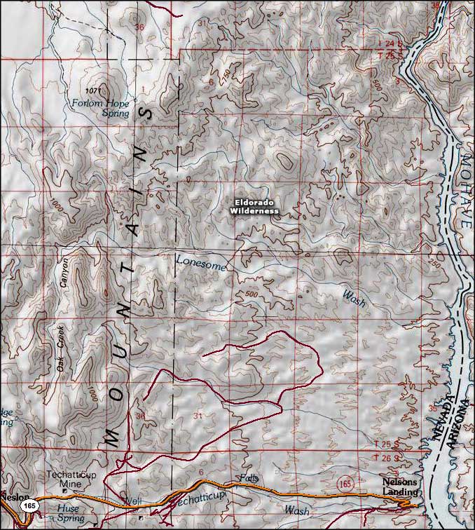 Eldorado Wilderness map |
|
|

|
| Index - Arizona - Colorado - Idaho - Montana - Nevada - New Mexico - Utah - Wyoming National Forests - National Parks - Scenic Byways - Ski & Snowboard Areas - BLM Sites Wilderness Areas - National Wildlife Refuges - National Trails - Rural Life Advertise With Us - About This Site - Privacy Policy |
| Upper photo courtesy of Peter Druschke, via Wilderness.net Upper left photo courtesy of Howard Booth, National Park Service Map courtesy of National Geographic Topo! Text Copyright © by Sangres.com. All rights reserved. |