 |
Quinn Canyon Wilderness |
|
|
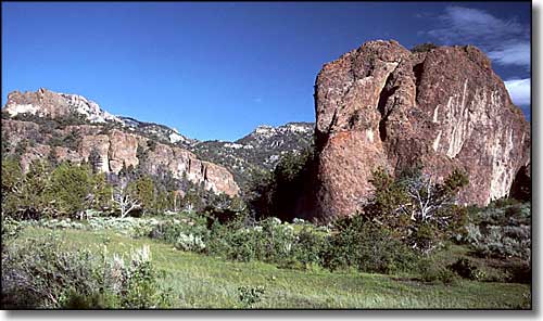 Little Cherry Creek Valley in the Quinn Canyon Wilderness |
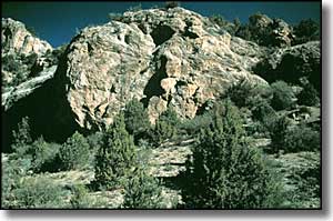
The 26,310-acre Quinn Canyon Wilderness is in the far southern section of the Grant Range in central Nevada. This is an isolated, remote area that sees very few human visitors. The main mountainous ridgeline in the Quinn Canyon area crests above 10,000', with many smaller ridges and narrow canyons dropping away to the east and west. The drainages are V-shaped rather than U-shaped (which signifies glaciation), and allow snowmelt and summer rains to collect in 4 year-round streams. The higher reaches of Quinn Canyon Wilderness are covered with white fir, mountain mahogany and aspen interspersed with small stands of bristlecone pine, while the zone just below carries stands of pinon pine and juniper and the lower areas are covered with typical desert sagebrush. For wildlife there's mule deer, bighorn sheep, mountain lion, bobcat, coyote and maybe a few elk. Most of the 20-or-so miles of trail are in poor to ridiculous condition and receive little to no use. The Little Cherry Creek Trail is the only trail in the area that is rated as fair, and a rough hike on that will lead you to the 10-mile Hooper Canyon semi-loop: a route through Quinn Canyon Wilderness that doesn't quite reconnect with itself. At the upper end of the north fork of Pine Creek you'll find several small waterfalls that flow in spring and early summer. To access the eastern side of Quinn Canyon Wilderness, go south of Ely for 24 miles on US 6 to the intersection with State Highway 318. Turn and go southeast for 45 miles to the turnoff to the Wayne E. Kirch Wildlife Refuge. Follow that dirt road for 45 miles to Forest Service Road 410, which ends at the Cherry Creek Guard Station in the town of Adaven. To access the western side of Quinn Canyon Wilderness, follow US 6 southwest from Ely for 60 miles. Just past the town of Currant is a dirt road on the left heading south. Follow that dirt road about 37 miles to Forest Service Road 419, which leads into Willow Creek Canyon. Quinn Canyon Wilderness is separated from the Grant Range Wilderness to the north only by an active dirt road. That dirt road leads to the Cherry Creek Campground, a primitive dispersed campground under the cottonwoods next to a year round stream. |
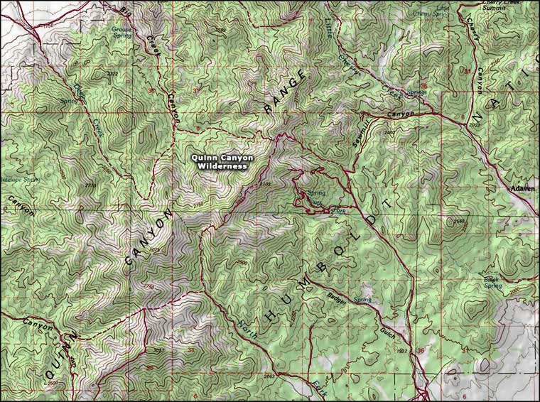 Quinn Canyon Wilderness map |
|
|

|
| Index - Arizona - Colorado - Idaho - Montana - Nevada - New Mexico - Utah - Wyoming National Forests - National Parks - Scenic Byways - Ski & Snowboard Areas - BLM Sites Wilderness Areas - National Wildlife Refuges - National Trails - Rural Life Advertise With Us - About This Site - Privacy Policy |
| Photo of the Little Cherry Creek Valley courtesy of G. Thomas. Photo of Quinn Canyon Wilderness courtesy of the Friends of Nevada Wilderness Map courtesy of National Geographic Topo! Text Copyright © by Sangres.com. All rights reserved. |