Cibola National Forest Campgrounds

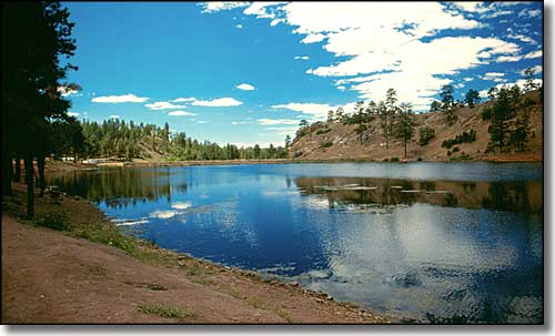
McGaffey Lake
Recreational Sites on the Mt. Taylor Ranger District
| Site Name | Location (Distances in miles) | Elevation | Open | Stay Limit | Comments | ||||||
|---|---|---|---|---|---|---|---|---|---|---|---|
| Ojo Redondo | 26m S of Thoreau via NM 412, FR 178 & 480 | 8,900' | 15 | 15 | No | No | No | 22' | May-Nov | 14 | |
| McGaffey Campground | 8m S of Fort Wingate via NM 400 | 8,000' | 29 | Yes | Yes* | No** | Yes | 22' | May-Sept | 14 | Nature Trails |
| McGaffey Lake | 8m S of Fort Wingate via NM 400 | 8,000' | 0 | 0 | No | No | Yes | No | Jan-Dec | Day Use Only | |
| Quaking Aspen | 6m S of Fort Wingate via NM 400 | 7,600' | 20 | 0 | $5.00 | No | No | 22' | May-Sept | 14 | |
| Coal Mine | 10m NE of Grants via NM 547 | 7,400' | 15 | 15 | $5.00 | No | No | 22' | May-Sept | 14 | Nature Trails |
| Lobo Canyon | 10m NE of Grants via NM 547, FR 239 & 193 | 7,400' | 6 | 6 | No | No | No | No | May-Sept | 14 | |
| Key: * - Overnight - $10.00, Hookup (electricity only) - $15.00, Additional Cars - $4.00 ** - Drinking water is currently NOT available at McGaffey Campground. |
|||||||||||
| Recreational Sites on the Mountainair Ranger District |
|||||||||||
| Site Name | Location (Distances in miles) | Elevation | Open | Stay Limit | Comments | ||||||
| Capilla | 12m W of Manzano via NM 55, FR 245 | 9,600' | 8 | 8 | No | No | No | 16' | May-Sept | 14 | Rough Road |
| New Canyon | 8m W of Manzano via NM 55, FR 245 | 7,800' | 10 | 10 | No | No | No | 22' | All Year | 14 | Rough Road |
| Red Canyon | 12m W of Manzano via NM 55, FR 245 | 7,600' | 38 | 11 | No | No | No | 22' | Apr-Oct | 14 | Handicap accessible, horse camping |
| Red Cloud | 18m SW of Corona via US 54, FR 161 & 399 | 7,600' | 5 | 1 | No | No | No | No | All Year | 14 | |
| Tajique | 5m W of Tajique via NM 55, FR 55 | 6,800' | 4 | 0 | No | No | No | No | All Year | 14 | |
| Fourth of July | 8m W of Tajique via NM 55, FR 55 | 7,400' | 24 | 4 | $7.00 | No | No | No | Apr-Oct | 14 | Handicap accessible |
| Recreational Sites on the Magdalena Ranger District |
|||||||||||
| Site Name | Location (Distances in miles) | Elevation | Open | Stay Limit | Comments | ||||||
| Springtime | 12m S of I-25 Exit 115 via NM 1, FR 225 | 7,400' | 6 | 6 | No | No | No | No | Apr-Nov | 14 | High clearance vehicles only |
| Luna Park | 8m NE or Monticello via FR 139 & FR 225 | 7,400' | 3 | 3 | No | No | No | 20' | Apr-Nov | 14 | High clearance vehicles only |
| Huges Mill | 26m SW of Magdalena via US 60 & NM 168 | 8,100' | 2 | 2 | No | No | No | 20' | May-Oct | 14 | |
| Bear Trap | 25m SW of Magdalena via US 60 & NM 168 | 8,500' | 4 | 4 | No | No | No | 20' | May-Oct | 14 | |
| Water Canyon | 16 SE of Magdalena via US 60 & FR 235 | 6,800' | 4 | 16 | No | No | No | 22' | Mar-Nov | 14 | |
| Recreational Areas on the Sandia Ranger District |
|||||||||||
| Site Name | Location Distances in miles | Elevation | Open | Stay Limit | Comments | ||||||
| Juan Tabo | 10m NE of Albuquerque via NM 556 & FR 333 | 6,800' | 0 | 22 | $3.00 | No | No | No | All Year | 1 | |
| La Cueva | 8m NE of Albuquerque via NM 556 & FR 333 | 6,600' | 0 | 36 | $3.00 | No | No | No | All Year | 1 | |
| La Luz | 10m NE of Albuquerque via NM 556 & FR 333 | 6,800' | 0 | 0 | $3.00 | No | No | No | All Year | 1 | Trailhead Parking |
| Las Huertas | 6m S of Placitas via NM 165 | 7,600' | 0 | 34 1 Group Area |
Yes* | Yes | No | No | All Year | 1 | Handicap accessible |
| Tunnel Spring | 2.2m W of Placitas via NM 165 | 6,400' | 0 | 0 | No | No | No | No | All Year | 1 | Trailhead, Horse trailer parking |
| Doc Long | 2m W of Sandia Park via NM 536 | 6,800' | 0 | 25 2 Group Areas |
Yes* | No | No | No | Apr-Oct | 1 | Handicap accessible, Horse trailer parking |
| Sulphur Canyon | 2m W of Sandia Park via NM 536 | 6,800' | 0 | 37 | $3.00 | No | No | No | May-Oct | 1 | Handicap accessible, Nature trails |
| Cienega Canyon | 2m W of Sandia Park via NM 536 | 7,600' | 0 | 72 1 Group Area |
Yes* | No | No | No | May-Oct | 1 | Handicap accessible, Nature Trails, Trailhead, Horse trailer parking |
| Tree Spring | 5.6m N of Sandia Park | 8,500' | 0 | 0 | $3.00 | No | No | No | All Year | 1 | Trailhead |
| Balsam Glade | Intersection of NM 165 & NM 536 | 8,800' | 0 | 19 1 Group Area |
Yes* | Yes | No | No | May-Oct | 1 | Handicap accessible |
| Ellis Trailhead | 5m E of Intersection on NM 165 & NM 536 | 10,260' | 0 | 0 | $3.00 | No | No | No | All Year | 1 | Handicap accessible, Trailhead |
| Capulin Springs | 1m W of Intersection of NM 165 & NM 536 | 8,800' | 0 | 33 | $3.00 | No | No | No | May-Oct | 1 | |
| Nine Mile - CLOSED** | 2m W of Intersection of NM 165 & NM 536 | 9,200' | 0 | 13 1 Group Area |
Yes* | No | No | No | May-Oct | 1 | |
| Dry Camp | 6.2m NW of Sandia Park via NM 536 | 8, 000' | 0 | 4 | $3.00 | No | No | No | Mar-Nov | 1 | |
| Cedro Trailhead | 4m SE of Tijeras via NM 337 | 7,450' | 0 | 0 | No | No | Yes | No | All Year | 1 | Trailhead, Horse trailer parking |
| Cedro Peak | 4m SE of Tijeras via NM 337 | 7,800' | 2 Group | 0 | Yes* | Yes | No | No | May-Oct | 14 | Group Reservation Area Only |
| Pine Flat | 6m SE of Tijeras via NM 337 | 7,200' | 0 | 2 Group Areas 16 Picnicking |
Yes* | No | No | No | May-Oct | 1 | |
| Oak Flat (Group Sites Only) | 10m SE of Tijeras via NM 337 | 7,600' | 0 | 6 Groups | Yes* | Yes | No | No | May-Oct | 1 | Handicap accessible, Group Reservation Area Only |
| Dead Man | 7m SE of Tijeras via NM 337 | 7,400' | 1 Group | 1 | Yes* | No | No | No | May-Oct | 14 | Group Reservation Area Only |
| Sandia Cave | 5m S of Placitas via NM 165 | 7,500' | 0 | 0 | No | No | No | No | All Year | 1 | Trailhead, Historic Register Site |
| Key: *For reservations and group ratesCall 505-281-3304 ** Please contact the Sandia Ranger District office for current information regarding when these sites will open. Phone: 505-281-3304 |
|||||||||||

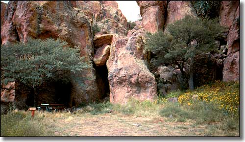
Campsite in the Magdalena Ranger District
Cibola National Forest Pages
Cibola National Forest - Selected Hiking TrailsMore New Mexico Information, Photos and Maps
Towns & Places - Scenic Byways - State Parks - History & HeritagePhoto Galleries - Unique Features - BLM Sites - Outdoor Sports & Recreation
New Mexico's National Forests - Wilderness Areas - New Mexico's National Parks
National Wildlife Refuges - Ski & Snowboard Areas
