 |
|---|
Hunting and Fishing on
|
|
|
 |

Conejos County State Trust Lands Alamosa Canyon - GMU 81 La Jara Reservoir - GMU 81 Rajadero Canyon - GMU 81 Pinon Hills - GMU 81 Vincente Canyon- GMU 81 Alamaditas Mesa - GMU81 Los Mogotes Peak - GMU 81 San Luis Hills - GMU 81 Conejos County State Wildlife Areas Conejos River Hot Creek - La Jara Reservoir La Jara - Sego Springs Terrace Reservoir - Trujillo Meadows |
|
Alamosa Canyon From Monte Vista go south on Highway 15 for 12 miles, then turn west and go 11 miles on Forest Service Road 250 to Terrace Reservoir (Alamosa Canyon). Park and go on foot or horseback through National Forest and BLM. La Jara Reservoir From La Jara go west on Highway 15 for 10.5 miles to USFS Road 240, then go about 23 miles to property. Timber activity may be present. Rajadero Canyon From La Jara go 14 miles west on CR 15, turn left onto dirt road at Centro, then go 7 miles on La Jara Reservoir Road to property. Pinon Hills From Manassa drive 3.6 miles east on Highway 142 to BLM Road 5006 and go southeast about 3 miles. The property is directly south of the road. Vincente Canyon From Monte Vista go 21 miles south on Highway 15 to Capulin. Travel 10 miles southwest on dump road (CR 8) from Capulin to north end of property. Alamaditas Mesa Route #1: From Los Mogotes Peak State Trust Lands, continue on two-track road west 7.5 miles to west boundary. Los Mogotes Peak From south side of Antonito at Highways 285 and 17, travel 7 miles west on Highway 17 to a two-track trail on north side of Highway 17 by an old cemetery. Travel north and west on two-track trail along north side of Los Mogotes Peak. Go past peak 5 miles through BLM property to east boundary of property. San Luis Hills In the town of Antonito at US 285 and 6th St. (CR G) go 11.5 miles east on CR G. Turn north on a two-track road, go 1 mile. Boundary of property is 1/4 mile to the east across BLM property to west edge of property. |
| State Wildlife Areas |
Conejos River From Antonito go 15 miles west on Highway 17 to Conejos Ranch. Fishing easements are intermittent for next 16 miles and are signed. Hot Creek From Monte Vista go 20 miles south on Highway 15 to access road, then 5 miles west to property. La Jara Reservoir From Monte Vista go 20 miles south on Highway 15 to access road, then 10 miles west to reservoir. La Jara From Capulin go 11 miles southwest on D Road to property. Sego Springs From Manassa go 3 miles east on Highway 142 to access road, then 1/2 mile north to property. Terrace Reservoir From Monte Vista go 12 miles south on Highway 15 to USFS Road 250, then 9 miles west to reservoir. Trujillo Meadows From Antonito go 36 miles west on Highway 17 to USFS Road 118, then 4 miles north to reservoir. |
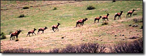
 Elk on the move |
|
|
Conejos County Related Pages
Colorado Trust Lands & Wildlife Areas - GMU Map (.pdf)
State Trust Lands FAQ - Big Game Seasons (.pdf) Conejos County - The Colorado Fishing Story Colorado Pages
Towns & Places - Scenic Byways - State Parks - BLM Sites - History & Heritage Ski & Snowboard Areas - Photo Galleries - Colorado Mountains - Scenic Railroads Unique Natural Features - Wilderness Areas - Outdoor Sports & Recreation Colorado's National Forests - National Wildlife Refuges - Colorado's National Parks |

|
| Index - Arizona - Colorado - Idaho - Montana - Nevada - New Mexico - Utah - Wyoming National Forests - National Parks - Scenic Byways - Ski & Snowboard Areas - BLM Sites Wilderness Areas - National Wildlife Refuges - National Trails - Rural Life Advertise With Us - About This Site - Privacy Policy |
| Photos courtesy of Sangres.com, CCA ShareAlike 3.0 License. All text Copyright © by Sangres.com. All rights reserved. |