 |
|---|
Hunting and Fishing on
|
|
|
 |
West Carter Mountain - GMU 181 Windy Ridge - GMU 27 Grand County State Wildlife Areas Hot Sulphur Springs Junction Butte Kemp-Breeze Radium Red Mountain Windy Gap Watchable Wildlife Area |
|
Antelope Creek Go west on Highway 40 from Kremmling for 14 miles. At Chimney Roack Road (FS 103), go east for 6 miles to East Carter Mountain gate. Access is through the walk-through gate. Carter Creek Go 14 miles north of Kremmling on Highway 40 to Chimney Rock Road (Forest Service Road 103). Turn east and go 3 miles to sign and parking area. Copper Mountain From Kremmling, take Highway 9 south to Williams Peak, or from CR 3 at Mule Creek. Access to property is across National Forest to the south. All other access involves crossing private land: get permission first. East Carter Mountain Go 14 miles north of Kremmling on Highway 40 to Chimney Rock Road (Forest Service Road 103), then go east 6 miles to sign and gate. Middle Carter (Gunsight) Northwest Sector: Take Highway 40 for 14 miles north of Kremmling to Forest Service Road 103 (Chimney Rock Road). Chimney Rock Road (also known as CR 27) accesses the northwest section. Southeast Sector: Take Highway 40 for 10 miles north of Kremmling to CR 25. Take left fork onto CR 26 about 1/2 mile from Highway 40 and go east for 5 miles. CR 26 (Gunsight Road) accesses southeast section of property. Middle Park Take Highway 40 for 6 miles north of Kremmling to Highway 134. Go 4 miles to FSR 100 (Red Dirt Road), then go 15 miles to Buffalo Park. Take FSR 131 east for 1 mile to sign and gate. Milk Creek Southwest access: Take Highway 40 for 6 miles west of Kremmling to Highway 134, then go 4 miles to FSR 100 (Red Dirt Road). Go north 15 miles to Buffalo Park, then east on FSR 131 to sign and gate. Northeast access: Take Highway 40 for 20 miles west from Kremmling to CR 184. In dry weather only, go 2 miles west through white pipe gate and along vehicle track to parking area just before Muddy Creek. In wet weather, stay on CR 184 to mile marker 161 and enter property from ridge or end of road. Two Bar access: go west from Kemmling for 18 miles on Highway 40 to signed parking area at mile marker 163. Timber activity may be present. Ptarmigan Cross the railroad tracks at the north end of Fraser and go southwest 8 miles on Church Park or Crooked Creek Road (CR 50) in Arapahoe National Forest. Slide Mountain East of Kremmling, turn north off Highway 40 onto CR 2 and go 4 miles to Black Mountain Road. Follow Black Mountain Road for 7.2 miles, then turn left, go 0.2 miles to fork, take left fork and go 0.3 miles to sign. The access is steep with no access across the neighboring private land to the south, west or north. Troublesome Valley Ranch Take Highway 40 east from Kremmling for 5 miles to CR 2, turn and go north on CR 2 about 9 miles to CR 24, then turn right. Access through BLM land or off road. West Carter Mountain Go 14 miles north of Kremmling on Highway 40 to Chimney Rock Road (CR 27/USFS Road 103). Access to southwest corner of the property begins at the gate 1.5 miles east of Highway 40. Access from the east and northeast sides continues up Chimney Rock Road 5 miles to marked gates.
Windy Ridge Go 20 miles west of Kremmling on Highway 40 (mile marker 163, Diamond Creek crossing), then go west 2 miles on CR 184. Timber activity may be present. CR access runs through private property until boundary of STL. Do not drive or park vehicles off county road in hay meadows.
|
|
State Wildife Areas |
|
Hot Sulphur Springs Several units, all off of Highway 40 just out of Hot Sulphur Springs
Junction Butte Go 3 miles south of Kremmling on Highway 9 to CR 387, turn and go east 1/2 mile. Kemp-Breeze Breeze Unit: On Highway 40, about 15 miles west of Granby look for mile marker 196. Turn left 1/4 mile west of marker for parking, or go west 3/4 mile for more parking. Unit is 11.5 miles east of Kremmling. Radium Go 2.5 miles south of Kremmling on Highway 9 to CR 1, then go 12 miles southwest on the Trough Road (CR 1) toward State Bridge. Red Mountain OPEN: April 16 to November 14 RESTRICTIONS: No fires or motor vehicles allowed; Dogs must be on a leash. _____________________________________________ Windy Gap Watchable Wildlife Area Go 2 miles west of Granby on Highway 40. Property is on Highway 125. |
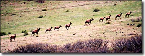
 Elk on the move |
|
|
Grand County Related Pages
Colorado Trust Lands & Wildlife Areas - GMU Map (.pdf)
State Trust Lands FAQ - Big Game Seasons (.pdf) Grand County - The Colorado Fishing Story Colorado Pages
Towns & Places - Scenic Byways - State Parks - BLM Sites - History & Heritage Ski & Snowboard Areas - Photo Galleries - Colorado Mountains - Scenic Railroads Unique Natural Features - Wilderness Areas - Outdoor Sports & Recreation Colorado's National Forests - National Wildlife Refuges - Colorado's National Parks |

|
| Index - Arizona - Colorado - Idaho - Montana - Nevada - New Mexico - Utah - Wyoming National Forests - National Parks - Scenic Byways - Ski & Snowboard Areas - BLM Sites Wilderness Areas - National Wildlife Refuges - National Trails - Rural Life Advertise With Us - About This Site - Privacy Policy |
| Photos courtesy of Sangres.com, CCA ShareAlike 3.0 License. All text Copyright © by Sangres.com. All rights reserved. |