 |
|---|
Hunting and Fishing on
|
|
|
 |
Moffat County State Trust Lands Bakers Peak - GMU 3/4 Bald Mountain - GMU 3 Ben Morgan Canyon - GMU 211 Big Hole Gulch - GMU 3 Boston Flats - GMU 3 Box Elder - GMU 211 Box Elder North - GMU 211 Castor Gulch - GMU 13 Cedar Springs - GMU 11 Cedars - GMU 4 Citadel - GMU 211 Cold Springs Mountain - GMU 2/201 Cross Mountain - GMU 11 Elk Springs #1 - GMU 11 Elk Springs #3 - GMU 10 Fortification - GMU 301 Godiva Rim - GMU 3 Greasewood - GMU 3 Great Divide - GMU 3 Homestead - GMU 11 Iles Grove - GMU 12/211 Jeffway Gulch - GMU 13 Jimmy Dunn Gulch - GMU 441 Jubb Creek - GMU 211
Little Snake - GMU 2/3 Maybell - GMU 3 Monument Butte - GMU 12 Morapos Creek - GMU 12 Morgan Gulch - GMU 211 Oxbow - GMU 2 Peck Mesa - GMU 11 Pine Tree Gulch - GMU 211 Pinon Ridge Pole Gulch - GMU 3 Rattlesnake Hill - GMU 211 Sagebrush Draw - GMU 11 Simsberry Draw -GMU 3 South Duffy Mountain - GMU 211 South Nipple Rim - GMU 2/3 Temple Canyon - GMU 211 Thornburg Draw - GMU 11 Triangle - GMU 11 Willow Creek - GMU 4 Moffat County State Wildlife Areas Bitter Brush Browns Park Elkhead Lake Little Snake |
|
Bakers Peak At highways 13 and 40 in Craig, go north on highway 13 for 24 miles to CR 101. Turn and go east on CR 101 for 1.5 miles. Bald Mountain Unit 1: Go north on CR 19 from Maybell for 15 miles to CR 150. Turn and go west on CR 150 for 1/2 mile. Unit 2: Go north from Maybell on CR 19 for 10 miles to CR 71, turn and go west on CR 71 to CR 71S, then go south on CR 71S another 2.5 miles. Units 3 & 4: Go west from Maybell on Highway 318 for 15 miles to CR 21. Turn north onto CR 21. Unit 3 is 9 miles north of Highway 318. Unit 4 is 14 miles north of Highway 318 and straddles CR 21. Ben Morgan Canyon Go 23 miles north of Meeker on Highway13. Turn west on CR 17 and go to CR 32. Go west from there 11 miles to CR 55. Follow that 2.5 miles to parking area. Big Hole Gulch Go 40 miles north of Craig on Highway 13, then turn west and follow CR 4 for 15 miles. Boston Flats Go northwest of Maybell 3.5 miles on Highway 318. Property is north of the highway with parking in between. No roads, walk-in access only. Box Elder From Hamilton, take Highway 13 south for 11 miles to CR 17. Turn west (right) and go 1.5 miles to CR 51, then go another mile to CR 32, and then another 8.5 miles to BLM access. Box Elder North Go 23 miles north of Meeker on Highway 13. Then go west on CR 32 for 7 miles to parking area. Castor Gulch Go south from Craig on Highway 13 for about 14 miles to CR 93. Turn east and go 1/2 mile. Signs designate area for hunting. Part of the property is state trust land, part private land. Cedar Springs Go 8 miles west of Maybell on Highway 40, then turn and go south on CR 23 about 2 miles. Vehicle access on CR 23 and BLM 1558. Cedars From Craig, go north 38 miles on Highway 13 to CR 2, then turn and go east on CR 2 for 6.5 miles. Citadel From Meeker, go north on Highway 64 to CR 71. Take that north to Indian Valley Truck Trail, then go north another 12 miles to the property. Cold Springs Mountain Go northwest from Maybell on Highway 318 for 41 miles to CR 10N. Turn and go north on CR 10N for 8 miles. A lot of the property is west of CR 10N on top of Cold Springs Mountain, but it is mixed with BLM and private land. 2,495 acres east of CR 10N is also mixed with BLM and private land. 4WD recommended if travelling CR 167 or BLM 2007. Cross Mountain From Maybell, take Highway 40 southwest for 16 miles to mile marker 44, then go north on Deer Lodge Park Road about 2.5 miles to BLM easement. Elk Springs #1 Go to mile marker 42 on Highway 40 west of Maybell. Turn south on BLM 1509 and go 9 miles through Section 36, then turn northwest. The private property in Sagebrush Draw (portions of Sections 14, 23, 26) open to hunting. Enter south end through Section 26. Elk Springs #3 Go 3/4 mile west of Elk Springs on Highway 40, then go south on BLM road. Property is split by BLM road. Fortification Go north from Craig for 9.5 miles on Highway 13.
Godiva Rim Take Highway 318 northwest from Maybell to CR 21. Turn and go north on CR 21 about 4 miles to BLM Godiva Rim access road 2124. Go east on BLM 2124 about 7 miles to the property. Greasewood Six parcels:
OPEN: August 1 to February 28 HUNTING: Deer, elk, pronghorn, rabbits, sage grouse RESTRICTIONS: Foot access only. _____________________________________________ Great Divide Go northwest from Craig on CR 7 to CR 5, then east on CR 5 to CR 118, then north on CR 118 for 1/4 mile. Homestead Take Highway 318 west from Maybell for 10 miles, then turn and go southwest on CR 10 for 6 miles. At intersection with BLM Road 1686, turn and go south on BLM road for 1 more mile. Iles Grove To east parcel: go south from Craig on Highway 13 to 4 miles south of Hamilton and 1 mile east of mile maker 70.4 (that's on the west boundary of the property). To west parcel: go south from Craig on Highway 13 to 5.5 miles south of Hamilton and 1 mile west of mile marker 70.4, turn and go south on CR 49 for 1 mile to parking area. Jeffway Gulch Go 14 miles south of Craig on Highway 13 to Highway 317, turn and go east on Highway 317 for 7.5 miles to CR 33. Go north 1.25 miles on CR 33 to property. There's a horse gate at the southeast corner. Jimmy Dunn Gulch Go 5 miles north of Hayden on Highway 40 to CR 80, then go north on CR 80 for 2.5 miles to property on west side of CR 80. Jubb Creek Go 23 miles north of Meeker on Highway 13, turn and go west on CR 17 to CR 32, then go west again 1/2 mile to parking area. Little Snake Go 15 miles northwest of Maybell on Highway 318 to CR 21, then go north on CR 21 about 3.5 miles. Maybell Go north of Maybell 1.5 miles on CR 19. Property is east and west of CR 19, north of Yampa River. CR 19 bisects property north/south and is primary access. Access also from Highway 40, 4.5 miles east of Maybell and off Highway 318, west of Maybell near town of Sunbeam. Monument Butte Go south of Hamilton 3 miles on Highway 13 to Yellow Jacket Pass Road (CR 45). Go south on CR 45 for 4 miles to parking area. Morapos Creek Go 2 miles south of Hamilton on Highway 13, then go south on CR 41 for 2 miles to access on BLM land. Access is steep and up to 2 miles from CR. Game retrieval may be difficult. Morgan Gulch Go south from Craig on Highway 13 to Axial Basin. Then go west on CR 51 to CR 32, turn onto CR 32 and go 4 miles. CR 32 runs through the property. CR 133 runs through north part of property. Oxbow Go 17 miles northwest of Maybell on Highway 318 to parking area on south side of property. Peck Mesa Take Highway 318 northwest from Maybell to CR 10, turn south on CR 10 and go about 2 miles. The property is to the north of CR 10. Pine Tree Gulch East of Maybell, go south of Highway 40 on CR 57 for 12 miles. Pinon Ridge Go west from Meeker on Highway 64 to CR 77, then go north on CR 77 to BLM Road 1509. Pole Gulch Go 39 miles north from Craig on Highway 13 to CR 4, then go west on CR 4 for 1.75 miles. Property is south of CR 4 and extends 5 miles west of CR 9. Rattlesnake Hill Go west on Highway 40 from Craig for 27 miles, turn south on CR 57 (Price Creek Road) and go 5 miles to CR 32. Turn south on CR 32 and go 4 miles to the parking area and walk-through access gate at the northeast corner of the property. There's a second walk-through gate on the drift fence in the southeast quarter. Sagebrush Draw Go east of Maybell on Highway 40 to mile marker 42, then turn south on BLM Road 1509 and go 5 miles to the property. Simsberry Draw From Maybell, go west on Highway 318 for 10 miles to BLM Road 2122, then go north 2.5 miles. South Duffy Mountain Go south from Craig on Highway 13 to CR 51, then go west 2 miles to CR 17, then turn and go north 5 miles to the property. South Nipple Rim Go north on CR 19 from Maybell for 12 miles to CR 21. Then turn and go north 11 more miles to CR 7, then head north 2 more miles to CR 4. Follow CR 4 west for 9 miles to CR 66, then go south to the property. Temple Canyon Go southwest from Craig on Highway 40 for 27 miles to CR 57 (Price Creek Road). Turn south to Rattlesnake Hill. Access via Rattlesnake Hill and BLM land, about 3 miles. Thornburg Draw Go west from Maybell for 5 miles on Highway 40, then turn south on BLM Road 1558 and go about 1/4 mile. Triangle Immediately west of Maybell off Highways 40 and 318. Willow Creek Go north from Craig for 29 miles on Highway 13 to CR 101, then go 7 miles northeast on CR 101 to CR 70. Then go 3 miles east on CR 70. Property is another 1/4 mile northeast through BLM land. |
|
State Wildife Areas |
|
Bitter Brush OPEN: May 1 to January 14 RESTRICTIONS: No camping or fires allowed; No vehicles allowed off the county roads. _____________________________________________ Brown's Park Several units, all 40+ miles northwest of Maybell off Highway 318. Elkhead Lake RESTRICTIONS:
Little Snake Go 17 miles north of Maybell on CR 19. CR 19 travels across the property. |
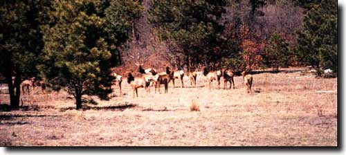
 Elk in a meadow |
|
|
Moffat County Related Pages
Colorado Trust Lands & Wildlife Areas - GMU Map (.pdf)
State Trust Lands FAQ - Big Game Seasons (.pdf) Moffat County - The Colorado Fishing Story Colorado Pages
Towns & Places - Scenic Byways - State Parks - BLM Sites - History & Heritage Ski & Snowboard Areas - Photo Galleries - Colorado Mountains - Scenic Railroads Unique Natural Features - Wilderness Areas - Outdoor Sports & Recreation Colorado's National Forests - National Wildlife Refuges - Colorado's National Parks |

|
| Index - Arizona - Colorado - Idaho - Montana - Nevada - New Mexico - Utah - Wyoming National Forests - National Parks - Scenic Byways - Ski & Snowboard Areas - BLM Sites Wilderness Areas - National Wildlife Refuges - National Trails - Rural Life Advertise With Us - About This Site - Privacy Policy |
| Photos courtesy of Sangres.com, CCA ShareAlike 3.0 License. All text Copyright © by Sangres.com. All rights reserved. |