 |
|---|
Hunting and Fishing on
|
|
|
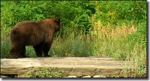
 A black bear heads into the weeds |
Routt County State Trust Lands Coal Bank Gulch - GMU 441 Cottonwood Creek - GMU 441 Deep Creek - GMU 214 Fly Gulch - GMU 214 Grassy Creek - GMU 13 Jimmy Dunn Gulch - GMU 441 King Creek - GMU 26 Maynard Gulch - GMU 441 Moody Creek - GMU 231 Moonhill - GMU 14 Morrison Creek - GMU 15 Sage Creek - GMU 13 Sleeping Giant - GMU 214 Stokes Gulch - GMU 13 Twenty Mile - GMU 13 Yampa River - GMU 13
Routt County State Wildlife Areas Adams Christina Chuck Lewis Elkhead Lake Emerald Mountain Indian Run Mount Werner Radium Rock Creek Service Creek Steamboat Springs Yampa River Routt County State Fish Unit Finger Rock |
|
Coal Bank Gulch Go 2.5 miles north of Hayden on CR 76 Cottonwood Creek Go north from Hayden on CR 80 for 1 mile to CR 70, then go east on CR 70 for 2.8 miles to CR 80 and follow that north for another 10.7 miles to the property. Deep Creek Go north on CR 129 for 10 miles from Steamboat Springs. At CR 54 go west 5 miles to CR 56. Then go west and south 3 miles to CR 52W and then another 2.4 miles west (the last 2 miles are 4WD only). Fly Gulch - youth mentors only Go north of Steamboat Springs on Highway 129 to CR 44. Go west on CR 44 to CR 44A, turn and go north 1 more mile. Grassy Creek Go east of Hayden on Highway 40 for 6 miles. At CR 27 turn and go south 6 miles. Parking is on Old Rockcastle Mine Access Road off CR 27. Jimmy Dunn Gulch Go 5 miles north of Hayden on Highway 40 to CR 80, then turn and go north on CR 80 for 2.5 miles to property on west side of CR 80. King Creek Go 1/2 mile south of Toponas on Highway 131, then turn and go west about 3 miles on CR 5 to CR 5A. Then go south 1 more mile. Maynard Gulch Go 8 miles west of Hayden on Highway 40. Property is north of highway. Moody Creek Take Highway 40 for 2 miles south from Steamboat Springs to Highway 131. Turn onto Highway 131 and go south to town of Yampa. Follow CR 7 southwest until it becmes FSR 900, then go 3/4 mile north. Moonhill Go southeast from Clark on FSR 440 to FSR 471. At FSR 471A, walk southwest into Long Draw. Go 3 miles to property. Also, corner of Moonhill next to CR 129 about 12 miles north of Highway 40 at Steamboat Springs. Parking at FSR 471A. Morrison Creek From Oak Creek, go south 1 mile on Highway 131 to CR 14, then go 4 miles east to inlet of Stagecoach Reservoir and go south for 7 miles on CR 16. There is a private access road on the property. Sage Creek Go south of Hayden 7 miles on CR 37 Sleeping Giant Go 8 miles west of Steamboat Springs on Highway 40, then turn and go north on CR 44 to CR 46. Turn onto CR 46 and go 4 miles to signed parking area. Gate and parking area are in northwest corner of property. Stokes Gulch Go south from Hayden on CR 37 to CR 59. Twenty Mile From Highway 40 east of Hayden, go south on CR 27 for 6 miles. Yampa River Go 8 miles west of Hayden on Highway 40. Property is on south side of Highway 40. Access from Yampa River State Wildlife Area parking area. |
|
State Wildife Areas |
|
Adams Go east on Highway 40 from Steamboat Springs to Highway 131, turn south. At CR 14 turn south again. Adams State Wildlife Area is 1/2 mile north of Stagecoach State Park. Christina Go 7 miles north of Steamboat Springs on Elk River Road (CR 129). Chuck Lewis From Highway 40, go south on Highway 131 to CR 14F, then go west to CR 14F, then north to parking area.
Elkhead Lake RESTRICTIONS:
Emerald Mountain RESTRICTIONS:
Indian Run Go 12 miles southeast of Hamilton on Highway 317 to CR 67, turn and go south for 6 miles to the property. Mount Werner RESTRICTIONS: No habitat stamp required. _____________________________________________ Radium Go 2 miles south of Kremmling on Highway 9 to CR 1 (the Trough Road to State Bridge), turn and go 12 miles southwest. Rock Creek Go 6 miles north of Kremmling on Highway 40 to Highway 134, then 12 miles west over Gore Pass to USFS Road 206, then 2.5 miles southwest. Service Creek Go 4.5 miles south of Steamboat Springs on Highway 131 to CR 18, then turn and go 7 miles southeast. Steamboat Springs RESTRICTIONS: No habitat stamp required. _____________________________________________ Yampa River RESTRICTIONS: No fires or camping allowed. |
| State Fish Unit |
|
Finger Rock Go 3 miles south of Yampa on Highway 131.
|
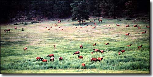
 Elk in a meadow |
|
|
Routt County Related Pages
Colorado Trust Lands & Wildlife Areas - GMU Map (.pdf)
State Trust Lands FAQ - Big Game Seasons (.pdf) Routt County - The Colorado Fishing Story Colorado Pages
Towns & Places - Scenic Byways - State Parks - BLM Sites - History & Heritage Ski & Snowboard Areas - Photo Galleries - Colorado Mountains - Scenic Railroads Unique Natural Features - Wilderness Areas - Outdoor Sports & Recreation Colorado's National Forests - National Wildlife Refuges - Colorado's National Parks |

|
| Index - Arizona - Colorado - Idaho - Montana - Nevada - New Mexico - Utah - Wyoming National Forests - National Parks - Scenic Byways - Ski & Snowboard Areas - BLM Sites Wilderness Areas - National Wildlife Refuges - National Trails - Rural Life Advertise With Us - About This Site - Privacy Policy |
| Photos courtesy of Sangres.com, CCA ShareAlike 3.0 License. All text Copyright © by Sangres.com. All rights reserved. |