 |
|---|
Hunting and Fishing on
|
|
|
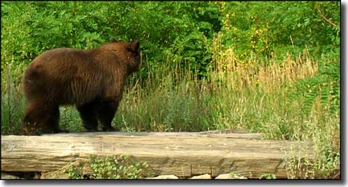
 A black bear in the weeds |
|
Saguache County State Trust Lands Baca - GMU 82 Burro Springs 1 & 2 - GMU 68 Carnero - GMU 68 Daley Gulch - GMU 551 Little La Garita Creek - GMU 79 Los Creek - GMU 67 Marshall Pass - GMU 551 Medano - GMU 82 Middle Creek - GMU 681 Mishak Lakes - GMU 68 Mineral Hot Springs - GMU 82 Mogotas Arroyo - GMU 68 Old Woman Creek - GMU 79 Saguache Creek - GMU 68 |
|
Baca North of Hooper on Highway 17 and east. Access via Roads D and G Carnero Go 4 miles west of La Garita on CR 41G Old Woman Creek From Del Norte go north on Highway 112 for 3/4 mile, turn left on CR 15. Go north and west about 4 miles. Turn right on USFS Road 660, travel 6 miles, turn left on FSR 646 and go 1 mile to property. Daley Gulch From Sargents at USFS Rd. 243 and Hwy. 50, go north .75 mile and turn left into property. Marshall Pass From Sargents at Hwy. 50 and USFS Rd. 243 (Marshall Pass Rd.) go east on USFS Rd. 243 for 4.5 miles to property. Little La Garita Creek From La Garita go west on Carnero Creek Road for 1 mile, then head south at fork on La Garita Road for 3 miles. Go west on USFS Road 670 (La Garita Creek) for 5 miles. Take USFS Road 670 to southeast corner or from west on USFS Road 670 to southwest corner. Medano 13 miles north of Alamosa on Highway 17, then go east 8 miles on Lane 6N to San Luis Lakes State Wildlife Area. Or, 17 miles north of Alamosa on Highway 17, go east 4 miles on Twelve Mile Lane. Middle Creek Take Highway 114 northwest out of Saguache to CR 38 EE, then go north on CR 38 EE for 2.5 miles, then north 2 more miles on FSR 856 to property. Mogotas Arroyo From Saguache go south 15 miles on US 285 to Saguache CR L. Go west 4 miles to BLM road that bisects property. San Juan Creek From Saguache go south on US 285 for 6 miles to CR T. Go west 2 miles on CR T, then south 1.25 miles to property. San Luis Creek From Moffat go 5 miles north on Highway 17, then east on CR Z for 1.5 miles to property. Steel Canyon From Villa Grove go east on CR LL (FR 970) for 3.5 miles to property. Saguache Creek From Moffat go south 2 miles on Highway 17, which bisects property and provides several access points west of CR O. Mishak Lakes From Moffat go south 2 miles on Highway 17, which bisects property and provides several access points west of Saguache CR O Stonehouse Gulch From Saguache go 10 miles north on US 285 to BLM road from Noland Gulch loop road to Stonehouse Gulch (across US 285 from Mineral Hot Springs), go west 1/2 mile, then south 2 miles to property. Mineral Hot Springs From Villa Grove go south 4 miles on US 285 to Saguache CR GG, go 1/8 mile east to property. Saguache Cty. Rds. GG and 58EE bisect parcel. Werner Arroyo From Saguache go south 7 miles on US 285 to CR T. Turn east and go 6 miles to CR 53, then go south 2 miles to CR R. Turn west and go 1 mile, then north and go 1/2 mile to property. Los Creek From Gunnison on US 50, go 8 miles to Highway 114. Go southeast on Highway 114 for 20 miles. Turn right on CR NN56. Travel southeast about 7.5 miles to USFS Road 787.2A. Go east 2 miles to south access of property. San Luis Creek #2 From Moffat go east on CR T. Take the first right on CR 60. Go southeast 1.25 miles to property. Burro Springs 1 & 2 From La Garita travel north on CR 42 for 2.2 miles to CR 42K. Travel west on CR 42K to property. Sanderson Gulch From La Garita travel north on CR 42 for 6 miles to property. Villa Grove One parcel is 8.5 miles north of Villa Grove on US 285. Other parcel is 3 miles northeast of Villa Grove on Hayden Pass Road, through BLM land. |
|
State Wildlife Areas |
|
Cochetopa From Gunnison go 8 miles east on US 50 to Highway 114, then 20 miles south to Cochetopa Creek. Dome Lakes From Gunnison go 8 miles east on US 50 to Highway 114, then 22 miles south to the property.
Viking Valley From Gunnison go east 16 miles on US 50 to Doyleville. Turn south on CR 3090, go 1 mile to fork in road, turn right on CR 3077, travel 2 miles to property. |
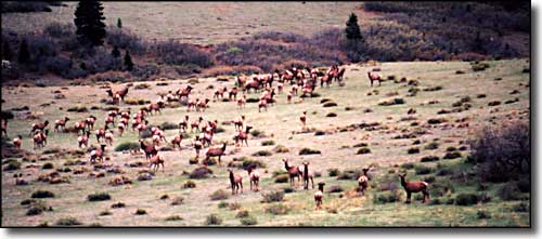
 Elk in a meadow |
|
|
Saguache County Related Pages
Colorado Trust Lands & Wildlife Areas - GMU Map (.pdf)
State Trust Lands FAQ - Big Game Seasons (.pdf) Saguache County - The Colorado Fishing Story Colorado Pages
Towns & Places - Scenic Byways - State Parks - BLM Sites - History & Heritage Ski & Snowboard Areas - Photo Galleries - Colorado Mountains - Scenic Railroads Unique Natural Features - Wilderness Areas - Outdoor Sports & Recreation Colorado's National Forests - National Wildlife Refuges - Colorado's National Parks |

|
| Index - Arizona - Colorado - Idaho - Montana - Nevada - New Mexico - Utah - Wyoming National Forests - National Parks - Scenic Byways - Ski & Snowboard Areas - BLM Sites Wilderness Areas - National Wildlife Refuges - National Trails - Rural Life Advertise With Us - About This Site - Privacy Policy |
| Photos courtesy of Sangres.com, CCA ShareAlike 3.0 License. All text Copyright © by Sangres.com. All rights reserved. |