 |
|---|
Angel Peak National Recreation Area |
|
|
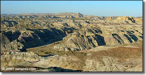 Angel Peak National Recreation Area (Angel Peak is that spire in the distance) |
|
Angel Peak National Recreation Area is more than 10,000 acres of scenic badlands about 15 miles southeast of Bloomfield in San Juan County. Looking at these photos you can tell that this is a heavily eroded, old ocean and river bottom landscape. The area started forming about 60 million years ago as the ancient waterflows piled up layers of mud and sand that turned to stone over time. The fantastic shapes have been carved in the layered, multi-colored sandstone, siltstone and mudstone by the action of wind, rain and frost. The banded colors exposed in the deep sculpted fingers at the base of Angel Peak itself (6,988') can only be seen by those who make the journey around the rim of the badlands. A lot of the mudstone slopes below the sandstone-capped mesas are materials of the Nacimiento Formation (the spire of Angel Peak is of the San Jose Formation, a harder sandstone laid down several million years later). The Nacimiento Formation is composed of hundreds of feet of rock, sand and other materials washed here by high energy rivers flowing down from the Rocky Mountains and meeting the Inland Cretaceous Sea in this area. These rivers were flowing from the high grasslands, swamps, marshes, lakes, and forests further north where the great mammal explosion was happening, after the mass extinction of the dinosaurs. The mudstone, siltstone and sandstone layers here at Angel Peak are still eroding, and with each rainfall, new mammalian fossils are exposed. There's also layers of petrified wood coming out of the canyon walls. We call this a "badlands" but for permitted paleontologists, this area is a vast treasure trove cataloguing the early evolution of mammals. As a recreation area managed by the Bureau of Land Management, Angel Peak offers 3 picnic areas (Cliffs, Castle Rock and Sage) and 1 campground (Angel Peak), all on the southern canyon rim. The campground is 6 miles in from US 550 on CR 7175. You'll pass all 3 picnic areas on your way there. Trash bins are at all 4 spots but only Sage, Cliffs and Angel Peak have toilets (all of the vault persuasion). Angel Peak has 9 tent sites, each with a picnic table and fire grate. 3 of the campsites have shelters over the picnic tables. There is also a short nature trail winding its way through the plants along the canyon rim leading to an overlook with a bench for relaxing and enjoying the other-worldly view. You'd better bring your own water here, and forget electricity (unless you bring that, too). And the gravel access road can be impassable in bad weather. You can see roads in the bottoms of the canyons in some of these photos: the area has a number of active gas wells, with underground pipelines, and sometimes traffic and heavy trucks. This countryside is also home to several species of rattlesnake, so watch where you walk and where you put your hands. Angel Peak National Recreation Site is open year round and everything is free. But there are certain special rules:
Maps: BLM - Navajo Reservoir; USGS - East Fork Kutz Canyon, Huerfanito Peak |
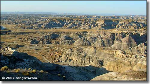 Looking northwest across the badlands 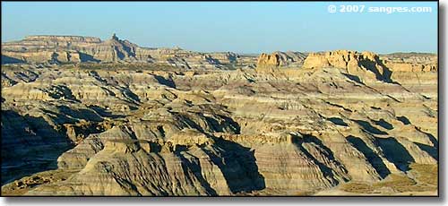 That pinnacle on the upper left is Angel Peak 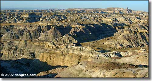 Another look into the badlands 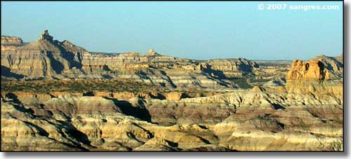 Angel Peak a little closer 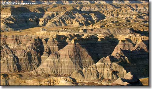 A closer view of the sandstone, siltstone and mudstone strata 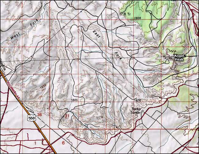 Angel Peak National Recreation Site area map |
|
|

|
| Index - Arizona - Colorado - Idaho - Montana - Nevada - New Mexico - Utah - Wyoming National Forests - National Parks - Scenic Byways - Ski & Snowboard Areas - BLM Sites Wilderness Areas - National Wildlife Refuges - National Trails - Rural Life Advertise With Us - About This Site - Privacy Policy |
| Photos courtesy of Sangres.com, CCA ShareAlike 3.0 License. Area map courtesy of National Geographic Topo! Text Copyright © by Sangres.com. All rights reserved. |