Rainbow Bridge National Monument

Rainbow Bridge

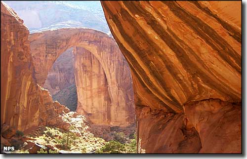
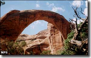
Rainbow Bridge National Monument was established in 1910 to preserve and protect the world's largest known natural bridge. In the canyons at the base of Navajo Mountain, Rainbow Bridge is 290' high and spans the river: 275' across. At the top of the arch the rock is 33' wide and 42' thick.
Discovered by non-Native Americans on August 14, 1909, Rainbow Bridge had been known since the days of the Ancestral Puebloans, and had been held sacred by all Native Americans since. It took the concerted efforts of two expeditions (who had to combine their efforts at the end) to locate and prove the existence of the long-legendary rainbow-shaped stone arch. President William Howard Taft signed the legislation creating Rainbow Bridge National Monument on May 30, 1910. Over the next few years, folks like Western author Zane Grey and adventurer/President Theodore Roosevelt made the arduous journey to visit Rainbow Bridge. After World War II, the journey was cut down to several days of rafting down the Colorado River and then enjoying a 7-mile hike just to get to the scene. Come the early 1950's and you could take a jet boat up the river from Lee's Ferry, make the hike and then return in only 5 or 6 days.
Then Glen Canyon Dam was authorized by Congress in 1956 and construction began soon after. In 1963, the gates of the dam were closed and Lake Powell began to fill. As the waters rose they engulfed (and essentially destroyed) thousands of Ancestral Puebloan sites and other sites held sacred by the five tribes with strong ties to the area: the Hopi, Navajo, Kaibab Paiute, San Juan Southern Paiute and the White Mesa Ute. The Navajos sued the Commissioner of the Bureau of Reclamation, the Director of the National Park Service and the Secretary of the Interior in US District Court in 1974, charging them with the destruction of important Navajo religious sites that were being lost under the water. Then in 1980, the Tenth District Court of Appeals ruled that the Navajo could not have the (now public) Rainbow Bridge site closed for their own religious ceremonies as that would violate the Constitutional guarantees of religious freedom for all American citizens. Finally, a National Park Service General Management Plan was adopted in 1993 that offered a long-term plan for preserving and protecting the resources of Rainbow Bridge National Monument by beginning to mitigate visitor impacts on the site and also to remind visitors that this is a sacred site and should be treated as such by all who come here. There is signage on-site asking that folks voluntarily refrain from approaching or walking under the bridge, as doing so without saying the appropriate prayers is sacrilege to the religious beliefs of the tribes that hold this Supreme Being-created site to be as sacred as any Western, man-made cathedral.
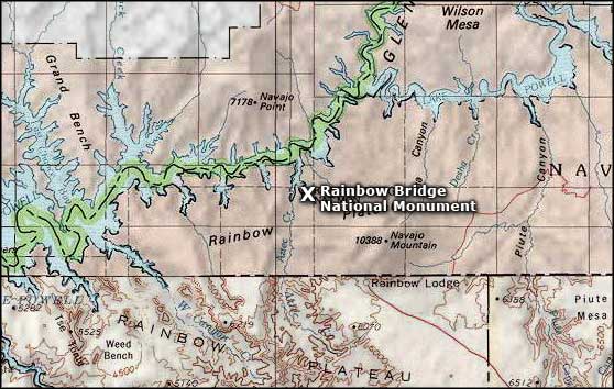
Although it is a separate unit of the National Park Service, Rainbow Bridge National Monument is managed by the Glen Canyon National Recreation Area. The only legal way to get there these days is by boat over Lake Powell to the courtesy dock in Bridge Canyon. Then you have to hike the main access trail to the bridge itself. The length of that hike varies daily as the water level in Lake Powell fluctuates.

It was snowmelt and rain water flowing down from the heights of Navajo Mountain through Bridge Canyon over the millenia that formed Rainbow Bridge. Most of the bridge is composed of Navajo Sandstone laid down up to 200 million years ago in wave after wave of wind-blown sand dunes up to 1,000' thick. The base of the bridge is composed of Kayenta Sandstone, put in place when this area was covered by the muds of inland seas and layered with the red-brown sands left behind by shifting winds from 200-and-more million years ago. These sandstones, shales, siltstones and mudstones were compressed for over 100 million years by an additional 5,000' of other materials deposited on top of them.
About 5.5 million years ago, the Colorado Plateau underwent a serious uplifting process that raised the surface of the land some 3,000' in a very short period of time. The land buckled and warped, earthquakes shook the countryside and volcanoes spewed ash into the sky and lava across the land. Then when the geological action eased off, the erosive action of flowing water came into play. The uplift had shifted things and caused water courses to become much steeper. Combine that with a long period of time when heavy rains saw a dramatic increase and you can almost see the water flows cutting deeper and deeper into the exposed layers of rock.
At the place where Rainbow Bridge is now, there was a thin fin of slightly harder sandstone that caused the waters of Bridge Canyon to flow around it. Erosion still went on but it affected that fin of rock a bit less, until a particular depth was reached and softer material was found in the bottom of that fin. The water washed that softer material away and slowly created a hole in the rock. Then the waters flowed through that hole, enlarging it and abandoning the other "stream bed" they had flowed through before. It was this mechanism that formed Rainbow Bridge as we see it today. Eventually, it is this same mechanism that will cause the end of Rainbow Bridge, and all of the other fantastical sandstone formations spread across this whole section of the Colorado Plateau.

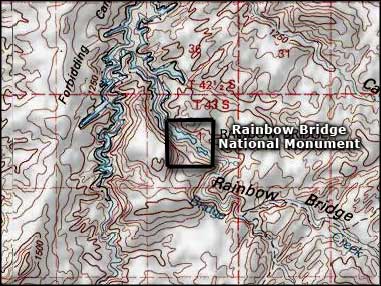
Rainbow Bridge National Monument area map
