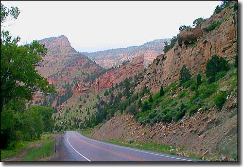
Emery County, Utah

Along the eastern edge of the Wasatch Front in Emery County
Castle Dale
Clawson
Cleveland
Elmo
Emery
Ferron
Green River
Huntington
Orangeville
Emery County is in east central Utah. This is Goblin Valley and Cleveland Lloyd Dinosaur Quarry country. The eastern boundary is the Green River, just north of Canyonlands National Park. The I-70 bisects the county east-to-west and a long stretch of the Dinosaur Diamond Prehistoric Highway is here. Emery County was named for George W. Emery, governor of Utah Territory in 1875.
Emery County contains 4,452 square miles of land and 10 square miles of water. The county seat is Castle Dale, the largest city Huntington.
In the early days of European exploration of the area, the Old Spanish Trail crossed through what is now Emery County. The trail route was "braided" but eventually came together on one primary route. And as much as most traffic on the trail was between Santa Fe, New Mexico and southern California, the principal trade that developed between the Spanish outposts and Utah concerned the Indian slave trade. Many of the landmark names still used in the area can be dated back to names given by Spanish travelers on the trail. Kit Carson followed the Old Spanish Trail east in 1849, carrying news of the California gold strike to the rest of the nation.
Settlement didn't start to happen until Brigham Young sent 50 families into the area in 1877 to colonize and occupy the space before any non-Mormons arrived. By 1879, they had laid claim to virtually all the usable land in the county. As usual, the industrious Mormons dug canals and built elaborate irrigation systems to help the land prosper. However, the underlying soils had spent millions of years as seabed and between poor drainage and over-irrigation, by 1903 about 30% of the previously arable land in the county was abandoned because of the salts that had risen to the surface.
The railroad bypassed most of the county, although the station built in Green River led to some real prosperity in that area. Coal mines were small and produced only for local use up until World War I when production was expanded to fuel the war effort. When the war ended, though, production dropped and wages dropped even more. As bad as the 1920's were in Emery County, the 1930's were worse. Things didn't pick up until World War II. Then things really picked up in the 1970's when Utah Power & Light built two coal-fired electric generation plants in the county and expanded the coal mines to feed them.
Private Sector, wages or salary: 72%
Government Sector: 20%
Unincorporated, Self-Employed: 7%
Homemaker, Unpaid: 1%
Population Density: 2 People per Square Mile
2011 Cost of Living Index for Emery County: 81.1
Median Resident Age: 30.1 Years
Estimated Median Household Income: $48,000
Estimated Median Home Value: $103,500
Major Industries:
Educational Services, Mining, Health Care, Government, Construction, Utilities, Agriculture & Forestry, Lodging & Food Services, Information Services, Transportation Services, Finance & Insurance Services
Population Demographics: 2010
| Total Population | 10,976 |
| Males | 5,589 |
| Females | 5,387 |
| Population by Age | |
| Under 18 | 3,488 |
| 18 & over | 7,488 |
| 20-24 | 562 |
| 25-34 | 1,440 |
| 35-49 | 1,748 |
| 50-64 | 2,067 |
| 65 & over | 1,368 |
| Population by Ethnicity | |
| Hispanic or Latino | 654 |
| Non Hispanic or Latino | 10,322 |
| Population by Race | |
| White | 10,309 |
| African-American | 26 |
| Asian | 38 |
| Native American | 78 |
| Hawaiian or Pacific Islander | 9 |
| Other | 421 |
| Two or more | 95 |
