Castle Valley, Utah

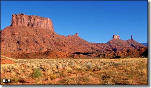
In Castle Valley, Utah
Geologically speaking, Castle Valley is part of a large collapsed salt anticline that runs through the La Sal Mountains and includes Paradox Valley on the other side of those mountains. 300 million years ago, this was ocean bottom and was collecting layers of sand and salt laid down from above. Then in the late Tertiary Period, this area was pushed up as part of the Colorado Plateau Uplift. Then water and wind played their parts in eroding away the sedimentary layers above the salt. Slowly, ground water reached into the layers of salt, dissolving the salt and washing it away. As the salt disappeared, the rock strata above collapsed and then eroded some more. It was this action that left the cliffs, the high-angle fault systems, that still exist on both sides of Castle Valley.
Then 24 million years ago, underground volcanic activity pushed up Round Mountain in Castle Valley and the La Sal Mountains to the southeast. Officially, the La Sal's are laccoliths, an area where the magma forced itself into cracks between the rock strata and pushed up the overlying layers, in this case by more than 6,000'.
The early human inhabitants of the area were the Fremont peoples, then the Utes. 1881 saw the Pinhook battle, a bad confrontation over land, fueled by misinformation, where 2 Moab cattlemen, 8 sheriff's posse members and maybe 2 dozen Native Americans lost their lives.
In the late 19th and early 20th centuries, there were mines scattered through the region while Castle Valley itself was mostly a farming and cattle and sheep ranching area. Then the mines gave out and most folks left. The land was consolidated into a couple of large ranches, with the McCormick Ranch being at the center of what is now the town of Castle Valley. The McCormick Ranch was bought by the Carlsberg Development Corporation who platted out the Castle Valley River Ranchos in 1973. Sales started the next year.
Today, the town of Castle Valley covers about 8 square miles, including the platted River Ranchos, the separate Upper 80 and a lot of undeveloped countryside. Castle Valley is about 16 miles northeast of Moab, off U-128 (the Upper Colorado River Scenic Byway). The Castle Valley area is another place where huge reserves of natural gas have been found in the deep coal beds.

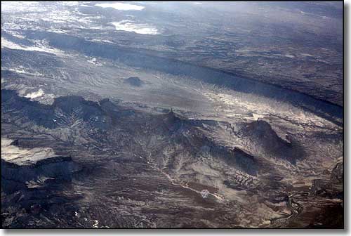
Castle Valley from 30,000' up
Latitude: 38.6344°N
Longitude: 109.4106°W
Incorporated: 1985
Elevation: 4,685'
Education:
High School or Higher: 95.8%
Bachelor's Degree or Higher: 49.6%
Graduate or Professional Degree: 17.6%
2011 Cost of Living Index for Castle Valley: 90.7
Median Resident Age: 45.0 Years
Estimated Median Household Income: $40,100
Estimated Median Home Value: $346,200
Population Density: 48 People per Square Mile
Major Industries:
Educational Services, Construction, Arts, Entertainment & Recreation, Lodging & Food Services, Professional Services, Waste Management Services, Agriculture, Government, Miscellaneous Manufacturing
Unemployed (March 2011): 12.3%
Population Demographics: 2010
| Total Population | 319 |
| Males | 166 |
| Females | 153 |
| Population by Age | |
| Under 18 | 26 |
| 18 & over | 293 |
| 20-24 | 5 |
| 25-34 | 18 |
| 35-49 | 42 |
| 50-64 | 159 |
| 65 & over | 62 |
| Population by Ethnicity | |
| Hispanic or Latino | 6 |
| Non Hispanic or Latino | 313 |
| Population by Race | |
| White | 310 |
| African-American | 0 |
| Asian | 2 |
| Native American | 1 |
| Hawaiian or Pacific Islander | 0 |
| Other | 2 |
| Two or more | 4 |
