Sierra Estrella Wilderness

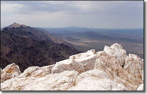
View from the summit of Quartz Peak in the Sierra Estrella Wilderness
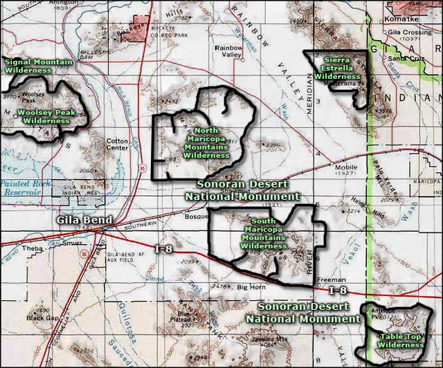
The Sierra Estrella Wilderness is 14,400 acres right up against the Gila Indian Reservation about 15 miles southwest of Phoenix. These mountains are among the most rugged in all of Arizona, with an elevation change at Butterfly Mountain (4,119') of about 2,600' in only 2 miles. These are rocky canyons that rise steeply to knife-edge ridgelines. At the bottom of the Sierra Estrella Wilderness you'll find cholla, ocotillo, saguaro, and paloverde, with juniper and shrub live oak further up the hill. The countryside supports a small herd of desert bighorn sheep, and some mule deer, mountain lion, javelina, coyote, and Gila monster. You'll also find Cooper's hawk, golden eagle and prairie falcon.
During your visit, you'll probably not see another soul in the area. You'll also come across some old jeep trails and mine sites in the area but you won't find much water: better bring lots of your own. You'll also want to have some good hiking shoes and perhaps a walking stick as the climbing in Sierra Estrella Wilderness is pretty rugged.
Get off the I-10 at exit 121 and go south to the Rainbow Valley Road and Riggs Road. Unmaintained dirt roads extend east to the Sierra Estrella Wilderness from here. These dirt roads tend to be extremely sandy or silty with rugged, rocky, deep arroyos to cross. You'll want high clearance on a good 4WD vehicle. Because most of the wilderness is bounded by the Gila Indian Reservation, only the western boundary is accessible to the public.
USGS Maps: 7.5 minute: Mobile NE, Montezuma Peak

Sierra Estrella Wilderness area map
