Agua Caliente Scenic Drive

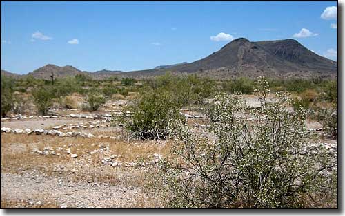
Near Sundad on the Agua Caliente Scenic Drive
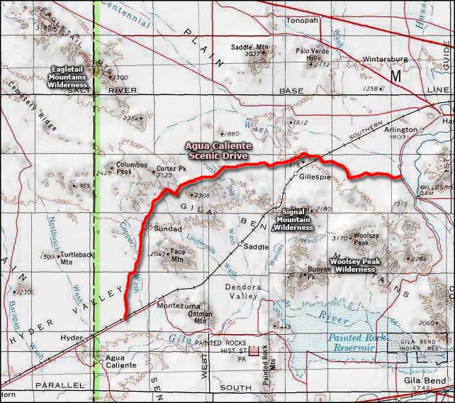
Agua Caliente Scenic Drive is a short route on a maintained gravel road in the heart of the Sonoran Desert (about 57 miles west of Phoenix). Get off Interstate 10 at the exit for State Route 85 (to Gila Bend). Head south on SR 85 for about six miles to the turnoff onto Old Route 80 (signs point to Palo Verde/Arlington). Follow Old Route 80 through Palo Verde, Hassayampa and Arlington. About 14.1 miles south of Arlington you'll come to the Gila Compressor Station. There should be a sign right near that saying "Agua Caliente Road." Turn right and keep driving. About 1 mile down you'll cross the Texas-gate marking the boundary of BLM land.
The route travels between the Eagletail and Gila Bend Mountains. There are dirt roads running north off Agua Caliente that reach the Eagletail Mountains Wilderness and other roads running south that reach the Signal Mountain and Woolsey Peak Wildernesses. Once through the mountains, the views open out into expansive vistas across the desert to other mountain ranges to the west. There are volcanic landscapes and monolithic features everywhere. The southern part of the route is up on the Sentinel Plain Lava Flow, the largest single lava flow in Arizona. It's a stark countryside where the solid lava base varies between 50 and 150 feet thick. There are several mine sites along the route, and the old ghost town at Sundad.
Travel on Agua Caliente Scenic Drive is not recommended from late May through early October. Springtime is particularly good for driving this route as that's when the paloverde, ocotillo and brittlebush are all in bloom. Do not drive the road when it's wet.

Agua Caliente Scenic Drive area map
