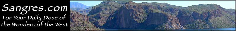
Harquahala Mountain Back Country Byway

Cactus and yellow brittlebush along the Harquahala Mountain Back Country Byway

For 10.5 miles, the Harquahala Mountain Back Country Byway follows the route that was used back in the 1920's by the Smithsonian Institute to carry materials for the construction of an Astrophysical Observatory on the summit of Harquahala Peak (5,691'). The observatory used large panels of thermometers to measure and record solar activity. The data was used to help predict the weather. The Byway runs right next to (and just west of) the 22,880-acre designated Harquahala Mountains Wilderness, an area known for its extreme diversity of vegetation and its abundant wildlife.
The Harquahala Mountains are among of the largest mountain ranges in Arizona and tend to be very rugged. The last 3/4 of a mile of the Harquahala Mountain Back Country Byway is very steep, gaining 1,400' before topping out at the observatory site. The road requires a good 4WD and is probably impassable in bad weather. You also need to be prepared for fallen rock all through the corridor. It may be only 10.5 miles but be prepared to take well over an hour to drive all the way. Because this is such a steep, narrow and winding road with cliffside drop-offs at many points, once you commit to it, you're pretty much stuck until you reach the top. There are a couple of pulloffs and places where you might be able to turn around, but the road may also be completely washed out in spots if there's been any thunderstorm activity lately.
The Byway is accessed via Eagle Eye Road, which in turn is accessed via the Salome Road running between Interstate 10 and US Highway 60 at Salome. There is a BLM sign announcing the Harquahala Mountain Back Country Byway at the edge of asphalt (when you turn off Eagle Eye Road). A few hundred yards beyond that is the parking area (for the less adventurous types) with a shade ramada, picnic area with campfire rings and a vault toilet. There's also a shaded area with informational displays about the Byway and the history and geology of the Harquahala Mountains.
For many years, the Harquahala's attracted mining prospectors, and they were sometimes rewarded with small finds of gold, silver and copper in these hills. These days, most of the area outside the designated wilderness is used as grazing land for cattle and sheep. Once you're up in the mountains, the temperature will drop a bit and you should start seeing Desert bighorn sheep in some areas. Because of the height, you'll also get views of the Eagletail Mountains, the Big Horn Mountains, the New Water Mountains, the Kofa Mountains and the Castle Dome Mountains to the south and west. Once you reach the crest of the range, you'll also start seeing the Harcuvar Mountains and the Granite Wash Mountains to the north and west.
When you get to the summit you'll find several interpretive displays along a winding path that leads almost to the Solar Observatory, however, the observatory itself was fenced off long ago because of the vandalism problem (even out here). There's also several picnic tables so you can sit, eat and enjoy the view. Because of the elevation and the desert below, it is highly recommended that you leave the summit and get back down the hill well before sunset.

The observatory on top of Harquahala Peak

Harquahala Mountain Back Country Byway area map
