Colorado National Monument Trails

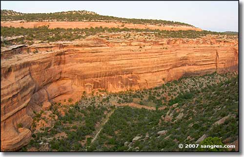
Along the Ute Canyon trail
In any season, the hiking trails of Colorado National Monument are a great way to explore the Monument. Before you start off from the trailhead, because of the nature of the countryside you will be going into, you want to take into account your experience in canyon country, your physical fitness, and your ability to carry lots of water. You'll want good hiking boots or other good footwear for climbing over rocks and walking in sand. Also, you never know when extreme weather may pop up: this isn't just Colorado, it's red rock country and flash floods or heavy snowfall can happen at almost any time. You want to be prepared with good equipment and the right kind of equipment: compass, topo maps, first aid kit, extra clothing, and plenty of water (and food), but no firearms.
When hiking here, stay on hard surfaces so that you don't disturb the cryptobiotic soil crust. It's best to walk single file in the middle of the trail, even when it's raining or just muddy. If you decide to leave the trail, stay on hard gravel or expanses of rock or in the middle of sandy washes so that you don't disturb the fragile vegetation. This is "Pack it in, Pack it out" country: leave no trace. There's all kinds of wildlife out here, including desert bighorn sheep, but don't approach them and don't feed them: leave them wild. The same goes for cultural artifacts, fossils and other natural objects: observe them, enjoy them, leave them untouched. Mountain bikes, off-road vehicles and pets are not allowed on the trails listed below.

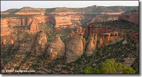
The Coke Ovens
Window Rock: .25 miles long, about 15 minutes (each way).
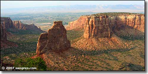
This is a level loop trail through a juniper and piñon landscape to an overlook with great views of most of the major rock formations in Monument and Wedding Canyons, including Independence Monument.
Canyon Rim: .5 miles long, about 30 minutes (each way).
This is a level trail along the cliff edge with outstanding views of Wedding Canyon.
Otto's Trail: .5 miles long, about 30 minutes (each way).
This is a gently sloping trail (I found it somewhat braided) that leads to a dramatic overlook with great views of many of the largest monoliths.
Coke Ovens: .5 miles long, about 30 minutes (each way).
This trail drops gradually to an overlook above the massive rounded formations named "The Coke Ovens."
Devils Kitchen: .75 miles long, about 30 minutes (each way).
This is a slow drop into the Devils Kitchen: a natural grotto surrounded by large upright boulders.
Serpents Trail: 1.75 miles long, about 90 minutes (each way).
This historic trail has more than 50 switchbacks (it's also known as "the The Crookedest Road in the World"). The trail is a steady climb from east to west. The trail follows a road built in the early 1900's that was actually part of the main road in the Monument until 1950.
Alcove Nature Trail: .5 miles long, about 90 minutes (each way).
This is a self-guiding nature trail on the Kayenta bench.
CCC Trail: .75 miles long, about 15 minutes (each way).
This short trail connects the Monument Canyon and Black Ridge Trails.

Independence Monument
Old Gordon Trail: 4 miles long, about 2.5 hours (each way).
This is a mostly undeveloped trail that rises steadily along the path of a historic lumber and cattle-drive route. The park's geological story is exhibited almost in its' entirety through the layers of rock naturally exhibited along the way.
Black Ridge: 5.5 miles long, about 3 hours (each way).
This is the highest trail in the park with great view west to the Utah canyonlands, east to Grand Valley and south to the San Juan Mountains. Crossing the McInnis National Conservation Area, this trail follows the up-and-down terrain of Black Ridge.
Monument Canyon: 6 miles long, about 3.5 hours (each way).
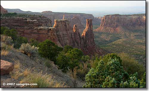
This is a steep, 600-foot descent into Monument Canyon from the plateau. Independence Monument, Kissing Couple, the Coke Ovens, and many other of the the park's major rock sculptures tower overhead along the way.
Ute Canyon: 7 miles long, about 4 hours (each way).
This is a rigorous descent from the plateau into narrow Ute Canyon along a maintained trail. Once down, the route follows the streambed past seasonal waterflows and small ponds bordered by willows and cottonwoods. You'll see a few arches along the way.
Liberty Cap: 7 miles long, about 4 hours (each way).
This trail winds across the gentle slopes of Monument Mesa through the piñon and juniper forest and sagebrush flats for 5.5 miles to the Liberty Cap rock sculpture. While the trail is ideal for horseback riding, the last 1.5 miles drops steeply into Grand Valley.
No Thoroughfare Canyon: 8.5 miles, about 8 hours (each way).
On a maintained trail, this is a steep drop from the plateau into No Thoroughfare Canyon. Once down, the route is essentially undeveloped through the bottom of the remote canyon with walls rising more than 400 feet above.

Monument Canyon
