Hunter-Fryingpan Wilderness

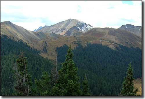
In the Williams Mountains of Hunter-Fryingpan Wilderness
Hunter-Fryingpan is 82,026 acres of Wilderness Paradise with Holy Cross Wilderness to the north, Maroon Bells-Snowmass Wilderness to the west, and Collegiate Peaks Wilderness to the south. Hunter-Fryingpan lies on the western side of the Continental Divide with the Mount Massive Wilderness on the east side of that ridge. Elevations vary from about 9,000' to about 13,000'. 8,300 acres along Spruce Creek on the northwest side was added to the original Wilderness in 1993.
Holding the headwaters of Hunter Creek and the Fryingpan River, the streams in this area make excellent habitat for large numbers of rainbow, brook, brown, and cutthroat trout. Here you'll find many of the unnamed peaks of the Williams Mountains. Aspen forests cover the lower elevations, with thick stands of spruce and fir higher up, and above that comes wildflower-strewn alpine tundra. In these woods, you'll come across elk, mule deer, black bear, and many smaller, fur-bearing animals.
About 50 miles of trail cross the Hunter-Fryingpan Wilderness, mostly wending their ways up different drainages into the Williams Mountains. The Lost Man Trail follows Lost Man Creek and then crosses South Fork Pass to continue down the South Fork of the Fryingpan River (about 10 miles distance). It's a beautiful hike into the center of the Wilderness.

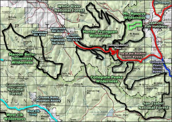
Hunter-Fryingpan Wilderness map

Hunter-Fryingpan Wilderness area map
Maroon Bells-Snowmass Wilderness - Gunnison National Forest - San Isabel National Forest
Top of the Rockies Scenic Byway - Collegiate Peaks Scenic Byway - West Elk Loop
Ski Cooper - Aspen Mountain Ski Area - Aspen Highlands Ski Area - Buttermilk Ski Area
Snowmass Ski Area - Crested Butte Mountain Resort - Independence Pass
Selected Hiking Trails
National Park Service Sites - BLM Sites - National Wilderness Areas - Unique Natural Features
Outdoor Sports & Recreation - Ski & Snowboard Areas - Photo Galleries - Colorado Mountains
