Mt. Massive Wilderness

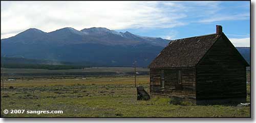
Mt. Massive in the distance
The Mount Massive Wilderness, encompassing 30,540 acres, was designated by Congress in 1980. The name comes from the second highest peak in Colorado, which has 7 summits over 14,000 ft. and truly lives up to its "Massive" name. With elevations between 9,700' and 14,421', much of the area is above timberline with alpine communities and a permanent snowfield. The lower slopes are forested mostly with lodgepole pine giving way to fir and spruce as you go up the hill. The western boundary of the Wilderness is against the Continental Divide, with the Hunter-Fryingpan Wilderness on the other side of that ridge.
About 10 miles of the Colorado Trail cross the eastern portion of the Wilderness. Other than that, there's only about 10 more miles of established trails in the Wilderness, and nearly every bit of these trails are involved in somehow getting to the top(s) of Mt. Massive itself.
About 2,500 acres of the Wilderness is managed by the Leadville National Fish Hatchery. There are some restrictions on fishing and hunting in that area. Native greenback cutthroat trout have recently been reintroduced in the Rock Creek drainage, so fishing there is limited to catch and release. This includes Native Lake. No special restrictions are in place for Windsor Lake.
-
Recommended Maps:
- National Forest Map: San Isabel
- Trails Illustrated: Independence Pass, Holy Cross
- USGS Quadrangle: Homestake, Mt. Massive, Mt. Champion
Trailheads:
- Hagerman Pass Road - The Colorado Trail, Native Lake and Windsor Lake Trailhead
- Leadville Fish Hatchery - The Rock Creek Trailhead
- Halfmoon Creek Trailhead - Mt. Elbert/Mt. Massive Trailhead and the North Halfmoon Lake Trailhead

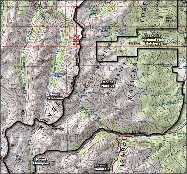
Mount Massive Wilderness map

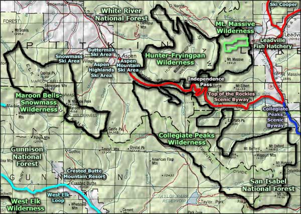
Mount Massive Wilderness area map
Selected Hiking Trails
Maroon Bells-Snowmass Wilderness - White River National Forest - Gunnison National Forest
Top of the Rockies Scenic Byway - Collegiate Peaks Scenic Byway - West Elk Loop
Ski Cooper - Aspen Mountain Ski Area - Aspen Highlands Ski Area
Buttermilk Ski Area - Snowmass Ski Area - Crested Butte Mountain Resort
Leadville National Fish Htchery
National Park Service Sites - BLM Sites - National Wilderness Areas - Unique Natural Features
Outdoor Sports & Recreation - Ski & Snowboard Areas - Photo Galleries - Colorado Mountains
