 |
Custer National Forest Hiking Trails |
 |
|
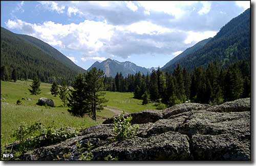
While there are quite a few trails in different areas of Custer National Forest, most are unmaintained to primitive at best. The trails that see the most use tend to be in the Beartooth Ranger District and lead into the Absaroka-Beartooth Wilderness, usually to Granite Peak. If your objective is Granite Peak, you would be well served to check with the Beartooth Ranger Station (406-446-2103) to check weather and trail conditions before you set out. Depending on your chosen route, the hike will be somewhere beween 21 and 25 miles to the base camp. Then there's the mountain itself: Granite Peak is rated as one of the hardest of the high points in the lower 48 states. As Granite Peak is in the heart of the Absaroka-Beartooth Wilderness, if you run into a problem on the mountain, you may well be on your own. And once you leave the lower areas and come up on treeline, you'll want to have lots of water with you because drinkable water above treeline is not to be counted on. |
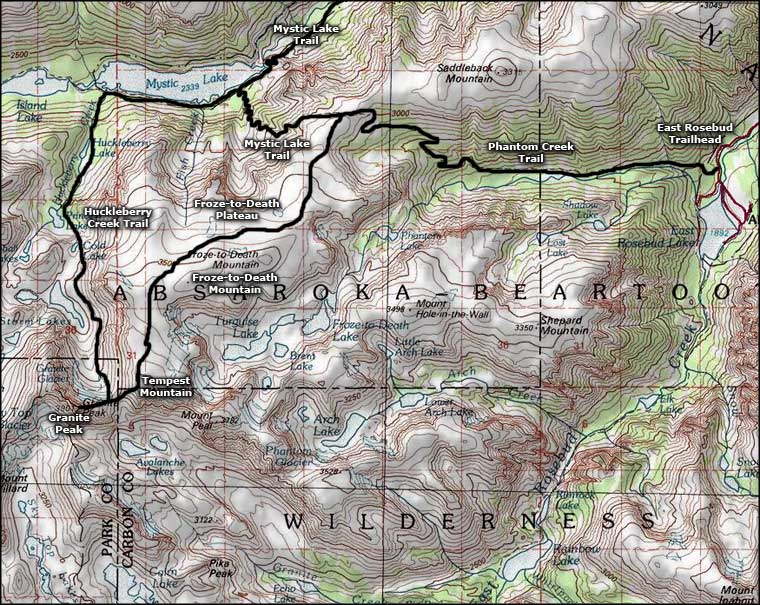 Trails in the Granite Peak area |
Froze-to-Death Plateau
Granite Peak Summit Grasshopper Glacier
Huckleberry Creek Trail
Mystic Lake Trail Phantom Creek Trail |
|
|
 |
| Index - Arizona - Colorado - Idaho - Montana - Nevada - New Mexico - Utah - Wyoming National Forests - National Parks - Scenic Byways - Ski & Snowboard Areas - BLM Sites Wilderness Areas - National Wildlife Refuges - National Trails - Rural Life Advertise With Us - About This Site - Privacy Policy |
| Map courtesy of National Geographic Topo! Text Copyright © by Sangres.com. All rights reserved. |