 |
Charles M. Russell National Wildlife Refuge |
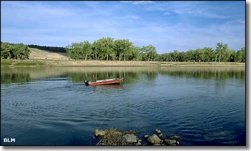 At the James Kipp Recreation Area in the Charles M. Russell National Wildlife Refuge |
The Charles M. Russell National Wildlife Refuge is a huge area (about 1.1 million acres) administered by the US Fish & Wildlife Service. It extends from the eastern edge of the Upper Missouri River Breaks National Monument downstream through Fort Peck Reservoir and includes Fort Peck Dam. The easternmost 10 miles of the Upper Missouri Wild and Scenic River extend into the National Wildlife Refuge from the Upper Missouri River Breaks National Monument boundary downstream to the James Kipp Recreation Area. Also within the Charles M. Russell National Wildlife Refuge is the UL Bend National Wildlife Refuge and Wilderness. Charles M. Russell was a famous cowboy artist and included in this Wildlife Refuge named in his honor are many of the spectacular badlands, river bottoms, native prairies and forested coulees that were the subjects of so many of his paintings. The Refuge is managed primarily as wildlife habitat and carries a large population of mule deer, elk, sharptail grouse, bighorn sheep and other game species. The Charles M. Russell National Wildlife Refuge also preserves and protects many important paleontological, archeological and cultural resources. The refuge was jointly managed by the Fish & Wildlife Service and Bureau of Land Management before 1976 but the differing mandates of those 2 agencies caused many wildlife/grazing conflicts over the years. The Game Range Bill of 1976 gave Fish & Wildlife complete control over the property. The Charles M. Russell National Wildlife Refuge is managed out of the headquarters office in Lewistown with 3 field stations located in Jordan, Sand Creek and Fort Peck. The Charles M. Russell National Wildlife Refuge Complex is also managed out of the office in Lewistown and operates the Lake Mason, Hailstone, War Horse and Halfbreed Lake National Wildlife Refuges as outlying satellites. |
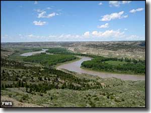
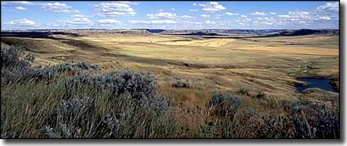 What most of the Charles M. Russell National Wildlife Refuge looks like 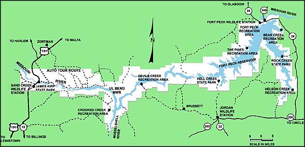 Map of Charles M. Russell National Wildlife Refuge |
|
|

|
| Index - Arizona - Colorado - Idaho - Montana - Nevada - New Mexico - Utah - Wyoming National Forests - National Parks - Scenic Byways - Ski & Snowboard Areas - BLM Sites Wilderness Areas - National Wildlife Refuges - National Trails - Rural Life Advertise With Us - About This Site - Privacy Policy |
| Upper photo of the Charles M. Russell National Wildlife Refuge courtesy of the Bureau of Land Management. Other photos and map courtesy of the US Fish & Wildlife Service. Text Copyright © by Sangres.com. All rights reserved. |