|
|||||||||||||||
|---|---|---|---|---|---|---|---|---|---|---|---|---|---|---|---|
Mt. MariquitaSangre de Cristo Mountains |
|||||||||||||||
|
|
|||||||||||||||
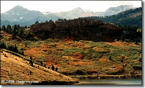 Mts. Mariquita, Maxwell and Quatro (l to r), North Lake in the foreground |
|||||||||||||||
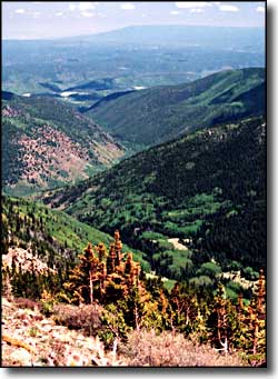
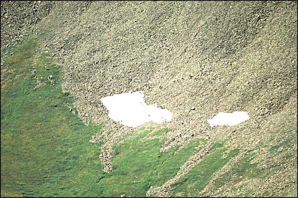
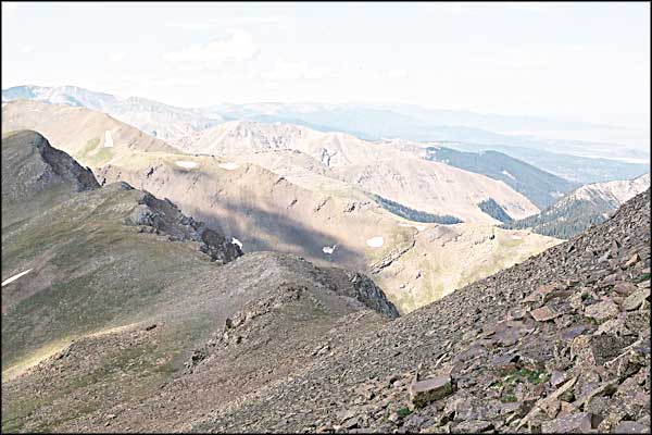
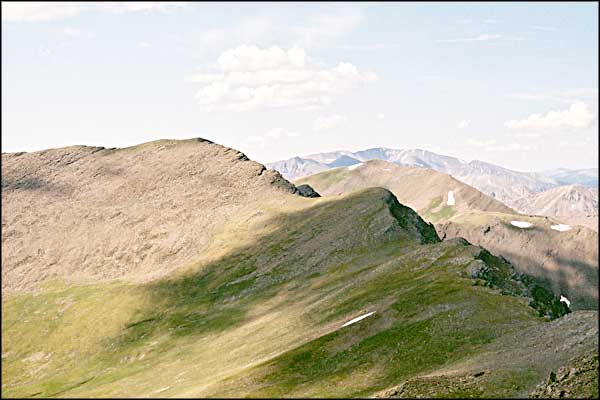
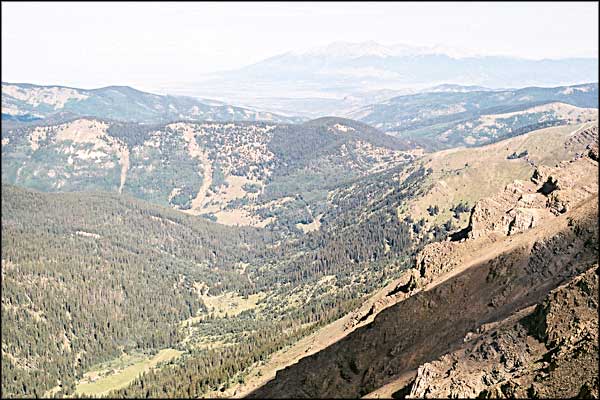
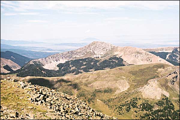
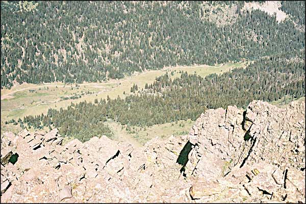
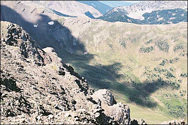
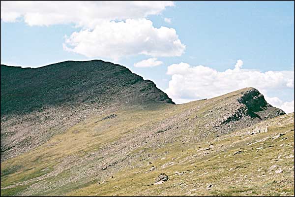
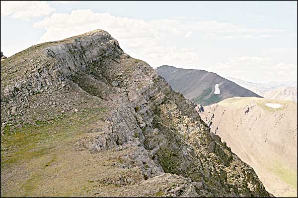
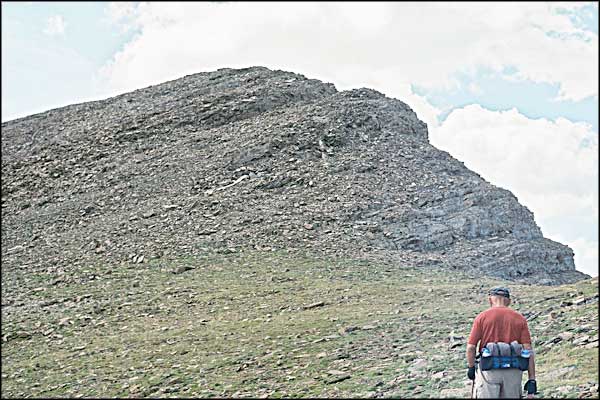
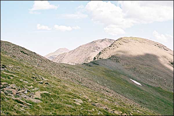
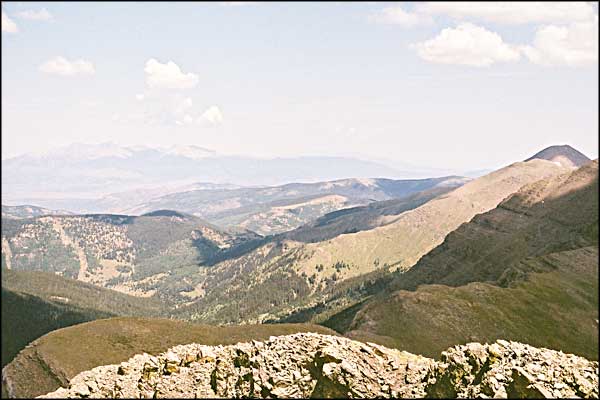
Mt. Mariquita is on private land just south of Mt. Maxwell. Because of the private land, Mariquita is most easily accessed by climbing Maxwell and then walking the ridge over to Mariquita. At least that's what we did. And on arrival on the summit of Mariquita we found a rock cairn and a register (from the Republic of Texas Mountaineering Association, no less). The photo on the left was taken above treeline on Mt. Maxwell's shoulder. The view is looking southeast down the canyon of the North Fork of the Purgatoire River. On the horizon is Fisher's Peak and Raton Mesa. The hill to the right of the canyon is the bottom of Mariquita. The ridge leading south from Trinchera Peak to Mt. Mariquita doesn't look too bad but I haven't walked it yet. There is lots of exposure in spots but most of it is a just a good walk. On the Cuatro Peak page you can see what is probably the worst area of the ridge but in both the Maxwell and Mariquita registers are notes from folks who have done it. The ridge from Maxwell presented no problems other than the one of finding the summit of Mariquita among the posible choices. The ridge is so obviously a broken and lifted fault line that it can be hard to determine which of those uplifted piles of rock actually leads to the summit without climbing up and down a couple of them and seeing directly. As I said, the easiest way up is to climb Mt. Maxwell and walk the ridge to the south. The photos below start at the top of Maxwell and follow the ridge. When you reach the summit pyramid of Mariquita you find the whole thing is a scree slope/boulder pile that you have to pick your way across. We've done it a couple of times now so we usually head straight to the scree and contour uphill to the southeast. The slope of the hill tends to lead you further east than you need to go so pay attention to what's above you. In a couple of places it's really easy to reach the fault line edge and take a look down the western slope: big rock and cliffbands dropping off into scree and talus before reaching treeline about 2,000' below. Nasty looking stuff at a bad angle. The summit, though, is large and broad. The correct cairn is the western one. The ridge leading south to De Anza Peak (13,350') looks pretty straight forward once you get off the summit pyramid of Mariquita. |
|||||||||||||||
| Clicking on any of these photos will open a new window or new tab in your browser and bring you a larger version of that photo. |
|||||||||||||||
| |||||||||||||||
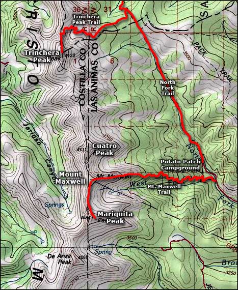 Mariquita Peak area map |
|||||||||||||||
|
|
|||||||||||||||
Mt. Mariquita Related PagesColorado Pages
Towns & Places - Scenic Byways - State Parks - BLM Sites - History & Heritage Ski & Snowboard Areas - Photo Galleries - Colorado Mountains - Scenic Railroads Unique Natural Features - Wilderness Areas - Outdoor Sports & Recreation Colorado's National Forests - National Wildlife Refuges - Colorado's National Parks |
|||||||||||||||

|
|||||||||||||||
| Index - Arizona - Colorado - Idaho - Montana - Nevada - New Mexico - Utah - Wyoming National Forests - National Parks - Scenic Byways - Ski & Snowboard Areas - BLM Sites Wilderness Areas - National Wildlife Refuges - National Trails - Rural Life Advertise With Us - About This Site - Privacy Policy |
|||||||||||||||
| Photos courtesy of Sangres.com, CCA ShareAlike 3.0 License. Map courtesy of National Geographic Topo! Text Copyright © by Sangres.com. All rights reserved. |