 |
|---|
Wild Trout Waters in Colorado |
|
|
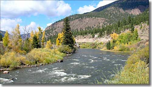 The Rio Grande at Coller State Wildlife Area |
|
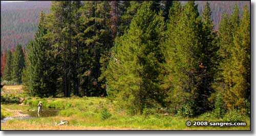
Selected trout streams and lakes are managed by the Colorado Division of Wildlife specifically to produce wild trout and are not stocked with hatchery fish. These trout are raised completely in the wild under natural conditions, affording anglers an opportunity to experience the joy and challenge of catching truly wild fish. The Colorado Fishing Guide and Land and Water Use information booklets have details on specific restrictions and regulations for Colorado waters. You should consult these resources before fishing. Portions of designated trout waters may be on private property. |
|
Blue River Cache la Poudre River Cascade Creek Cochetopa Creek Colorado River Conejos River East River Emerald Lake Fraser River Gunnison River Lake Fork of the Conejos Laramie River Los Pinos Creek Middle Fork of the South Platte River North Platte River North St. Vrain Creek Osier Creek Roaring Fork River South Platte River Tarryall Creek Trappers Lake |
 In Rocky Mountain National Park |
Related Colorado Fishing Pages
Fishing Index - Gold Medal Fishing Streams - Warmwater Fishing Spots
Coldwater Fishing Spots - Warm Water Game Fish - Cold Water Game Fish Colorado Pages
Towns & Places - Scenic Byways - State Parks - BLM Sites - History & Heritage Ski & Snowboard Areas - Photo Galleries - Colorado Mountains - Scenic Railroads Unique Natural Features - Wilderness Areas - Outdoor Sports & Recreation Colorado's National Forests - National Wildlife Refuges - Colorado's National Parks |
 |
| Index - Arizona - Colorado - Idaho - Montana - Nevada - New Mexico - Utah - Wyoming National Forests - National Parks - Scenic Byways - Ski & Snowboard Areas - BLM Sites Wilderness Areas - National Wildlife Refuges - National Trails - Rural Life Advertise With Us - About This Site - Privacy Policy |
| Photos courtesy of Sangres.com, CCA ShareAlike 3.0 License. All text Copyright © by Sangres.com. All rights reserved. |