Bull Creek Pass National Back Country Byway

Along the Bull Creek Pass Back Country Byway

The Bull Creek Pass National Back Country Byway is a 68-mile drive through some of Utah's most spectacular and yet almost unknown/unseen scenery. The road is drivable but is not an easy drive: figure on taking 6 to 8 hours to drive the whole route because it is windy, twisty, rugged, steep in spots, single lane and thoroughly unpaved. There are sections where you'll wish you were driving 4WD with high clearance. The road is impassable in the winter and when wet. But the views of the alpine mountains, the wildly colored canyons, the sheer cliffs and the vast badlands... Figure on gaining and losing more than a mile of elevation between the beginning and the end of the road in this zone between Capitol Reef and Canyonlands National Parks. Bull Creek Pass itself is at 10,485 feet in the Henry Mountains, the last mountains to be named and explored in the lower 48 states.
Bull Creek Pass National Back Country Byway passes close to three of the five highest peaks in the Henry's. At the summit of Bull Creek Pass you'll find the trailhead for a 5-mile round trip hike to the summit of Mt. Ellen (11,506') with one of the most spectacular viewpoints in central Utah: Canyonlands National Park, the Abajo Mountains and Dirty Devil River to the east, Boulder Mountain, Circle Cliffs and Waterpocket Fold to the west.
Vegetation along the route will vary from salt desert scrub and juniper to Ponderosa pines, spruce and aspen. You might come across pronghorns, bighorn sheep, mule deer, mountain lion and even a few free-roaming bison in this countryside. You'll find a developed campground at McMillan Springs (10 sites with picnic tables, fire rings, vault toilets and drinking water west of Bull Creek Pass along the byway) and at Lonesome Beaver Campground (5 sites with picnic tables, fire rings, vault toilets and drinking water just north of the byway near Eagle City). There are also two undeveloped campgrounds along the route but it's legal to camp anywhere along the way as long as you are on BLM property. There is a third developed campground on the south side of Mount Pennell (12 sites with picnic tables, fire rings, vault toilets and drinking water but well off the byway route on a separate road that heads southeast to Ticaboo).
Near the beginning of the byway you'll pass by the remains of Eagle City on Crescent Creek. Gold was discovered in Bromide Basin (about 2 miles up the canyon from what became Eagle City) in 1889. The Oro and Bromide mines were developed and processing mills were soon built at the canyon junction. Eagle City grew next to the mills as soon as word got out and shortly, there were two saloons, a dance hall, a hotel, a doctor's office, a post office and three stores in operation. Up to maybe 100 people eventually lived here but when the mine shafts reached a 300-foot depth, they began filling with water. A drain tunnel was planned but never built because of the lack of funding. In 1911 the Bromide Mill burned to the ground and shortly, the town was almost completely deserted: one resident stayed after the beginning of World War I and he was busy searching the hills for the Lost Josephine Mine until he died sometime in the 1970's. Eagle City had a reputation as a rough town and among the saloon patrons were members of Butch Cassidy's Wild Bunch. Some of the buildings are still standing but I would imagine all the artifacts have been heavily picked over by now.
Between Eagle City and Highway 95 (the Bicentennial Highway) you'll find the Little Egypt Geologic Site: an area where the eroded hoodoos in the Entrada Formation sandstone resemble the ancient temples of Egypt. The rock is the same formation found at Goblin Valley State Park, in Cathedral Valley at Capitol Reef National Park and at Arches National Park. The entrance to the site is about two miles off Highway 95 and is signed "Little Egypt Geologic Site."

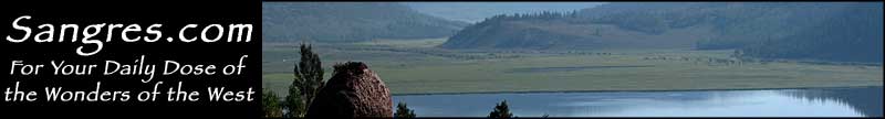
Coming up on the Henry Mountains along the Bull Creek Pass Back Country Byway

Bull Creek Pass Back Country Byway area map
