Nine Mile Canyon Backway

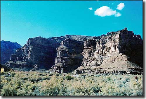
Daddy Canyon, one of the side canyons along the Nine Mile Canyon Backway
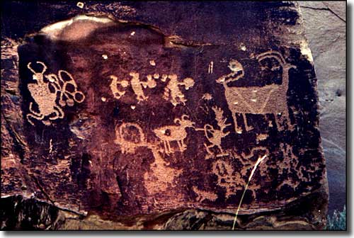
Nine Mile Canyon Backway is a 78-mile route across the high desert in eastern Utah. Along the way you'll find many panels of painted rock art and carved rock faces, left by the prehistoric Fremont people with some newer panels left by the Utes. Among the pictures are many hunting scenes, animals, universal archetype symbols and god-like figures. There are ruins in some areas and cliff granaries on high canyon ledges in others. The area also saw a lot of use by the Army and by fur trappers throughout the 1800's with most traffic occuring in the 1880's. Those "newcomers" left behind stage stops, settler cabins and iron telegraph poles.
Conservative estimates have put the number of rock art panels in Nine Mile Canyon at somewhere upwards of 1,000, with at least 10,000 separate images among them. No one has really done a full inventory but the total number could be well more than ten times that. This area has the highest concentration of petroglyphs and pictographs in North America. Researchers have also identified the locations of hundreds of ancient granaries, rock shelters and pit-houses but no real excavation has ever been done. Many of the ancient structures are located on mesas, pinnacles and cliff ledges well above the canyon floor.
The Fremont Culture was prevalent in this area from about 950 CE to about 1250 CE and some folks think this area was the center of their civilization. When Anglo-Europeans first arrived, many of their irrigation ditches and earthen lodges were still visible but they have since been erased by the passage of time and the ravages of modern agricultural cultivation. Nine Mile Creek is not a large water source but it is a very reliable one. The ancients cultivated corn and squash in the area but probably not beans (beans require a long cook time in a pottery vessel and there have been very few pottery vessels found in the area).
More modern settlers did build a town named Harper but the population never added up to much more than 100 and the majority of folks left the canyon before World War II. The Army (the US 9th Cavalry specifically - a regiment of Buffalo Soldiers) built the road and installed a telegraph line on steel telegraph poles along it in 1886. They then used the road to haul freight overland from Price to Fort Duchesne until 1895. That telegraph line became the local phone line in 1907 and that phone line was in operation up into the 1990's. There was a school built around 1895 but that closed in 1930 and the building was moved to Wellington a few years later. There was also a two-story hotel built in Harper but the remains of that building burned to the ground in the late 1980's. Only the stone foundation is left now. What's left of the townsite of Harper is mostly on private land and if you want to visit, you'll need to get permission first.
As elevations along the road vary up to 2,000', you'll find that vegetation varies from high desert sagebrush and cottonwoods to groves of aspen and stands of Douglas fir. There are herds of mule deer, pronghorns and even a few elk in some areas. A large section of the canyon corridor is presently being considered for classification as a Historic District so hunting in the area is not allowed. There is no fishery to speak of either.
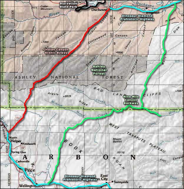
Nine Mile Canyon Backway leaves the Dinosaur Diamond Prehistoric Highway just south of Myton and crosses back country roads to emerge on pavement again near Wellington. The 7.5 miles of road south of Myton and the 12 miles north of Wellington are paved. In between you'll find a narrow dirt road with several blind corners. 2WD vehicles can drive the road when it's dry but when wet the road can be virtually impossible. In winter the road is often snow-packed but the main route is usually kept open.
One thing to watch for when driving the road: natural gas exploration has boomed in the area since 2002 so in some respects, it is now an industrial zone. 63 sites along the canyon were added to the National Register of Historic Places in 2009 in an effort to force the government to restrict truck traffic in the area. The BLM has announced plans to nominate another 800 sites in the area for inclusion on the National Register over the next several years.

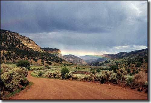
Weather moving in over Nine Mile Canyon Backway

One of the rock art panels found along the Nine Mile Canyon Backway

Nine Mile Canyon Backway area map
