Paiute Wilderness

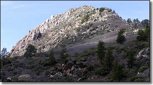
The summit of Mount Bangs in Paiute Wilderness

The 87,900 acres of the Paiute Wilderness are in extreme northwest Arizona, surrounding the Virgin Mountains. This area has seen very little incursion by humans. The Virgin Mountains are a mix of limestone, gneiss and granite cut by deep, hidden canyons. Elevations vary from a low of about 2,400' to the summit of Mount Bangs at 8,012'. Near the top of Mount Bangs you'll find Ponderosas growing among the pinon, cedar, sagebrush, scrub oak, yucca, barrel cactus, and Joshua trees. And from the summit you'll get some great views of the Virgin Mountains below and out across the Mohave Desert to the south and west. Wildlife in the area includes mule deer, desert bighorn sheep, bobcat, mountain lion, desert tortoise and (my personal favorite) Gila monster.
Summer tends to be very hot so spring and fall are your best times to travel around this beautiful place. While there are several poorly marked (and strenuous) trails in Paiute Wilderness, finding a level camping spot can be hard.
Trails in the Paiute Wilderness tend to be poorly defined. If you scramble over the boulders and make it to the summit of Mount Bangs, you'll discover the benchmarks driven into the ground denote this as "Hancock Peak." There is a faint trail near the summit with a few rock cairns marking the way but all too often you'll be picking your own route. The Sullivan Trail leads south from the Virgin River Recreation Area ($2 to park) for 15 miles but is faint and poorly marked. It requires that you ford the Virgin River to get into Sullivan Canyon, then it follows Sullivan Canyon until you come to an old jeep trail that heads up onto the spine of the Virgins and makes its way to Mount Bangs. Another trailhead is reached by getting off the I-15 at Black Rock Road, then go east on BLM 1009 for 20 miles to the intersection with BLM 1004. Turn right (south) and follow the often quite rough BLM 1004 along the eaastern boundary of Paiute Wilderness for about 13 miles, over Black Rock Mountain and past Cottonwood Wash to a road going right to the Cougar Spring Trailhead. This route will have you wishing your 4WD had better clearance but it will bring you up just below Mount Bangs on the south side. The route is closed from November 15 to March 15, rain and snow season (yes, it does snow here).
USGS Maps: 7.5 minute: Mountain Sheep Spring, Littlefield, Elbow Canyon, Mount Bangs, Cane Springs, Jacobs Well, Purgatory Canyon, Mustang Knoll, Wolf Hole Mountain

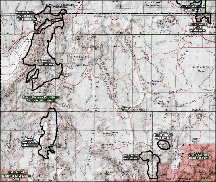
Paiute Wilderness area map
