Fort Garland, Colorado

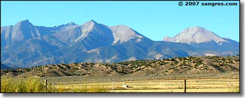
Looking north in Fort Garland toward the Blanca Massif and Mt. Lindsey
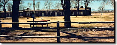
Fort Garland was established in 1858 to protect settlers in the San Luis Valley, then part of the Territory of New Mexico. Built in a parallelogram around the parade ground, the fort could accomodate two companies of 100 men and a handful of officers.
Over 25 years, the fort was home to a number of different companies of infantrymen, mounted riflemen and volunteers. Kit Carson and his volunteer unit were commanded to the fort in 1866 to keep the peace and negotiate with the Utes. Regular troops returned in 1867 and Carson and his volunteers were mustered out. Most of them returned to Taos but Kit moved to Boggsville (near today's Las Animas) and settled down as Colorado's Superintendent of Indian Affairs. He died there in 1868.
Fort Garland was abandoned as a military post in 1883, following the confinement of the Utes to reservations.


Today you can walk the parade ground of the fort and tour the adobe buildings. The Commandant's Quarters features a re-creation of the quarters during Carson's time. Fort Garland also highlights the folk art and culture of the Hispanic community in southern Colorado.
Fort Garland is a "census-designated place" located on US 160 in the San Luis Valley of southern Colorado, 25 miles east of Alamosa. The town consists of maybe 400 people settled at a crossroad. There are a few gas stations, a couple of restaurants and convenience stores and several other businesses along the highway. The town of Blanca is 4 miles further west. The two towns share their community center and their schools. The two towns are nearly surrounded by Forbes developments (Forbes Trinchera, Forbes Wagon Wheel, Sangre de Cristo Ranches, etc.).
The Fort Garland Museum and Visitor Center is open daily 9 AM to 5 PM, April 1 to October 31. From November 1 to March 31 it is open Thursday through Monday, 8 AM to 4 PM. Admission is charged. For more information please call (719) 379-3512.

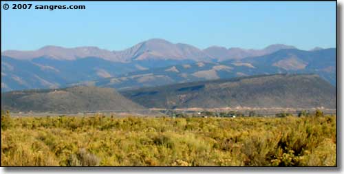
Trinchera Peak, from Fort Garland
Latitude: 37.4295°N
Longitude: 105.4353°W
Unincorporated
Elevation: 7,936'
Education:
High School or Higher: 61.4%
Bachelor's Degree or Higher: 10.3%
Graduate or Professional Degree: 1.8%
2011 Cost of Living Index for Fort Garland: 91.4
Median Resident Age: 34.3 Years
Estimated Median Household Income: $23,200
Estimated Median Home Value: $79,850
Major Industries:
Government, Construction, Real Estate Services, Retail Services, Lodging & Food Services, Recreation & Entertainment, Social Services
Unemployed (March 2011): 15.6%
Population Demographics: 2010
| Total Population | 433 |
| Males | 210 |
| Females | 223 |
| Population by Age | |
| Under 18 | 111 |
| 18 & over | 322 |
| 20-24 | 23 |
| 25-34 | 40 |
| 35-49 | 83 |
| 50-64 | 94 |
| 65 & over | 69 |
| Population by Ethnicity | |
| Hispanic or Latino | 368 |
| Non Hispanic or Latino | 65 |
| Population by Race | |
| White | 256 |
| African-American | 2 |
| Asian | 2 |
| Native American | 16 |
| Hawaiian or Pacific Islander | 9 |
| Other | 135 |
| Two or more | 13 |
Great Sand Dunes National Park - Los Caminos Antiguos Scenic Byway
Mt. Blanca - State Trust Lands & Wildlife Areas - San Luis Valley
Sangre de Cristo National Heritage Area
National Park Service Sites - BLM Sites - National Wilderness Areas - Unique Natural Features
Outdoor Sports & Recreation - Ski & Snowboard Areas - Photo Galleries - Colorado Mountains
