
Swink, Colorado
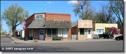
The Swink Town Hall
Swink was most likely founded as another railroad town/agricultural center (I later learned there was a large sugar beet processing plant located here back in the 1950's, but the Colorado sugar beet market was pretty much destroyed by manipulations in the commodities markets in 1956). While I saw quite a few kids around town, I came across a lot more retirees. Most of Swink seems to be running south of US Highway 50 so folks are pretty much out of that major traffic pattern. This is another area where the northern Front Range cities are coming to buy up water rights from distressed Arkansas River Valley farmers.
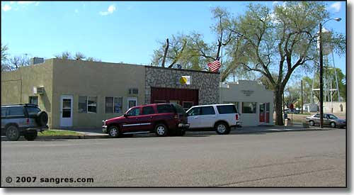
The Post Office and other businesses in downtown Swink
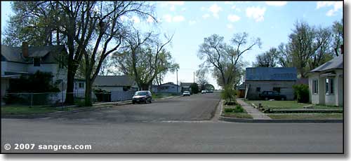
A typical street in Swink
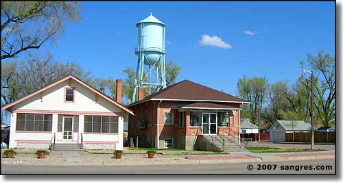
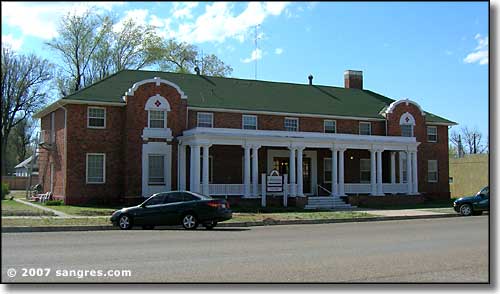
The Swink Community Center (with the town water supply hanging over the back yard)
Fast Facts about Swink, Colorado
Swink, Otero County, CO 81077
Latitude: 38.0147°N
Longitude: 103.6278°W
Incorporated: June 6, 1906
Elevation: 4,121'
Education:
High School or Higher: 86.6%
Bachelor's Degree or Higher: 17.4%
Graduate or Professional Degree: 5.6%
2011 Cost of Living Index for Swink: 90.7
Latitude: 38.0147°N
Longitude: 103.6278°W
Incorporated: June 6, 1906
Elevation: 4,121'
Education:
High School or Higher: 86.6%
Bachelor's Degree or Higher: 17.4%
Graduate or Professional Degree: 5.6%
2011 Cost of Living Index for Swink: 90.7
2009 Estimates:
Estimated Median Household Income: $35,900
Estimated Median Home Value: $101,000
Median Resident Age: 39.0 Years
Major Industries:
Health Care, Educational Services, Lodging & Food Services, Construction, Government, Rail Transportation, Finance & Insurance Services, Transportation Services
Unemployed (March 2011): 10.4%
Population Demographics: 2010
| Total Population | 617 |
| Males | 297 |
| Females | 320 |
| Population by Age | |
| Under 18 | 163 |
| 18 & over | 454 |
| 20-24 | 20 |
| 25-34 | 65 |
| 35-49 | 123 |
| 50-64 | 135 |
| 65 & over | 91 |
| Population by Ethnicity | |
| Hispanic or Latino | 171 |
| Non Hispanic or Latino | 446 |
| Population by Race | |
| White | 486 |
| African-American | 3 |
| Asian | 2 |
| Native American | 5 |
| Hawaiian or Pacific Islander | 0 |
| Other | 99 |
| Two or more | 22 |
Otero County Pages
La Junta - Rocky Ford - Swink - Otero CountySanta Fe Trail - Bent's Old Fort - Picketwire Canyonlands
State Trust Lands & Wildlife Areas
More Colorado Information, Photos and Maps
Towns & Places - Scenic Byways - State Parks - National Forests - National Wildlife RefugesNational Park Service Sites - BLM Sites - National Wilderness Areas - Unique Natural Features
Outdoor Sports & Recreation - Ski & Snowboard Areas - Photo Galleries - Colorado Mountains
