Arkansas Headwaters Recreation Area
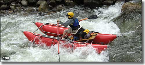
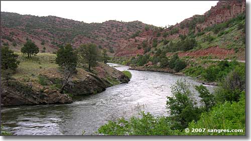
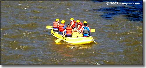
The upper Arkansas River is the most commercially rafted river on Earth, probably because the Arkansas is recognized world-wide for its incredible opportunities for whitewater rafting and kayaking. As the river drops 4,650 feet in about 125 miles, folks can find anything from Class II and III stretches that are ideal for beginners and for family outings to heavy duty Class IV and V rapids. The Arkansas River is also well-known for the quality of its brown trout fisheries. There are a number of commercial rafting outfitters that offer rafting trips (half-day to 3 days) on the Arkansas and a number of local fishing guides available to help you get the most out of your visit.
The Arkansas Headwaters Recreation Area first started as a cooperative arrangement between Colorado State Parks and the federal Bureau of Land Management. These days, those 2 agencies have been joined by the National Forest Service and the Colorado Division of Wildlife. Among those 4 agencies the nationally significant natural resources found in the Arkansas River Valley get well taken care of.
Visitors to the Arkansas Headwaters Recreation Area basically have that zone between Leadville and Pueblo in which to enjoy rafting, fishing, kayaking, canoeing, camping, picnicking, mountain biking, hiking, horseback riding, OHV riding, sightseeing, rock climbing and even gold panning. All through the area you'll find many camping areas and river put-in and take-out sites. There are also many public fishing areas easily accessed from the highway, and some that require a bit more of a hike, but the Arkansas is one of Colorado's premier fishing rivers: if you're a true angler, you'll find a relatively easy (and legal) way to get to that water. Along the river you'll also find numerous picnic areas with picnic tables, fire rings or grills and excellent views of the mountains and the river. Picnicking is permitted everywhere in the Arkansas Headwaters Recreation Area except in designated campsites. If you should decide to camp or picnic outside of a developed area, you'll need to bring your own portable toilet system and/or fire pan. All your waste needs to be carried out and disposed of properly. None of the picnic areas or campgrounds offer potable water, electric hookups or trash services. You'll need to bring your own drinking water and pack out all your trash when you leave.
There are many commercial (fees charged) camping sites along the river and a couple of federal (BLM - free) sites but the Colorado state sites do have fees attached. The vehicle pass is $7 per day and covers everyone in the vehicle at all AHRA sites until noon of the following day. Individual passes are available to walk-ins, bikers, rafters, etc. (who don't come in a drivable vehicle) for $3 per person per day, ages 16 and up. You can avoid this by buying the annual Colorado State Parks pass (2011 fee was $70). Basic campsite fees run $16 per night plus the daily vehicle pass.
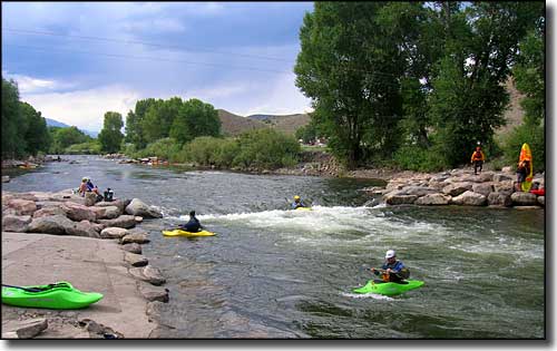
Kayakers practicing their craft on the Arkansas River (at the Salida Boat Ramp)
Leadville to Buena Vista:
River Access Sites:
- Hayden Meadows - No commercial boaters or rafters allowed
- Hayden Ranch - No commercial boaters or rafters allowed
- Arkansas River Ranch - No commercial boaters or rafters allowed
- Kobe - No commercial boaters or rafters allowed
- Granite
- Clear Creek
- Stone Cabin
- Numbers Site
- Rapid #4
- Railroad Bridge
- Buena Vista Boat Ramp - Managed by the Town of Buena Vista
Campgrounds:
- Railroad Bridge Campground
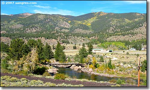
Below Leadville, the river course was shaped by waters flowing fast through broken glacial dams. That action scattered large boulders all through the bottom of the canyon. The banks here vary between being forested with Douglas fir and Englemann spruce and just being wide open scrub. The float is really easy (Class I or II) until you pass Granite. Below Granite the canyon narrows and the river passes through the Pine Creek rapids (Class IV-V). Once past Pine Creek, the river quiets a bit but is still challenging with Class III and IV water to Buena Vista.
Buena Vista to Salida:
River Access Sites:
- Buena Vista Boat Ramp
- Fisherman's Bridge
- Ruby Mountain
- Hecla Junction
- Stone Bridge
- Big Bend
- Salida Boat Ramp - Managed by the City of Salida
Campgrounds:
- Ruby Mountain Campground
- Hecla Junction Campground
You'll find the Buena Vista River Park (a kayak play-spot) at the Biena Vista Boat Ramp. Below the River Park, the Arkansas comes into that brown granite gorge full of white-water rapids known as Browns Canyon. Browns Canyon is a challenging river trip at any water level but is especially wild in high water. This busy stretch of the river is marked at its northern gateway by Ruby Mountain. Below Ruby Mountain, the river enters into the Browns Canyon Wilderness Study Area - a 6,660-acre potential candidate for future full wilderness designation. Then below Browns Canyon the river opens out again and passes through a reasonably calm section known as the Big Bend. The Big Bend area offers excellent trout fishing and the Colorado Division of Wildlife has negotiated numerous easements with private landowners in the area to allow anglers good river access through here.
Salida to Vallie Bridge:
River Access Sites:
- Salida Boat Ramp
- Salida East
- incon
- Vallie Bridge
Campgrounds:
- Rincon Campground
- Vallie Bridge - Boat In/Walk Out
At the Salida Boat Ramp you'll find a kayak play-hole and slalom course known as the Salida Whitewater Park. As the Arkansas exits the Salida Whitewater Park, it enters Bighorn Sheep Canyon: this is a pinon pine, juniper, oak brush-dotted granite canyon with deep pools, gravel bars and rock banks. The water runs Class II to Class IV through here but be careful of the anglers: CDOW easements provide a lot of river access and the fishermen love this part of the river, too.
Vallie Bridge to Parkdale:
River Access Sites:
- Vallie Bridge
- Canyon Trading Post
- Lone Pine
- Texas Creek
- Pinnacle Rock
- Salt Lick
- Spikebuck
- Parkdale
Campgrounds:
- Vallie Bridge - Boat In/Walk Out
- Five Points Campground
Between Vallie Bridge and Parkdale you'll need to look out for the herds of mule deer and bighorn sheep that come down to the river to drink. In season, this is a rafter's favorite, although the banks can be crowded with fishermen and picnickers in most seasons...The water here runs Class II to Class V, making this a very popular boating/rafting area.
Parkdale to Canon City:
River Access Sites:
- Parkdale
- River Station - Managed by Canon City - closed to private boaters
- Centennial Park - Managed by Canon City - closed to commercial boaters
The Parkdale Recreation Site offers the last public access before the Arkansas enters Royal Gorge. This is an area where you want to know your stuff: scouting the river ahead and portaging are extremely hard when the edge of the water laps against a 1,000' vertical granite wall... and the water is running Class IV and V rapids. Once you enter Royal Gorge, you're pretty much committed to making it out the other side on/in the water with no possibility of any other escape.
Canon City to Lake Pueblo State Park:
River Access Sites:
- Centennial Park - Managed by Canon City - closed to commercial boaters
- River Station - Managed by Canon City - closed to private boaters
- Florence River Park - Managed by the City of Florence
- Blue Heron - Bureau of Land Management site
- Lake Pueblo State Park
Campgrounds:
- Lake Pueblo State Park
The Arkansas calms down significantly after leaving Canon City. Between Canon City and Lake Pueblo is one long riparian zone with Class I-II water. The fishing is excellent and there's wildlife everywhere. The biggest hazards here are low-head dams and fallen or overhanging trees. However, the river banks all through this area are private land: do not trespass. The Arkansas Headwaters Recreation Area ends at Lake Pueblo State Park.
Bighorn Sheep Canyon - Sawatch Mountains - San Isabel National Forest
Collegiate Peaks Scenic Byway - Lake Pueblo State Park
National Park Service Sites - BLM Sites - National Wilderness Areas - Unique Natural Features
Outdoor Sports & Recreation - Ski & Snowboard Areas - Photo Galleries - Colorado Mountains
