Neota Wilderness

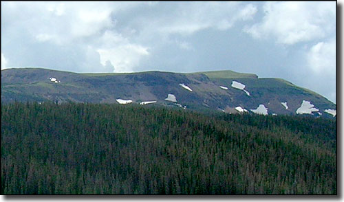
Flat Top Mountain in the Neota Wilderness
The 9,924-acre Neota Wilderness is located with Rocky Mountain National Park to the south, Comanche Peak Wilderness to the east and Rawah Wilderness to the northwest. Elevations vary between about 10,000' and 11,896'. Neota was established to protect a series of flattened granite ridges unusual in the steep-sided Rockies. If you climb to the summit of Iron Mountain (12,265') just southwest of the Neota boundary, you can look down across the entire wilderness area.
There are 3 main drainages on the property: Neota, Trap and Corral Creeks. As the higher elevations hold snow for a long time here, these creek valleys tend to stay very wet in the warmer months. Reintroduced moose have done very well among the bogs, marshes, sedges and willows of the Neota creeks. There's also the usual assortment of black bear, elk, deer, mountain lion and bobcat in these woods. Technically there are 1.5 miles of trail on the property but none of it sees any kind of maintenance.

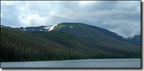
Iron Mountain in Neota Wilderness, from Joe Wright Reservoir

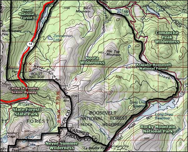
Neota Wilderness map

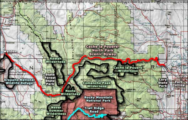
Neota Wilderness area map
Never Summer Wilderness - Cache la Poudre Wilderness - Rawah Wilderness
Comanche Peak Wilderness - Arapaho National Wildlife Refuge
State Forest State Park - Trail Ridge Road - Lory State Park
Selected Hiking Trails
National Park Service Sites - BLM Sites - National Wilderness Areas - Unique Natural Features
Outdoor Sports & Recreation - Ski & Snowboard Areas - Photo Galleries - Colorado Mountains
