 |
Wild Horse Trail Scenic Byway |
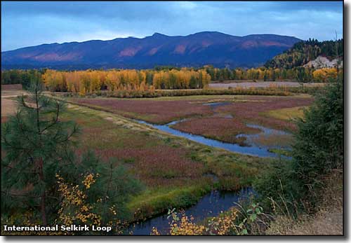 A view along the Wild Horse Trail Scenic Byway |
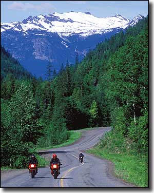
The Wildhorse Trail Scenic Byway is a 59-mile-long journey along the Kootenai tribe's historic pathway between their ancestral homeland in British Columbia and their ancient fishing grounds at Lake Pend Oreille. Incoming gold miners in the 1860's also used this route to get to the mountains and possible riches by traveling through this same glacially-carved landscape on the eastern side of the Selkirk Mountains. When the Northern Pacific Railroad built through, this valley became home to one of America's main east-west freight routes. 1808 saw explorer David Thompson journeying on this route, looking for an easy way to reach the Columbia River. Gold was discovered on Wild Horse Creek in British Columbia (about 120 miles north of Bonner's Ferry) in 1863. That brought a huge movement of prospectors and pack trains through the area. Paddlewheel steamers plied the Kootenai River carrying men, freight and food supplies to the gold fields until the gold ore petered out around 1880. But it was that traffic of prospectors and pack animals that induced Edwin Bonner to build his ferry crossing on the Kootenai River in 1864, at the place that was incorporated as Bonners Ferry in 1893. The topsoil in the glacier-carved Kootenai Valley south of Bonners Ferry (running down to Sandpoint) is so fertile that the area is prime agricultural land, and that is part of the reason why Bonners Ferry still exists as a town. The Kootenai Valley is home to what is probably the world's largest contiguous hops field. The Wildhorse Trail Scenic Byway is a simply beautiful route running north from the northern shores of Lake Pend Oreille through the glacial valley between the Selkirk Mountains to the west and the Cabinet Mountains to the east. At Bonners Ferry, the Wildhorse Trail crosses the Kootenai River and continues north to Porthill (on the border with British Columbia) in the valley of the Kootenai. The Wildhorse Trail Scenic Byway is one leg of the International Selkirk Loop, a route that encircles the Selkirk Mountains by traveling through Idaho, Washington and British Columbia. The rise and fall of the Wildhorse Trail makes it an excellent route for cyclists who like to ride in big, beautiful country. Traveling north from Sandpoint, 48 miles of the route is along US Highway 95. At the intersection with Idaho Highway 1, the scenic byway turns northwest and follows Highway 1 for the next 11 miles to Porthill and the border crossing. At the southern terminus of the Wildhorse Trail is Sandpoint, on the northern shore of Lake Pend Oreille. Sandpoint is also the terminus of the Pend Oreille Scenic Byway and the Panhandle Historic Rivers Passage (another leg of the International Selkirk Loop). Just west of Bonners Ferry is Kootenai National Wildlife Refuge. |
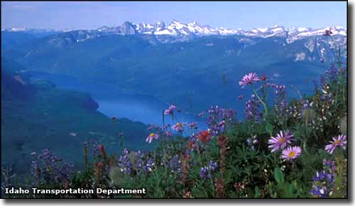 Another view along the Wild Horse Trail Scenic Byway 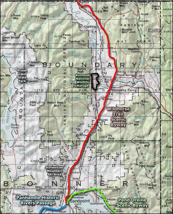 Wild Horse Trail Scenic Byway area map |
|
|
 |
| Index - Arizona - Colorado - Idaho - Montana - Nevada - New Mexico - Utah - Wyoming National Forests - National Parks - Scenic Byways - Ski & Snowboard Areas - BLM Sites Wilderness Areas - National Wildlife Refuges - National Trails - Rural Life Advertise With Us - About This Site - Privacy Policy |
| Photo of the Wild Horse Trail Scenic Byway courtesy of Aaron Drew, © International Selkirk Loop Lower photo of the Wild Horse Trail courtesy of David Gluns, Idaho Transportation Department Area map courtesy of National Geographic Topo! Text Copyright © by Sangres.com. All rights reserved. |