 |
Kootenai National Wildlife Refuge |
 Kootenai National Wildlife Refuge |
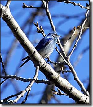
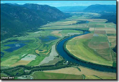
Kootenai National Wildlife Refuge is a small refuge (about 2,775 acres) located along the Kootenai River on the eastern side of the Selkirk Mountains about 5 miles from the town of Bonner's Ferry, about 20 miles south of the Canadian border. Kootenai NWR is located just off the Wildhorse Scenic Byway, part of the International Selkirk Loop. The primary management objective is to provide nesting and feeding habitat for migrating waterfowl. The refuge extends westward from the edge of the river valley into the base of the Selkirk Mountains with another 500 acres of land that is heavily forested and abuts the Kaniksu National Forest (part of the Idaho Panhandle National Forest). The property is a mix of hardwood and conifer forests dropping down to wetlands and associated uplands in the bottom of the Kootenai River Valley. More than 300 species of birds and mammals have been documented on the refuge, including thousands of migrating waterfowl of many different species. The refuge has more than 800 acres of wetlands that are managed to provide fish, invertebrates and aquatic vegetation for food. There's another 200 acres of land planted with grain and other crops specifically for the wildlife. The grain fields get flooded every year in the fall to make sure the waterfowl can get the food they need, then the fields are drained again every January and allowed to dry before planting again in the spring. The primary managed water source in the refuge is Myrtle Creek, and the water from that is diverted to maintain water levels in the permanent ponds. In the fall, water is pumped from Deep Creek and the Kootenai River to flood the grain fields. More than 300 species of animals and birds use the refuge so you'll find lots of water and marsh birds, the usual gaggle of waterfowl (northern pintails, mallards, Canada geese, cinnamon and blue-winged teal, redheads, wood ducks, common golden-eyes and perhaps some tundra swans), muskrats, beavers and even moose in the wetlands. The planted fields seem to attract a lot of mice and other rodents, who, in turn, attract eagles, owls, hawks and coyotes. The ground-nesting birds like that tall, dense grass on the upland areas around the wetlands. The rodents seem to like that area of brush and grasses, too. In those uplands you'll also find raccoons, weasels, wood rats and songbirds. The refuge is at the eastern foot of the Selkirk Mountains and that makes for a narrow strip of coniferous and hardwood forest between the mountains and the wetlands. But under those trees you'll find mule deer, white-tailed deer, elk, moose and black bear. The trees are also home to pileated woodpeckers, ruffed grouse and Cooper's hawks. Some of the riparian areas are lined with willow and cottonwood, giving the raptors a nice place to sit while they wait for lunch to meander along down below. For human visitors, Kootenai NWR offers a 4.5-mile, one-way graveled Auto Tour Road. The route begins near the visitor center and ends at the junction with the county road near the mouth of Deep Creek. The Auto Tour Road is open during daylight hours but is not plowed in winter. When snow-covered, it's an excellent trail for snowshoeing and cross-country skiing. There are five other hiking trails available on the refuge, three of them are open year round but two (Deep Creek Trail and Island Pond Trail) are closed to hikers during waterfowl hunting days in the fall. The Chickadee Trail is a 1,000-foot long flat, universally accessible trail with interpretive signs and benches. The Moose Overlook Photo Blind is also universally accessible. To get there: go west from Bonner's Ferry on Riverside Road (south bank of the Kootenai River) for 5 miles to the refuge entrance. The refuge office is another 2 miles past the entrance. These are narrow county-maintained roads and they see a lot of use by large logging trucks. The office is open weekdays from 7:30 am to 4:00 pm except Federal holidays. The property itself is open to the public from sunrise to sunset daily. Fishing is allowed in designated areas only. Hunting is also allowed in designated areas in season only. Campfires and camping are not allowed on the property. Kootenai National Wildlife Refuge is administered together with Little Pend Oreille National Wildife Refuge and Turnbull National Wildlife Refuge (both in Washington) as part of the Inland Northwest National Wildlife Refuge Complex. |
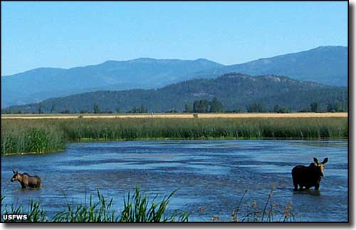 Cow and calf moose at Kootenai National Wildlife Refuge 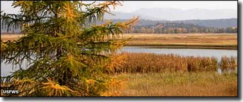 Greenwing Pond at Kootenai National Wildlife Refuge 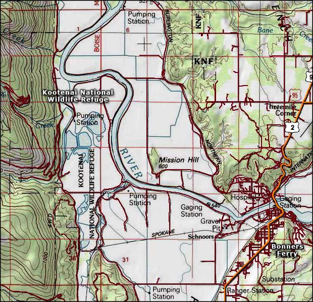 Map of Kootenai National Wildlife Refuge 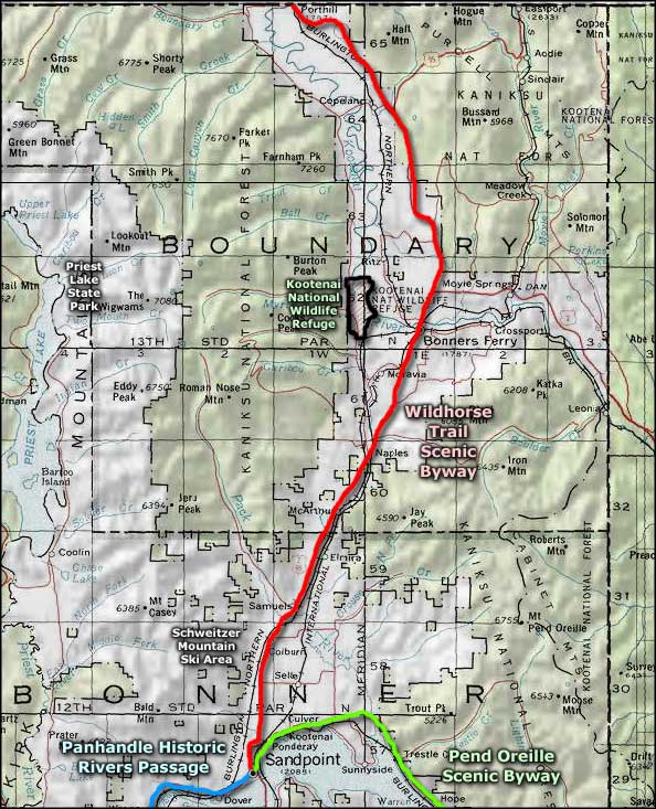 Kootenai National Wildlife Refuge area map |
|
|
 |
| Index - Arizona - Colorado - Idaho - Montana - Nevada - New Mexico - Utah - Wyoming National Forests - National Parks - Scenic Byways - Ski & Snowboard Areas - BLM Sites Wilderness Areas - National Wildlife Refuges - National Trails - Rural Life Advertise With Us - About This Site - Privacy Policy |
|
Upper photo of Kootenai NWR courtesy of Idaho DOT. Photo of cow and calf moose courtesy of Aaron Drew, US Fish & Wildlife Service Lower photos courtesy of Janet Satchwell, US Fish & Wildlife Service Maps courtesy of National Geographic Topo! Text Copyright © by Sangres.com. All rights reserved. |