 |
Fort Smith, Montana |
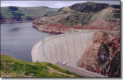
 Yellowtail Dam on the Bighorn River, next to Fort Smith |
|
A Census Designated Place, Fort Smith is located near the foot of the Yellowtail Dam that creates Bighorn Lake of the Bighorn Canyon National Recreation Area. Originally, this was the site of Fort CF Smith, a cavalry post in the late 1800's. Today, Fort Smith is a "Mecca" for fly fisherman with the Bighorn River recording about 7,000 trout per mile in this area. |
| Fast Facts about Fort Smith, Montana |
|
Fort Smith, Big Horn County, MT 59035
Elevation: 3,287' Latitude: 45.3079°N Longitude: 107.9274°W Resident Racial Breakdown: White Non-Hispanic: 68.4% Native American: 31.6% Education: High School or Higher: 73.7% Bachelor's Degree or Higher: 0.0% Graduate or Professional Degree: 0.0%
2009 Estimates: Population: 122 Males: 75 Females: 47 Median Resident Age: 33.8 Years Estimated Median Household Income: $30,000 Population Density: 104 People per Square Mile 2011 Cost of Living Index for Fort Smith: 84.0 Unemployed (March 2011): 13.3% |
|
|
 |
| Index - Arizona - Colorado - Idaho - Montana - Nevada - New Mexico - Utah - Wyoming National Forests - National Parks - Scenic Byways - Ski & Snowboard Areas - BLM Sites Wilderness Areas - National Wildlife Refuges - National Trails - Rural Life Advertise With Us - About This Site - Privacy Policy |
|
Text Copyright © by Sangres.com. All rights reserved. |