 |
Missouri Breaks Back Country Byway |
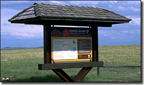 Route marker with interpretive features along the Missouri Breaks Back Country Byway |
|
The Missouri Breaks Back Country Byway runs about 80 miles in the uplands south of the Missouri River and to the southwest of Charles M. Russell National Wildlife Refuge. This road will make you wish your vehicle had higher clearance, and 4WD really helps, except in wet weather when you'll end up parked because the vehicle is buried in the road up to its axles. But if the road is dry and you've got 2-to-3 hours to spend, this is a gorgeous drive through unpopulated countryside with some great natural and archaeological features, and great views. In many spots there are even worse roads heading off toward the river that lead to some nice overlooks and viewpoints, looking over and down into the Missouri Breaks, a wild and crazy badlands along the Upper Missouri National Wild and Scenic River corridor. 200 years ago, Lewis & Clark and the Corps of Discovery paddled up the river below and hunted this land for their food. Except for the roads and a few signs, you wouldn't know that anything had changed since then. Several of their campsites have been located along the river bottom, and you can almost hear the men chatting after a good meal down there... They did have a lot of trouble in this area, though, because the shoreline was studded with flint fragments that cut right through their mocassins. And walking in the water wasn't any better because the river bottom was pure silt and mud... and they often had to tow or carry their boats in shallow areas. A section of this route is also along the Nez Perce National Historic Trail. In the days of the outlaws, desperados and cattle rustlers, this was some of their favorite hideout country. |
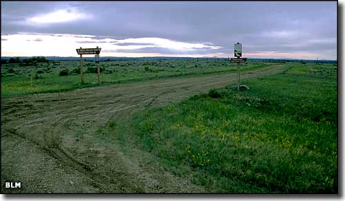 Now this is a Back Country Byway: notice the road conditions (this is probably within the Charles M. Russell NWR) 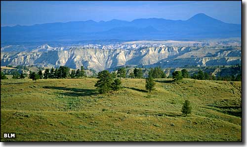 A view of the Missouri Breaks landform itself 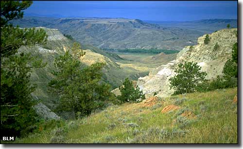 Another view down to the river 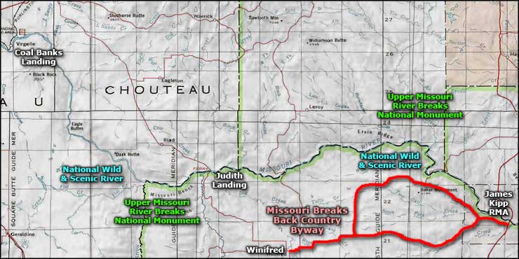 Area map of the Missouri Breaks Back Country Byway |
|
|
 |
| Index - Arizona - Colorado - Idaho - Montana - Nevada - New Mexico - Utah - Wyoming National Forests - National Parks - Scenic Byways - Ski & Snowboard Areas - BLM Sites Wilderness Areas - National Wildlife Refuges - National Trails - Rural Life Advertise With Us - About This Site - Privacy Policy |
| Photos along the Missouri Breaks Back Country Byway courtesy of the Bureau of Land Management. Map courtesy of National Geographic Topo! Text Copyright © by Sangres.com. All rights reserved. |