 |
Maverick Mountain Ski Area |
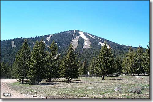 Maverick Mountain |
|
While Maverick Mountain Ski Area is a favorite among families for its downhill skiing, there's also an extensive network of cross-country trails, including trails that connect Maverick Mountain Ski Area with the nearby Elkhorn Resort and their mineral pools and hot springs. The base lodge has a cafe, beer and wine room, and a ski shop with downhill equipment rentals. Cross-country gear can be rented at the Elkhorn Resort. 2 restaurants, a bar and a motel are within 2 miles of the base lodge. To get to Maverick Mountain Ski Area: go south from Butte on the I-15 to Exit 59. Go 5 miles west on Highway 278, then turn and go north on the Pioneer Mountains Scenic Byway for 13 miles to Maverick Mountain. |
| Quick Facts about Maverick Mountain Ski Area |
|
Beaverhead-Deerlodge National Forest
Nearest City: Dillon GPS Coordinates: 45.435, -113.129444 Google Satellite Map Season: Mid-December to mid-April (Weather permitting) Hours of operation: 9:30 AM to 4:00 PM, Thursday through Sunday only. Lifts: 2 * 1 double chair * 1 rope tow Average Annual Snowfall: 200 inches Base Elevation: 6,500 ft
Top Elevation: 8,520 ft Vertical Rise: 2,020 ft Skiable Terrain: 210 Acres Number of Trails: 24 Trails Classifications: Beginner: 20% More Difficult: 35% Most Difficult: 35% Experts Only: 10% Longest Run: 2.5 miles |
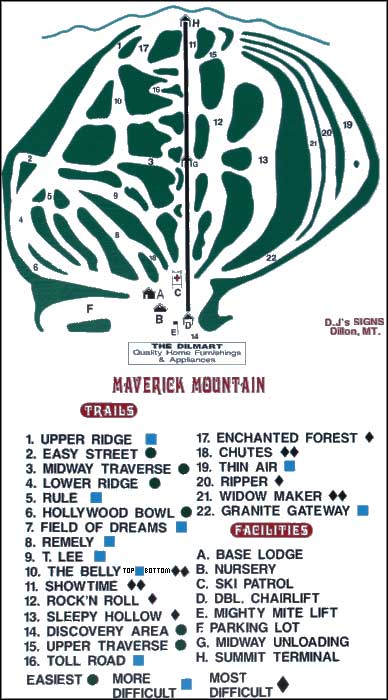 Maverick Mountain Ski Area trails map 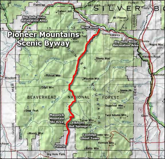 Maverick Mountain Ski Area area map |
|
|

|
| Index - Arizona - Colorado - Idaho - Montana - Nevada - New Mexico - Utah - Wyoming National Forests - National Parks - Scenic Byways - Ski & Snowboard Areas - BLM Sites Wilderness Areas - National Wildlife Refuges - National Trails - Rural Life Advertise With Us - About This Site - Privacy Policy |
| Ski Trails Maps courtesy of Maverick Mountain. Photo of Maverick Mountain courtesy of the National Forest Service Area map courtesy of National Geographic Topo! Text Copyright © by Sangres.com. All rights reserved. |